Machado, California
| Machado | |
|---|---|
| Former settlement | |
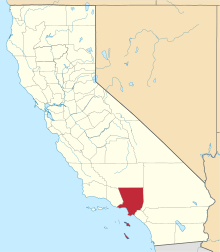
 Machado Location in California | |
| Coordinates: 33°59′04″N 118°26′49″W / 33.98444°N 118.44694°WCoordinates: 33°59′04″N 118°26′49″W / 33.98444°N 118.44694°W | |
| Country | United States |
| State | California |
| County | Los Angeles County |
| Elevation[1] | 13 ft (4 m) |
Machado is a former settlement in Los Angeles County, California.[1] It lay at an elevation of 13 feet (4 m).[1] Machado still appeared on USGS maps as of 1934.[1]
Machado is a name derived from Spanish meaning "hatchet".[2]
References
- 1 2 3 4 U.S. Geological Survey Geographic Names Information System: Machado, California
- ↑ Gannett, Henry (1905). The Origin of Certain Place Names in the United States. U.S. Government Printing Office. p. 195.
This article is issued from
Wikipedia.
The text is licensed under Creative Commons - Attribution - Sharealike.
Additional terms may apply for the media files.