Llano, California
| Llano, California | |
|---|---|
| Unincorporated community | |
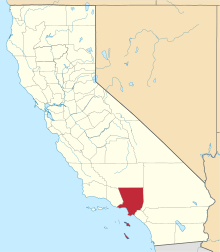
 Location within Los Angeles county | |
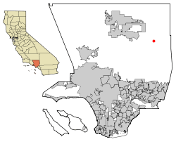
 Llano, California Location in the United States | |
| Coordinates: 34°29′36″N 117°47′16″W / 34.49333°N 117.78778°WCoordinates: 34°29′36″N 117°47′16″W / 34.49333°N 117.78778°W | |
| Country |
|
| State |
|
| County |
|
| Population (2000) | |
| • Total | 1,201 |
| Time zone | UTC-8 (Pacific (PST)) |
| • Summer (DST) | UTC-7 (PDT) |
| ZIP codes | 93544 |
| Area code(s) | 661 |
Llano is an unincorporated community located in Los Angeles County, California, near the San Bernardino County line. The town has a population of about 1,200.
Geography
Llano is located about 25 miles (40 km) southeast of Palmdale in the Antelope Valley portion of Southern California. The town of Pearblossom lies to the west, while the town of Pinon Hills lies to the east.
Pearblossom Highway (State Route 138) runs through the heart of Llano and is its principal street.
Details
- Postal ZIP code: 93544
- County: Los Angeles
- Population: 1201
- Telephone area code: 661
History
Llano is a name derived from Spanish meaning "plain".[1]
Llano was once the home of English writer Aldous Huxley.
At the turn of the 20th century there were socialist colonies in Llano, the most notable being Job Harriman's Llano del Rio commune. The ruins of Llano del Rio are still extant along Highway 138 east of 165th Street East.
Notable residents
- Aldous Huxley's former home, now Pearblossom Picture Ranch, a filming location
References
- ↑ Gannett, Henry (1905). The Origin of Certain Place Names in the United States. U.S. Government Printing Office. p. 188.
Places adjacent to Llano, California | ||||||||||
|---|---|---|---|---|---|---|---|---|---|---|
| ||||||||||