Andrade Corner, California
| Andrade Corner | |
|---|---|
| Unincorporated community | |
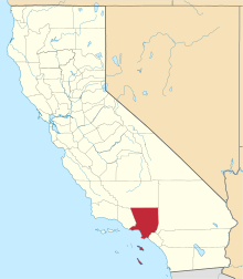
 Andrade Corner Location in California  Andrade Corner Andrade Corner (the US) | |
| Coordinates: 34°38′55″N 118°22′37″W / 34.64861°N 118.37694°WCoordinates: 34°38′55″N 118°22′37″W / 34.64861°N 118.37694°W | |
| Country | United States |
| State | California |
| County | Los Angeles County |
| Elevation[1] | 3,412 ft (1,040 m) |
Andrade Corner (formerly, Talamantes) is an unincorporated community in the Sierra Pelona Mountains, Los Angeles County, California.[1]
It is located 1.4 miles (2.2 km) southwest of Johnson Summit at the southwest base of Portal Ridge, 2.5 miles (4 km) northeast of the town of Green Valley, at an elevation of 3412 feet (1040 m).[1]
References
This article is issued from
Wikipedia.
The text is licensed under Creative Commons - Attribution - Sharealike.
Additional terms may apply for the media files.