Saint-Révérien
| Saint-Révérien | |
|---|---|
| Commune | |
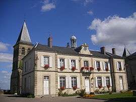 The town hall in Saint-Révérien | |
 Saint-Révérien Location within Bourgogne-Franche-Comté region  Saint-Révérien | |
| Coordinates: 47°12′39″N 3°30′03″E / 47.2108°N 3.5008°ECoordinates: 47°12′39″N 3°30′03″E / 47.2108°N 3.5008°E | |
| Country | France |
| Region | Bourgogne-Franche-Comté |
| Department | Nièvre |
| Arrondissement | Clamecy |
| Canton | Corbigny |
| Intercommunality | Val du Beuvron |
| Area1 | 18.48 km2 (7.14 sq mi) |
| Population (2006)2 | 241 |
| • Density | 13/km2 (34/sq mi) |
| Time zone | UTC+1 (CET) |
| • Summer (DST) | UTC+2 (CEST) |
| INSEE/Postal code | 58266 /58420 |
| Elevation | 229–382 m (751–1,253 ft) |
|
1 French Land Register data, which excludes lakes, ponds, glaciers > 1 km2 (0.386 sq mi or 247 acres) and river estuaries. 2 Population without double counting: residents of multiple communes (e.g., students and military personnel) only counted once. | |
Saint-Révérien is a commune in the Nièvre department in central France. It takes its name from St. Reverianus.
See also
References
| Wikimedia Commons has media related to Saint-Révérien. |
This article is issued from
Wikipedia.
The text is licensed under Creative Commons - Attribution - Sharealike.
Additional terms may apply for the media files.