Cercy-la-Tour
| Cercy-la-Tour | ||
|---|---|---|
| Commune | ||
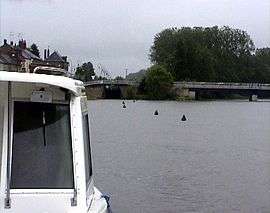 River Aron in Cercy-la-Tour | ||
| ||
 Cercy-la-Tour Location within Bourgogne-Franche-Comté region  Cercy-la-Tour | ||
| Coordinates: 46°52′10″N 3°38′45″E / 46.8694°N 3.6458°ECoordinates: 46°52′10″N 3°38′45″E / 46.8694°N 3.6458°E | ||
| Country | France | |
| Region | Bourgogne-Franche-Comté | |
| Department | Nièvre | |
| Arrondissement | Château-Chinon | |
| Canton | Luzy | |
| Intercommunality | Loire et Morvan | |
| Area1 | 45.57 km2 (17.59 sq mi) | |
| Population (1999)2 | 2,108 | |
| • Density | 46/km2 (120/sq mi) | |
| Time zone | UTC+1 (CET) | |
| • Summer (DST) | UTC+2 (CEST) | |
| INSEE/Postal code | 58046 /58340 | |
| Elevation | 191–253 m (627–830 ft) | |
|
1 French Land Register data, which excludes lakes, ponds, glaciers > 1 km2 (0.386 sq mi or 247 acres) and river estuaries. 2 Population without double counting: residents of multiple communes (e.g., students and military personnel) only counted once. | ||

Cercy-la-Tour is a commune in the Nièvre department in central France.
Geography
The village is located in the middle of the commune, where the river Alène joins the Aron.
Demographics
At the 1999 census, the population was 2,108. On 1 January 2005, the estimate was 2,091.
See also
References
| Wikimedia Commons has media related to Cercy-la-Tour. |
This article is issued from
Wikipedia.
The text is licensed under Creative Commons - Attribution - Sharealike.
Additional terms may apply for the media files.