Larochemillay
| Larochemillay | |
|---|---|
| Commune | |
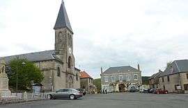 | |
 Larochemillay Location within Bourgogne-Franche-Comté region  Larochemillay | |
| Coordinates: 46°52′41″N 4°00′10″E / 46.8781°N 4.0028°ECoordinates: 46°52′41″N 4°00′10″E / 46.8781°N 4.0028°E | |
| Country | France |
| Region | Bourgogne-Franche-Comté |
| Department | Nièvre |
| Arrondissement | Château-Chinon |
| Canton | Luzy |
| Intercommunality | Alène et la Roche |
| Government | |
| • Mayor (2001–2008) | Michel Berthier |
| Area1 | 41.15 km2 (15.89 sq mi) |
| Population (1999)2 | 287 |
| • Density | 7.0/km2 (18/sq mi) |
| Time zone | UTC+1 (CET) |
| • Summer (DST) | UTC+2 (CEST) |
| INSEE/Postal code | 58140 /58370 |
| Elevation | 282–780 m (925–2,559 ft) |
|
1 French Land Register data, which excludes lakes, ponds, glaciers > 1 km2 (0.386 sq mi or 247 acres) and river estuaries. 2 Population without double counting: residents of multiple communes (e.g., students and military personnel) only counted once. | |
Larochemillay is a commune in the Nièvre department in central France.
Demographics
At the 1999 census, the population was 287. On 1 January 2004, the estimate was 294.
See also
References
| Wikimedia Commons has media related to Larochemillay. |
This article is issued from
Wikipedia.
The text is licensed under Creative Commons - Attribution - Sharealike.
Additional terms may apply for the media files.