Lurcy-le-Bourg
| Lurcy-le-Bourg | |
|---|---|
| Commune | |
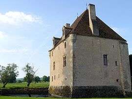 The château in Lurcy-le-Bourg | |
 Lurcy-le-Bourg Location within Bourgogne-Franche-Comté region  Lurcy-le-Bourg | |
| Coordinates: 47°09′42″N 3°23′15″E / 47.1617°N 3.38750°ECoordinates: 47°09′42″N 3°23′15″E / 47.1617°N 3.38750°E | |
| Country | France |
| Region | Bourgogne-Franche-Comté |
| Department | Nièvre |
| Arrondissement | Cosne-Cours-sur-Loire |
| Canton | La Charité-sur-Loire |
| Intercommunality | Nièvres et Forêts |
| Government | |
| • Mayor (2001–2008) | Jacques Legrain |
| Area1 | 22.58 km2 (8.72 sq mi) |
| Population (1999)2 | 323 |
| • Density | 14/km2 (37/sq mi) |
| Time zone | UTC+1 (CET) |
| • Summer (DST) | UTC+2 (CEST) |
| INSEE/Postal code | 58147 /58700 |
| Elevation | 239–381 m (784–1,250 ft) |
|
1 French Land Register data, which excludes lakes, ponds, glaciers > 1 km2 (0.386 sq mi or 247 acres) and river estuaries. 2 Population without double counting: residents of multiple communes (e.g., students and military personnel) only counted once. | |
Lurcy-le-Bourg is a commune in the Nièvre department in central France.
See also
References
| Wikimedia Commons has media related to Lurcy-le-Bourg. |
This article is issued from
Wikipedia.
The text is licensed under Creative Commons - Attribution - Sharealike.
Additional terms may apply for the media files.