Leross, Saskatchewan
| Leross | |
|---|---|
| Village | |
| Village of Leross | |
 Location of Leross in Saskatchewan  Leross, Saskatchewan (Canada) | |
| Coordinates: 51°17′17″N 103°52′05″W / 51.288°N 103.868°W | |
| Country |
|
| Province |
|
| Region | Central |
| Census division | 10 |
| Rural Municipality | Kellross No. 247 |
| Government | |
| • Type | Municipal |
| • Governing body | Leross Village Council |
| • Mayor | Francis Klyne |
| • Administrator | Elaine Klyne |
| Area | |
| • Total | 1.21 km2 (0.47 sq mi) |
| Population (2016) | |
| • Total | 46 |
| • Density | 38.0/km2 (98/sq mi) |
| Time zone | UTC-6 (CST) |
| Postal code | S0A 2C0 |
| Area code(s) | 306 |
| Highways |
|
| [1][2][3][4] | |
Leross (/ˈliːrɒs/ or /ləˈrɒs/) is a village within the Rural Municipality of Kellross No. 247, in the province of Saskatchewan, Canada. Leross had a population of 46 in the 2016 Canada Census, (a 24.3% increase from 37 in the [[2011 Canada Census).
Demographics
| Canada census – Leross, Saskatchewan community profile | |||
|---|---|---|---|
| 2016 | 2011 | 2006 | |
| Population: | 46 (24.3% from 2011) | 37 (-11.9% from 2006) | 42 (-28.8% from 2001) |
| Land area: | 1.21 km2 (0.47 sq mi) | 1.21 km2 (0.47 sq mi) | 1.21 km2 (0.47 sq mi) |
| Population density: | 38.0/km2 (98/sq mi) | 30.6/km2 (79/sq mi) | 34.7/km2 (90/sq mi) |
| Median age: | 50.2 (M: 51.0, F: 47.5) | 54.8 (M: 52.5, F: 56.5) | |
| Total private dwellings: | 26 | 23 | 27 |
| Median household income: | |||
| References: 2016[5] 2011[6] 2006[7] earlier[8] | |||
Attractions
The Kellross Heritage Museum (1962–3) is a municipal heritage property on the Canadian Register of Historic Places, located within the village of Leross.[9]
See also
References
- ↑ National Archives, Archivia Net, Post Offices and Postmasters, archived from the original on October 6, 2006
- ↑ Government of Saskatchewan, MRD Home, Municipal Directory System, archived from the original (– Scholar search) on November 21, 2008
- ↑ Canadian Textiles Institute. (2005), CTI Determine your provincial constituency, archived from the original on 2007-09-11
- ↑ Commissioner of Canada Elections, Chief Electoral Officer of Canada (2005), Elections Canada On-line, archived from the original on April 21, 2007
- ↑ "2016 Community Profiles". Canada 2016 Census. Statistics Canada. February 21, 2017. Retrieved 2017-03-15.
- ↑ "2011 Community Profiles". Canada 2011 Census. Statistics Canada. July 5, 2013. Retrieved 2012-10-14.
- ↑ "2006 Community Profiles". Canada 2006 Census. Statistics Canada. March 30, 2011. Retrieved 2011-02-20.
- ↑ "2001 Community Profiles". Canada 2001 Census. Statistics Canada. February 17, 2012.
- ↑ Canadian Register of Historic Places.
External links
- Saskatchewan City & Town Maps
- Saskatchewan Gen Web - One Room School Project
- Post Offices and Postmasters - ArchiviaNet - Library and Archives Canada
- Saskatchewan Gen Web Region
- Online Historical Map Digitization Project
- GeoNames Query
- 2006 Community Profiles
| Subdivisions | |
|---|---|
| Communities | |
| Cities | |
| Topics |
|
| |
| Towns | 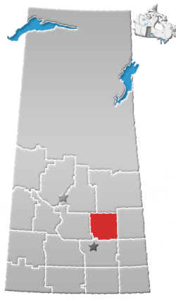 | ||||
|---|---|---|---|---|---|
| Villages | |||||
| Resort villages | |||||
| Rural municipalities | |||||
| Unincorporated communities |
| ||||
This article is issued from
Wikipedia.
The text is licensed under Creative Commons - Attribution - Sharealike.
Additional terms may apply for the media files.