Kelliher, Saskatchewan
| Kelliher | |
|---|---|
| Village | |
| Village of Kelliher | |
 Location of Kelliher in Saskatchewan  Kelliher, Saskatchewan (Canada) | |
| Coordinates: 51°15′40″N 103°44′24″W / 51.261°N 103.740°W | |
| Country |
|
| Province |
|
| Region | Central |
| Census division | 10 |
| Rural Municipality | Kellross No. 247 |
| Government | |
| • Type | Municipal |
| • Governing body | Kelliher Village Council |
| • Mayor | Darcy King |
| • Administrator | Angela Romanson |
| Area | |
| • Total | 2.81 km2 (1.08 sq mi) |
| Population (2016) | |
| • Total | 217 |
| • Density | 77.3/km2 (200/sq mi) |
| Time zone | UTC−6 (CST) |
| Postal code | S0A 1V0 |
| Area code(s) | 306 |
| Highways |
|
| Railways | Canadian National Railway |
| Website | Village of Kelliher |
| [1][2][3][4] | |
Kelliher is a village within the Rural Municipality of Kellross No. 247, in the province of Saskatchewan, Canada. The village is located about 140 km north of the provincial capital, Regina. The village had a population of 217 in the 2016 Canada Census, (a 0.5% increase from 216 in the 2011 Canada Census).
Demographics
| Canada census – Kelliher, Saskatchewan community profile | |||
|---|---|---|---|
| 2016 | 2011 | 2006 | |
| Population: | 217 (0.5% from 2011) | 216 (-16.0% from 2006) | 257 (-18.9% from 2001) |
| Land area: | 2.81 km2 (1.08 sq mi) | 2.81 km2 (1.08 sq mi) | 2.81 km2 (1.08 sq mi) |
| Population density: | 77.3/km2 (200/sq mi) | 76.9/km2 (199/sq mi) | 91.5/km2 (237/sq mi) |
| Median age: | 55.2 (M: 55.0, F: 55.4) | 57.5 (M: 58.0, F: 61.0) | 57.5 (M: 53.8, F: 58.0) |
| Total private dwellings: | 151 | 136 | 166 |
| Median household income: | |||
| References: 2016[5] 2011[6] 2006[7] earlier[8] | |||
Climate
| Climate data for Kelliher | |||||||||||||
|---|---|---|---|---|---|---|---|---|---|---|---|---|---|
| Month | Jan | Feb | Mar | Apr | May | Jun | Jul | Aug | Sep | Oct | Nov | Dec | Year |
| Record high °C (°F) | 9 (48) |
8 (46) |
19 (66) |
30.6 (87.1) |
37.8 (100) |
38 (100) |
37.2 (99) |
38.3 (100.9) |
34.4 (93.9) |
29.5 (85.1) |
20 (68) |
9.5 (49.1) |
38.3 (100.9) |
| Average high °C (°F) | −12 (10) |
−8.2 (17.2) |
−1.4 (29.5) |
9.1 (48.4) |
17.2 (63) |
21.5 (70.7) |
23.9 (75) |
23.5 (74.3) |
16.7 (62.1) |
9.5 (49.1) |
−2.2 (28) |
−9.6 (14.7) |
7.3 (45.1) |
| Daily mean °C (°F) | −17.2 (1) |
−13.2 (8.2) |
−6.4 (20.5) |
3.2 (37.8) |
10.7 (51.3) |
15.3 (59.5) |
17.5 (63.5) |
16.6 (61.9) |
10.5 (50.9) |
3.9 (39) |
−6.4 (20.5) |
−14.4 (6.1) |
1.7 (35.1) |
| Average low °C (°F) | −22.3 (−8.1) |
−18.1 (−0.6) |
−11.3 (11.7) |
−2.6 (27.3) |
4.1 (39.4) |
8.9 (48) |
11 (52) |
9.8 (49.6) |
4.2 (39.6) |
−1.8 (28.8) |
−10.6 (12.9) |
−19.1 (−2.4) |
−4 (25) |
| Record low °C (°F) | −46.7 (−52.1) |
−42.2 (−44) |
−42.2 (−44) |
−25.6 (−14.1) |
−13 (9) |
−3.3 (26.1) |
0 (32) |
−3.5 (25.7) |
−11.1 (12) |
−25 (−13) |
−35 (−31) |
−43 (−45) |
−46.7 (−52.1) |
| Average precipitation mm (inches) | 22.3 (0.878) |
15.4 (0.606) |
24.7 (0.972) |
30.4 (1.197) |
50.1 (1.972) |
79.5 (3.13) |
71.5 (2.815) |
58.2 (2.291) |
42.1 (1.657) |
26.7 (1.051) |
19.1 (0.752) |
25.2 (0.992) |
465.1 (18.311) |
| Source: Environment Canada[10] | |||||||||||||
See also
References
- ↑ National Archives, Archivia Net, Post Offices and Postmasters, archived from the original on 6 October 2006
- ↑ Government of Saskatchewan, MRD Home, Municipal Directory System, archived from the original (– Scholar search) on 21 November 2008
- ↑ Canadian Textiles Institute. (2005), CTI Determine your provincial constituency, archived from the original on 11 September 2007
- ↑ Commissioner of Canada Elections, Chief Electoral Officer of Canada (2005), Elections Canada On-line, archived from the original on 21 April 2007
- ↑ "2016 Community Profiles". Canada 2016 Census. Statistics Canada. February 21, 2017. Retrieved 2018-03-11.
- ↑ "2011 Community Profiles". Canada 2011 Census. Statistics Canada. July 5, 2013. Retrieved 2015-04-16.
- ↑ "2006 Community Profiles". Canada 2006 Census. Statistics Canada. March 30, 2011. Retrieved 2009-02-24.
- ↑ "2001 Community Profiles". Canada 2001 Census. Statistics Canada. February 17, 2012.
- ↑ Statistics Canada. 2012. Kelliher, Saskatchewan (Code 4710009) and Division No. 10, Saskatchewan (Code 4710) (table). Census Profile. 2011 Census. Statistics Canada Catalogue no. 98-316-XWE. Ottawa. Released 24 October 2012.
- ↑ Environment Canada Canadian Climate Normals 1971–2000, accessed 29 July 2010
External links
- Saskatchewan City & Town Maps
- Saskatchewan Gen Web – One Room School Project
- Post Offices and Postmasters – ArchiviaNet – Library and Archives Canada
- Saskatchewan Gen Web Region
- Online Historical Map Digitization Project
- GeoNames Query
- 2006 Community Profiles
| Subdivisions | |
|---|---|
| Communities | |
| Cities | |
| Topics |
|
| |
| Towns | 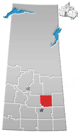 | ||||
|---|---|---|---|---|---|
| Villages | |||||
| Resort villages | |||||
| Rural municipalities | |||||
| Unincorporated communities |
| ||||
Coordinates: 51°15′40″N 103°44′24″W / 51.261°N 103.740°W
This article is issued from
Wikipedia.
The text is licensed under Creative Commons - Attribution - Sharealike.
Additional terms may apply for the media files.