Kuroki, Saskatchewan
| Kuroki | |
|---|---|
| Organized hamlet | |
 Kuroki | |
| Coordinates: 51°52′21″N 103°29′37″W / 51.87250°N 103.49361°W | |
| Country | Canada |
| Province | Saskatchewan |
| Region | West Central Saskatchewan |
| Census division | 10 |
| Rural Municipality | Sasman |
| Government | |
| • Governing body | Kuroki Council |
| Area | |
| • Total | 0.59 km2 (0.23 sq mi) |
| Population (2016) | |
| • Total | 50 |
| • Density | 84.6/km2 (219/sq mi) |
| Time zone | CST |
| Area code(s) | 306 |
| Highways | Highway 5, Highway 38 & Highway 310 |
| Railways | Canadian National Railway |
| [1][2][3][4] | |
Kuroki is a hamlet in the Rural Municipality of Sasman No. 336, Saskatchewan, Canada. Listed as a designated place by Statistics Canada, the hamlet had a population of 50 in the Canada 2016 Census.[5] The community is named after the Japanese general Kuroki Tamemoto.
Demographics
| Canada census – Kuroki, Saskatchewan community profile | |||
|---|---|---|---|
| 2016 | |||
| Population: | 50 (+ 11.1% from 2011) | ||
| Land area: | 0.59 km2 (0.23 sq mi) | ||
| Population density: | 84.6/km2 (219/sq mi) | ||
| Median age: | 53.5 (M: 51.5, F: 56.0) | ||
| Total private dwellings: | 38 | ||
| Median household income: | $N/A | ||
| References: 2016[6] earlier[7] | |||
History
As an interesting aside, this village was founded after the Japanese had won several victories in the war against Russia (Russo-Japanese War 1904-05). Britain was allied with Japan in this war and Japan was a very popular nation throughout the British Empire. Three towns in Saskatchewan were named along the CN line in memory of the Japanese achievements in this war: Mikado, Togo and Kuroki.
Points of Interest
A Japanese Garden was created by residents, complete with rock gardens and small pond. It has a sign in Japanese saying "Kuroki Japanese Gardens." On the western edge of town there is a small Ukrainian Orthodox church and St. Helena Cemetery. The grain elevator still stands in good condition but has been purchased and is now owned privately.
Climate
| Climate data for Kuroki | |||||||||||||
|---|---|---|---|---|---|---|---|---|---|---|---|---|---|
| Month | Jan | Feb | Mar | Apr | May | Jun | Jul | Aug | Sep | Oct | Nov | Dec | Year |
| Record high °C (°F) | 5 (41) |
9 (48) |
19.5 (67.1) |
30 (86) |
37.5 (99.5) |
38.5 (101.3) |
38.5 (101.3) |
39.4 (102.9) |
36.7 (98.1) |
28.9 (84) |
18.3 (64.9) |
9 (48) |
39.4 (102.9) |
| Average high °C (°F) | −13.4 (7.9) |
−9.8 (14.4) |
−2.7 (27.1) |
8.4 (47.1) |
17.8 (64) |
21.8 (71.2) |
23.7 (74.7) |
23 (73) |
16.3 (61.3) |
8.9 (48) |
−3.7 (25.3) |
−11.3 (11.7) |
6.6 (43.9) |
| Daily mean °C (°F) | −18.2 (−0.8) |
−14.7 (5.5) |
−7.7 (18.1) |
2.8 (37) |
11 (52) |
15.4 (59.7) |
17.4 (63.3) |
16.4 (61.5) |
10.3 (50.5) |
3.5 (38.3) |
−7.5 (18.5) |
−15.9 (3.4) |
1.1 (34) |
| Average low °C (°F) | −23 (−9) |
−19.6 (−3.3) |
−12.6 (9.3) |
−2.8 (27) |
4.2 (39.6) |
8.9 (48) |
11 (52) |
9.8 (49.6) |
4.3 (39.7) |
−2 (28) |
−11.4 (11.5) |
−20.4 (−4.7) |
−4.5 (23.9) |
| Record low °C (°F) | −45.6 (−50.1) |
−43.9 (−47) |
−42.8 (−45) |
−30 (−22) |
−11.1 (12) |
−4 (25) |
0 (32) |
−4 (25) |
−10 (14) |
−23.3 (−9.9) |
−35 (−31) |
−44 (−47) |
−45.6 (−50.1) |
| Average precipitation mm (inches) | 24.7 (0.972) |
20.2 (0.795) |
30.2 (1.189) |
28.1 (1.106) |
47.8 (1.882) |
69 (2.72) |
75.1 (2.957) |
54.9 (2.161) |
43.6 (1.717) |
23.5 (0.925) |
24.1 (0.949) |
26.1 (1.028) |
467.3 (18.398) |
| Source: Environment Canada[8] | |||||||||||||
See also
References
- ↑ National Archives, Archivia Net, Post Offices and Postmasters
- ↑ Government of Saskatchewan, MRD Home, Municipal Directory System, archived from the original on 21 November 2008
- ↑ Canadian Textiles Institute. (2005), CTI Determine your provincial constituency
- ↑ Commissioner of Canada Elections, Chief Electoral Officer of Canada (2005), Elections Canada On-line
- ↑ Canada 2016 Census: Designated places in Saskatchewan
- ↑ "2016 Community Profiles". Canada 2016 Census. Statistics Canada. February 21, 2017.
- ↑ "2001 Community Profiles". Canada 2001 Census. Statistics Canada. February 17, 2012.
- ↑ Environment Canada Canadian Climate Normals 1971–2000, accessed 4 August 2010
External links
| Subdivisions | |
|---|---|
| Communities | |
| Cities | |
| Topics |
|
| |
| Towns | 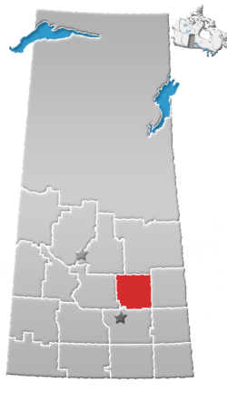 | ||||
|---|---|---|---|---|---|
| Villages | |||||
| Resort villages | |||||
| Rural municipalities | |||||
| Unincorporated communities |
| ||||
Coordinates: 51°52′18″N 103°29′19″W / 51.87167°N 103.48861°W