Lestock, Saskatchewan
| Lestock | |
|---|---|
| Village | |
| Village of Lestock | |
 Lestock Lestock in Saskatchewan  Lestock Lestock (Canada) | |
| Coordinates: 51°18′40″N 103°58′59″W / 51.311°N 103.983°W | |
| Country |
|
| Province |
|
| Region | Central |
| Census division | 10 |
| Rural Municipality | Kellross No. 247 |
| Government | |
| • Type | Municipal |
| • Governing body | Lestock Village Council |
| • Mayor | Kelly Komodowski |
| • Administrator | Susan Ross |
| Area | |
| • Total | 0.87 km2 (0.34 sq mi) |
| Population (2016) | |
| • Total | 95 |
| • Density | 109.3/km2 (283/sq mi) |
| Time zone | UTC-6 (CST) |
| Postal code | S0A 2G0 |
| Area code(s) | 306 |
| Highways |
|
| Railways | Canadian National Railway |
| Website | Village of Lestock |
| [1][2][3][4] | |
Lestock is a village within the Rural Municipality of in the province of Saskatchewan, Canada. Lestock had a population of 95 in the 2016 Canada Census, (a -24.0% decline from 125 in the 2011 Canada Census).
The village was named after John Lestock Reid, a surveyor for the railway.[5]
Demographics
| Canada census – Lestock, Saskatchewan community profile | |||
|---|---|---|---|
| 2016 | 2011 | 2006 | |
| Population: | 95 (-24.0% from 2011) | 125 (-9.4% from 2006) | 138 (-38.9% from 2001) |
| Land area: | 0.87 km2 (0.34 sq mi) | 0.87 km2 (0.34 sq mi) | 0.87 km2 (0.34 sq mi) |
| Population density: | 187.7/km2 (486/sq mi) | 182.4/km2 (472/sq mi) | 158.8/km2 (411/sq mi) |
| Median age: | 56.8 (M: 61.2, F: 53.0) | 51.7 (M: 52.8, F: 50.0) | 51.0 (M: 49.5, F: 53.5) |
| Total private dwellings: | 98 | 76 | 98 |
| Median household income: | |||
| References: 2016[6] 2011[7] 2006[8] earlier[9] | |||
See also
References
- ↑ National Archives, Archivia Net, Post Offices and Postmasters, archived from the original on October 6, 2006
- ↑ Government of Saskatchewan, MRD Home, Municipal Directory System, archived from the original on November 21, 2008
- ↑ Canadian Textiles Institute. (2005), CTI Determine your provincial constituency, archived from the original on 2007-09-11
- ↑ Commissioner of Canada Elections, Chief Electoral Officer of Canada (2005), Elections Canada On-line, archived from the original on April 21, 2007
- ↑ "Lesstock, Saskatchewan profile". epodunk.com. Retrieved 2010-09-11.
- ↑ "2016 Community Profiles". Canada 2016 Census. Statistics Canada. February 21, 2017. Retrieved 2017-03-15.
- ↑ "2011 Community Profiles". Canada 2011 Census. Statistics Canada. July 5, 2013. Retrieved 2012-10-14.
- ↑ "2006 Community Profiles". Canada 2006 Census. Statistics Canada. March 30, 2011. Retrieved 2010-09-11.
- ↑ "2001 Community Profiles". Canada 2001 Census. Statistics Canada. February 17, 2012.
External links
- GeoNames Query
- Official site
- Online Historical Map Digitization Project
- Post Offices and Postmasters - ArchiviaNet - Library and Archives Canada
- Saskatchewan City & Town Maps
- Saskatchewan Gen Web Region
- Saskatchewan Gen Web - One Room School Project
- Saskatchewan Roman Catholic Churches ~ Online Parish Registers ~ History >>Ituna - Jasmin - Lestock.
- Saskatchewan Roman Catholic Churches ~ Online Parish Registers ~ History >>Mostyn / Lestock.
Places adjacent to Lestock, Saskatchewan | ||||||||||
|---|---|---|---|---|---|---|---|---|---|---|
| ||||||||||
| Subdivisions | |
|---|---|
| Communities | |
| Cities | |
| Topics |
|
| |
| Towns | 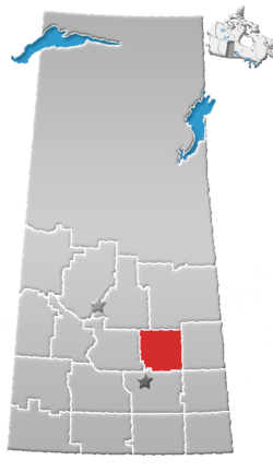 | ||||
|---|---|---|---|---|---|
| Villages | |||||
| Resort villages | |||||
| Rural municipalities | |||||
| Unincorporated communities |
| ||||
This article is issued from
Wikipedia.
The text is licensed under Creative Commons - Attribution - Sharealike.
Additional terms may apply for the media files.