Ramnagar, Barabanki
| Ramnagar, Barabanki Ramnagar | |
|---|---|
| city | |
 Ramnagar barabanki | |
 Ramnagar, Barabanki Location in Uttar Pradesh, India | |
| Coordinates: 27°05′44″N 81°29′05″E / 27.09556°N 81.48472°ECoordinates: 27°05′44″N 81°29′05″E / 27.09556°N 81.48472°E | |
| Country |
|
| State | Uttar Pradesh |
| District | Barabanki |
| Government | |
| • Type | Nagar panchayat |
| Elevation | 64 m (210 ft) |
| Population (2001) | |
| • Total | 12,416 |
| Languages | |
| • Official | Hindi |
| Time zone | UTC+5:30 (IST) |
| Vehicle registration | UP-41 |
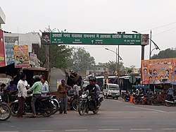
Ramnagar is a City in Barabanki district in the state of Uttar Pradesh, India. It is a town, tehsil and a nagar panchayat in Barabanki District in the Indian state of Uttar Pradesh.
Geography
Ramnagar is located at 27°05′44″N 81°29′05″E / 27.09556°N 81.48472°E.[1] It has an average elevation of 64 metres (209 feet). It is close to some historic and religious places like Mahadeva, Parijaat etc. Ram Nagar is situated on NH28C. Burhwal Junction is the nearest railway station.
Demographics
As of 2001 India census,[2] Ramnagar had a population of 12,416. Males constitute 53% of the population and females 47%. Ramnagar has an average literacy rate of 52%, lower than the national average of 59.5%: male literacy is 59%, and female literacy is 45%. In Ramnagar, 18% of the population is under 6 years of age.
References
- ↑ Falling Rain Genomics, Inc - Ramnagar
- ↑ "Census of India 2001: Data from the 2001 Census, including cities, villages and towns (Provisional)". Census Commission of India. Archived from the original on 2004-06-16. Retrieved 2008-11-01.