Pont-de-Roide-Vermondans
| Pont-de-Roide-Vermondans | ||
|---|---|---|
| Commune | ||
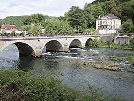 Bridge over the Doubs | ||
| ||
 Pont-de-Roide-Vermondans Location within Bourgogne-Franche-Comté region  Pont-de-Roide-Vermondans | ||
| Coordinates: 47°23′07″N 6°46′15″E / 47.3853°N 6.7708°ECoordinates: 47°23′07″N 6°46′15″E / 47.3853°N 6.7708°E | ||
| Country | France | |
| Region | Bourgogne-Franche-Comté | |
| Department | Doubs | |
| Arrondissement | Montbéliard | |
| Canton | Valentigney | |
| Government | ||
| • Mayor (2014–2020) | Denis Arnoux | |
| Area1 | 13.58 km2 (5.24 sq mi) | |
| Population (2012)2 | 4,309 | |
| • Density | 320/km2 (820/sq mi) | |
| Time zone | UTC+1 (CET) | |
| • Summer (DST) | UTC+2 (CEST) | |
| INSEE/Postal code | 25463 /25150 | |
| Elevation | 344–817 m (1,129–2,680 ft) | |
|
1 French Land Register data, which excludes lakes, ponds, glaciers > 1 km2 (0.386 sq mi or 247 acres) and river estuaries. 2 Population without double counting: residents of multiple communes (e.g., students and military personnel) only counted once. | ||

Pont-de-Roide-Vermondans (before 2014: Pont-de-Roide)[1] is a commune in the Doubs département in the Bourgogne-Franche-Comté region in eastern France.
Geography
The town is at the heart of the Pays de Lomont, 17 km (11 mi) from Montbéliard at the confluence of the Doubs River, the Ranceuse, and the Roide; it is therefore located at the crossroad of different valleys. On the east end of the town are high cliffs known as les Roches, leading to a plateau near the Franco-Swiss border.
History
In 1973, the adjacent village of Vermondans joined the commune of Pont-de-Roide. In 2013 the fusion was made official by the creation of a new commune: Pont-de-Roide - Vermondans.
Population
| Historical population | ||
|---|---|---|
| Year | Pop. | ±% |
| 1962 | 4,626 | — |
| 1968 | 5,261 | +13.7% |
| 1975 | 5,342 | +1.5% |
| 1982 | 4,958 | −7.2% |
| 1990 | 4,983 | +0.5% |
| 1999 | 4,781 | −4.1% |
| 2008 | 4,597 | −3.8% |
| 2012 | 4,309 | −6.3% |
See also
- Communes of the Doubs department
- US Pont-de-Roide
- Armand Machabey (1886–1966), musicologist, born in Pont-de-Roide-Vermondans
References
- ↑ Décret n° 2014-1447 3 December 2014 (in French)
External links
| Wikimedia Commons has media related to Pont-de-Roide-Vermondans. |
- Official Web site (in French)
| Authority control |
|---|