Mathay
| Mathay | ||
|---|---|---|
| Commune | ||
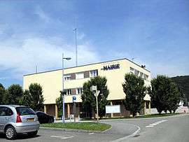 Town hall | ||
| ||
 Mathay Location within Bourgogne-Franche-Comté region  Mathay | ||
| Coordinates: 47°26′16″N 6°47′02″E / 47.4378°N 6.7839°ECoordinates: 47°26′16″N 6°47′02″E / 47.4378°N 6.7839°E | ||
| Country | France | |
| Region | Bourgogne-Franche-Comté | |
| Department | Doubs | |
| Arrondissement | Montbéliard | |
| Canton | Valentigney | |
| Intercommunality | Pays de Montbéliard | |
| Government | ||
| • Mayor (2008–2014) | Daniel Granjon | |
| Area1 | 14.85 km2 (5.73 sq mi) | |
| Population (2012)2 | 2,158 | |
| • Density | 150/km2 (380/sq mi) | |
| Time zone | UTC+1 (CET) | |
| • Summer (DST) | UTC+2 (CEST) | |
| INSEE/Postal code | 25370 /25700 | |
| Elevation | 330–551 m (1,083–1,808 ft) | |
|
1 French Land Register data, which excludes lakes, ponds, glaciers > 1 km2 (0.386 sq mi or 247 acres) and river estuaries. 2 Population without double counting: residents of multiple communes (e.g., students and military personnel) only counted once. | ||

Mathay is a commune in the Doubs department in the Bourgogne-Franche-Comté region in eastern France.
Geography
Mathay lies 6 km (3.7 mi) north of Pont-de-Roide.
Population
| Historical population | ||
|---|---|---|
| Year | Pop. | ±% |
| 1962 | 1,172 | — |
| 1968 | 1,360 | +16.0% |
| 1975 | 1,482 | +9.0% |
| 1982 | 1,634 | +10.3% |
| 1990 | 1,960 | +20.0% |
| 1999 | 1,988 | +1.4% |
| 2008 | 2,156 | +8.5% |
| 2012 | 2,158 | +0.1% |
See also
References
External links
| Wikimedia Commons has media related to Mathay. |
This article is issued from
Wikipedia.
The text is licensed under Creative Commons - Attribution - Sharealike.
Additional terms may apply for the media files.