Bart, Doubs
| Bart | |
|---|---|
| Commune | |
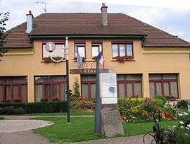 Town hall | |
 Bart Location within Bourgogne-Franche-Comté region  Bart | |
| Coordinates: 47°29′34″N 6°46′20″E / 47.4928°N 6.7722°ECoordinates: 47°29′34″N 6°46′20″E / 47.4928°N 6.7722°E | |
| Country | France |
| Region | Bourgogne-Franche-Comté |
| Department | Doubs |
| Arrondissement | Montbéliard |
| Canton | Montbéliard |
| Intercommunality | Pays de Montbéliard |
| Government | |
| • Mayor (2008–2014) | Pierre Schlatter |
| Area1 | 3.84 km2 (1.48 sq mi) |
| Population (2012)2 | 1,952 |
| • Density | 510/km2 (1,300/sq mi) |
| Time zone | UTC+1 (CET) |
| • Summer (DST) | UTC+2 (CEST) |
| INSEE/Postal code | 25043 /25420 |
| Elevation | 309–480 m (1,014–1,575 ft) |
|
1 French Land Register data, which excludes lakes, ponds, glaciers > 1 km2 (0.386 sq mi or 247 acres) and river estuaries. 2 Population without double counting: residents of multiple communes (e.g., students and military personnel) only counted once. | |
Bart is a commune in the Doubs department in the Bourgogne-Franche-Comté region in eastern France.
Population
| Historical population | ||
|---|---|---|
| Year | Pop. | ±% |
| 1962 | 1,385 | — |
| 1968 | 1,516 | +9.5% |
| 1975 | 1,852 | +22.2% |
| 1982 | 1,874 | +1.2% |
| 1990 | 2,074 | +10.7% |
| 1999 | 2,076 | +0.1% |
| 2008 | 1,931 | −7.0% |
| 2012 | 1,952 | +1.1% |
See also
References
External links
| Wikimedia Commons has media related to Bart (Doubs). |
- Pays de Montbéliard website (in French)
This article is issued from
Wikipedia.
The text is licensed under Creative Commons - Attribution - Sharealike.
Additional terms may apply for the media files.