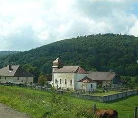
Remoray-Boujeons
| Remoray-Boujeons | |
|---|---|
| Commune | |
 | |
 Remoray-Boujeons Location within Bourgogne-Franche-Comté region  Remoray-Boujeons | |
| Coordinates: 46°46′06″N 6°14′23″E / 46.7683°N 6.2397°ECoordinates: 46°46′06″N 6°14′23″E / 46.7683°N 6.2397°E | |
| Country | France |
| Region | Bourgogne-Franche-Comté |
| Department | Doubs |
| Arrondissement | Pontarlier |
| Canton | Frasne |
| Intercommunality | Mont d'Or et des Deux Lacs |
| Government | |
| • Mayor (2008–2014) | Jean-Paul Vuillaume |
| Area1 | 15.15 km2 (5.85 sq mi) |
| Population (2012)2 | 381 |
| • Density | 25/km2 (65/sq mi) |
| Time zone | UTC+1 (CET) |
| • Summer (DST) | UTC+2 (CEST) |
| INSEE/Postal code | 25486 /25160 |
| Elevation | 849–1,166 m (2,785–3,825 ft) |
|
1 French Land Register data, which excludes lakes, ponds, glaciers > 1 km2 (0.386 sq mi or 247 acres) and river estuaries. 2 Population without double counting: residents of multiple communes (e.g., students and military personnel) only counted once. | |
Remoray-Boujeons is a commune in the Doubs department in the Bourgogne-Franche-Comté region in eastern France.
Population
| Historical population | ||
|---|---|---|
| Year | Pop. | ±% |
| 1962 | 242 | — |
| 1968 | 256 | +5.8% |
| 1975 | 220 | −14.1% |
| 1982 | 184 | −16.4% |
| 1990 | 210 | +14.1% |
| 1999 | 284 | +35.2% |
| 2008 | 323 2012 | — |
| 381 | — | |
See also
References
| Wikimedia Commons has media related to Remoray-Boujeons. |
This article is issued from
Wikipedia.
The text is licensed under Creative Commons - Attribution - Sharealike.
Additional terms may apply for the media files.