Maîche
| Maîche | ||
|---|---|---|
| Commune | ||
 | ||
| ||
 Maîche Location within Bourgogne-Franche-Comté region  Maîche | ||
| Coordinates: 47°15′07″N 6°48′16″E / 47.2519°N 6.8044°ECoordinates: 47°15′07″N 6°48′16″E / 47.2519°N 6.8044°E | ||
| Country | France | |
| Region | Bourgogne-Franche-Comté | |
| Department | Doubs | |
| Arrondissement | Montbéliard | |
| Canton | Maîche | |
| Intercommunality | Plateau Maîchois | |
| Government | ||
| • Mayor (2008–2014) | Joseph Parrenin | |
| Area1 | 17.42 km2 (6.73 sq mi) | |
| Population (2012)2 | 4,331 | |
| • Density | 250/km2 (640/sq mi) | |
| Time zone | UTC+1 (CET) | |
| • Summer (DST) | UTC+2 (CEST) | |
| INSEE/Postal code | 25356 /25120 | |
| Elevation | 729–981 m (2,392–3,219 ft) | |
|
1 French Land Register data, which excludes lakes, ponds, glaciers > 1 km2 (0.386 sq mi or 247 acres) and river estuaries. 2 Population without double counting: residents of multiple communes (e.g., students and military personnel) only counted once. | ||
.svg.png)
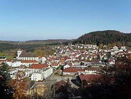
Maîche is a commune in the Doubs department in the Bourgogne-Franche-Comté region in eastern France.
Geography
Maîche is situated between the Doubs River and the Dessoubre. It is surrounded by evergreen forests. The highest point in the commune is the Faux Verger.
Population
| Historical population | ||
|---|---|---|
| Year | Pop. | ±% |
| 1962 | 3,361 | — |
| 1968 | 3,714 | +10.5% |
| 1975 | 4,381 | +18.0% |
| 1982 | 4,216 | −3.8% |
| 1990 | 4,168 | −1.1% |
| 1999 | 3,978 | −4.6% |
| 2004 | 3,875 | −2.6% |
| 2008 | 4,179 | +7.8% |
| 2012 | 4,331 | +3.6% |
See also
References
External links
| Wikimedia Commons has media related to Maîche. |
- Official website (in French)
- Maîche on the intercommunal Web site of the department (in French)
This article is issued from
Wikipedia.
The text is licensed under Creative Commons - Attribution - Sharealike.
Additional terms may apply for the media files.