Scey-Maisières
| Scey-Maisières | |
|---|---|
| Commune | |
 | |
 Scey-Maisières Location within Bourgogne-Franche-Comté region  Scey-Maisières | |
| Coordinates: 47°06′05″N 6°04′35″E / 47.1014°N 6.0764°ECoordinates: 47°06′05″N 6°04′35″E / 47.1014°N 6.0764°E | |
| Country | France |
| Region | Bourgogne-Franche-Comté |
| Department | Doubs |
| Arrondissement | Besançon |
| Canton | Ornans |
| Intercommunality | Pays d'Ornans |
| Government | |
| • Mayor (2008–2014) | Michèle Beauvais |
| Area1 | 12.53 km2 (4.84 sq mi) |
| Population (2012)2 | 308 |
| • Density | 25/km2 (64/sq mi) |
| Time zone | UTC+1 (CET) |
| • Summer (DST) | UTC+2 (CEST) |
| INSEE/Postal code | 25537 /25290 |
| Elevation | 305–558 m (1,001–1,831 ft) |
|
1 French Land Register data, which excludes lakes, ponds, glaciers > 1 km2 (0.386 sq mi or 247 acres) and river estuaries. 2 Population without double counting: residents of multiple communes (e.g., students and military personnel) only counted once. | |
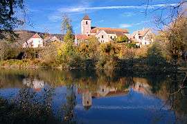
Scey-Maisières is a commune in the Doubs department in the Bourgogne-Franche-Comté region in eastern France.
Geography
The commune lies 4 km (2.5 mi) west of Ornans on the banks of the Loue.
History
The commune was formed from the former communes of Scey-en-Varais and Maisières-Notre-Dame.
Population
| Historical population | ||
|---|---|---|
| Year | Pop. | ±% |
| 1962 | 208 | — |
| 1968 | 221 | +6.2% |
| 1975 | 223 | +0.9% |
| 1982 | 208 | −6.7% |
| 1990 | 267 | +28.4% |
| 1999 | 253 | −5.2% |
| 2008 | 315 | +24.5% |
| 2012 | 308 | −2.2% |
See also
References
External links
| Wikimedia Commons has media related to Scey-Maisières. |
- Scey-Maisières on the regional Web site (in French)
This article is issued from
Wikipedia.
The text is licensed under Creative Commons - Attribution - Sharealike.
Additional terms may apply for the media files.