Montagney-Servigney
| Montagney-Servigney | |
|---|---|
| Commune | |
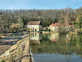 Forge and dam on the Ognon | |
 Montagney-Servigney Location within Bourgogne-Franche-Comté region  Montagney-Servigney | |
| Coordinates: 47°28′55″N 6°18′26″E / 47.4819°N 6.3072°ECoordinates: 47°28′55″N 6°18′26″E / 47.4819°N 6.3072°E | |
| Country | France |
| Region | Bourgogne-Franche-Comté |
| Department | Doubs |
| Arrondissement | Besançon |
| Canton | Baume-les-Dames |
| Intercommunality | Pays de Rougemont |
| Government | |
| • Mayor (2008–2014) | Christian Filet |
| Area1 | 6.55 km2 (2.53 sq mi) |
| Population (2012)2 | 124 |
| • Density | 19/km2 (49/sq mi) |
| Time zone | UTC+1 (CET) |
| • Summer (DST) | UTC+2 (CEST) |
| INSEE/Postal code | 25385 /25680 |
| Elevation | 241–297 m (791–974 ft) |
|
1 French Land Register data, which excludes lakes, ponds, glaciers > 1 km2 (0.386 sq mi or 247 acres) and river estuaries. 2 Population without double counting: residents of multiple communes (e.g., students and military personnel) only counted once. | |
Montagney-Servigney is a commune in the Doubs department in the Bourgogne-Franche-Comté region in eastern France.
Geography
The commune lies 4 km (2.5 mi) south of Rougemont.
Population
| Historical population | ||
|---|---|---|
| Year | Pop. | ±% |
| 1962 | 111 | — |
| 1968 | 115 | +3.6% |
| 1975 | 111 | −3.5% |
| 1982 | 111 | +0.0% |
| 1990 | 130 | +17.1% |
| 1999 | 112 | −13.8% |
| 2008 | 111 | −0.9% |
| 2012 | 124 | +11.7% |
See also
References
External links
| Wikimedia Commons has media related to Montagney-Servigney. |
This article is issued from
Wikipedia.
The text is licensed under Creative Commons - Attribution - Sharealike.
Additional terms may apply for the media files.