Étupes
| Étupes | ||
|---|---|---|
| Commune | ||
 | ||
| ||
 Étupes Location within Bourgogne-Franche-Comté region  Étupes | ||
| Coordinates: 47°30′25″N 6°51′43″E / 47.5069°N 6.8619°ECoordinates: 47°30′25″N 6°51′43″E / 47.5069°N 6.8619°E | ||
| Country | France | |
| Region | Bourgogne-Franche-Comté | |
| Department | Doubs | |
| Arrondissement | Montbéliard | |
| Canton | Bethoncourt | |
| Intercommunality | Pays de Montbéliard | |
| Government | ||
| • Mayor (2008–2014) | Catherine Dessables | |
| Area1 | 9.87 km2 (3.81 sq mi) | |
| Population (2012)2 | 3,581 | |
| • Density | 360/km2 (940/sq mi) | |
| Time zone | UTC+1 (CET) | |
| • Summer (DST) | UTC+2 (CEST) | |
| INSEE/Postal code | 25228 /25460 | |
| Elevation | 319–406 m (1,047–1,332 ft) | |
|
1 French Land Register data, which excludes lakes, ponds, glaciers > 1 km2 (0.386 sq mi or 247 acres) and river estuaries. 2 Population without double counting: residents of multiple communes (e.g., students and military personnel) only counted once. | ||

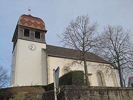
Étupes is a commune in the Doubs department in the Bourgogne-Franche-Comté region in eastern France.
Population
| Historical population | ||
|---|---|---|
| Year | Pop. | ±% |
| 1962 | 2,471 | — |
| 1968 | 5,198 | +110.4% |
| 1975 | 5,250 | +1.0% |
| 1982 | 4,671 | −11.0% |
| 1990 | 3,603 | −22.9% |
| 1999 | 3,543 | −1.7% |
| 2008 | 3,428 | −3.2% |
| 2012 | 3,581 | +4.5% |
See also
References
| Wikimedia Commons has media related to Étupes. |
This article is issued from
Wikipedia.
The text is licensed under Creative Commons - Attribution - Sharealike.
Additional terms may apply for the media files.