Arc-sous-Montenot
| Arc-sous-Montenot | ||
|---|---|---|
| Commune | ||
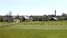 A general view of Arc-sous-Montenot | ||
| ||
 Arc-sous-Montenot Location within Bourgogne-Franche-Comté region  Arc-sous-Montenot | ||
| Coordinates: 46°54′46″N 6°00′10″E / 46.9128°N 6.0028°ECoordinates: 46°54′46″N 6°00′10″E / 46.9128°N 6.0028°E | ||
| Country | France | |
| Region | Bourgogne-Franche-Comté | |
| Department | Doubs | |
| Arrondissement | Pontarlier | |
| Canton | Frasne | |
| Intercommunality | Altitude 800 | |
| Government | ||
| • Mayor (2008–2014) | Patrick Grillon | |
| Area1 | 10.72 km2 (4.14 sq mi) | |
| Population (2012)2 | 225 | |
| • Density | 21/km2 (54/sq mi) | |
| Time zone | UTC+1 (CET) | |
| • Summer (DST) | UTC+2 (CEST) | |
| INSEE/Postal code | 25026 /25270 | |
| Elevation | 613–727 m (2,011–2,385 ft) | |
|
1 French Land Register data, which excludes lakes, ponds, glaciers > 1 km2 (0.386 sq mi or 247 acres) and river estuaries. 2 Population without double counting: residents of multiple communes (e.g., students and military personnel) only counted once. | ||
.svg.png)
Arc-sous-Montenot is a commune in the Doubs department in the Bourgogne-Franche-Comté region in eastern France.
Population
| Historical population | ||
|---|---|---|
| Year | Pop. | ±% |
| 1962 | 223 | — |
| 1968 | 249 | +11.7% |
| 1975 | 212 | −14.9% |
| 1982 | 232 | +9.4% |
| 1990 | 216 | −6.9% |
| 1999 | 217 | +0.5% |
| 2008 | 225 | +3.7% |
| 2012 | 225 | +0.0% |
See also
References
| Wikimedia Commons has media related to Arc-sous-Montenot. |
This article is issued from
Wikipedia.
The text is licensed under Creative Commons - Attribution - Sharealike.
Additional terms may apply for the media files.