Phatthalung Province
| Phatthalung พัทลุง | |||
|---|---|---|---|
| Province | |||
 | |||
| |||
 Map of Thailand highlighting Phatthalung Province | |||
| Country | Thailand | ||
| Capital | Phatthalung | ||
| Government | |||
| • Governor | Wanchai Khongkasem (since June 2016) | ||
| Area | |||
| • Total | 3,424.5 km2 (1,322.2 sq mi) | ||
| Area rank | Ranked 58th | ||
| Population (2014) | |||
| • Total | 520,419 | ||
| • Rank | Ranked 47th | ||
| • Density | 150/km2 (390/sq mi) | ||
| • Density rank | Ranked 27th | ||
| Time zone | UTC+7 (ICT) | ||
| ISO 3166 code | TH-93 | ||


Phatthalung (Thai: พัทลุง, pronounced [pʰát.tʰā.lūŋ]) is one of the southern provinces (changwat) of Thailand.[1] Neighboring provinces are (from north clockwise) Nakhon Si Thammarat, Songkhla, Satun, and Trang. Phatthalung is essentially a landlocked province, one of the only two in Southern Thailand, the other being Yala[2].
Geography
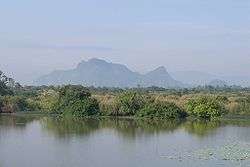
The province is on the Malay Peninsula. To the east it borders the large shallow Songkhla lake, while the west is covered by mountains of the Nakhon Si Thammarat chain. Khao Pu–Khao Ya National Park is at the border to Trang.[3]
History
Phatthalung was formerly known as Mardelong (Jawi: مردلوڠ) in Malay, especially during the time when the region came under Malay-Muslim influence.[4]
During the reign of King Ramathibodi I of the Ayutthaya kingdom in the 14th century, Phatthalung became one of twelve royal cities. At the end of the 18th century King Rama I submitted the city to the Ministry of Defense, which was responsible for all the southern provinces. During the administrative reform by King Chulalongkorn, Phatthalung became part of the Monthon Nakhon Si Thammarat.
Demographics
The majority of the province's populace are Thai Buddhists. Muslims account for 11.1 percent of the population. Many Muslims in Phatthalung have some ethnic Malay ancestry, who have gradually intermarried with the Thais and adopted Thai cultural norms.[5]
Symbols
The provincial seal shows the 177 meter high Phu Khao Ok Thalu mountain, the symbol of the province. The provincial tree and flower is the sweet shorea (Shorea roxburghii).
Administrative divisions
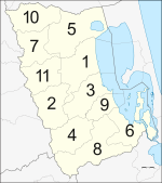
Phatthalung is divided into 11 districts (amphoe). The districts are further subdivided into 65 sub-districts (tambon) and 626 villages (muban).
Transport
Air
Phatthalung does not have an airport but the nearest airport is Trang Airport is 66 km from the center of Phatthalung.
Rail
Nakhon Si Thammarat has main station is Phatthalung Railway Station.
Tourism
Sights
Phraya Thukkharat (Chuai) Monument (อนุสาวรีย์พระยาทุกขราษฎร์ (ช่วย)) Phraya Thukkharat was a former monk named Phra Maha Chuai. During the Nine Armies War in the reign of King Rama I, Phra Maha Chuai assisted Phraya Phatthalung who headed a force of villagers to fight against and defeat the Burmese army. Later, he left the monkhood and was royally appointed as Phraya Thukkharat in charge of official duties as an assistant to the city ruler.[6]
Culture
Manora or Nora (มโนราห์หรือโนรา) A local performing art in the south. It was an influence from the south of India, together with Lakhon Chatri (theatrical show by males). However, some dancing patterns were changed to match folk cultures in each province. There are 12 major dancing patterns. The audience will see dancing patterns and listen to lyrics sung by dancers, be they impromptu or composed verses.
Talung (ตะลุง) A popular folk performance in the south. Talung puppet figures are made of dried sheets of cattle hide cut and carved beautifully into characters for a shadow play. The characters are usually painted wholly in black and each of them is put firmly between a split bamboo slat called "mai tap". A character’s mouth and hands will be moved to accord with the narration. A Talung ensemble comprises puppet masters who are also vocalists, and a band, totalling not over eight persons. The musical instruments include pipe, drum, phon (a drum), and gong.
References
- ↑ "Phatthalung". Tourism Authority of Thailand (TAT). Retrieved 23 May 2015.
- ↑ http://www.siewlianlim.com/uploads/7/1/1/3/7113499/the_role_of_shadow_puppetry_in_the_development_of__phatthalung.pdf
- ↑ "Khao Pu-Khao Ya National Park". Department of National Parks (DNP) Thailand. Archived from the original on 17 November 2015. Retrieved 23 May 2015.
- ↑ C. Skinner (1985). The Battle for Junk Ceylon: The Syair Sultan Maulana. Foris Publications. p. 272. ISBN 90-6765-066-8.
- ↑ William Chambers (publisher), Robert Chambers (1898). Chambers's Journal. W. & R. Chambers. p. 539.
- ↑ "Phraya Thukkharat (Chuai) Monument". Tourism Authority of Thailand (TAT). Retrieved 23 May 2015.
External links
| Wikimedia Commons has media related to Phatthalung Province. |

- Website of the province (Thai only)
- Phattalung provincial map, coat of arms and postal stamp Archived October 6, 2010, at the Wayback Machine.
Places adjacent to Phatthalung Province | ||||||||||
|---|---|---|---|---|---|---|---|---|---|---|
| ||||||||||
Coordinates: 7°36′56″N 100°04′22″E / 7.61556°N 100.07278°E