Si Banphot District
| Si Banphot ศรีบรรพต | |
|---|---|
| Amphoe | |
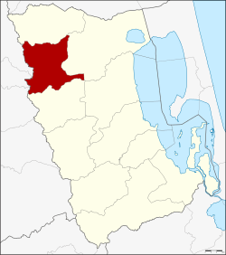 Amphoe location in Phatthalung Province | |
| Coordinates: 7°43′12″N 99°53′0″E / 7.72000°N 99.88333°ECoordinates: 7°43′12″N 99°53′0″E / 7.72000°N 99.88333°E | |
| Country | Thailand |
| Province | Phatthalung |
| Seat | Khao Ya |
| Area | |
| • Total | 218.504 km2 (84.365 sq mi) |
| Population (2005) | |
| • Total | 16,465 |
| • Density | 75.4/km2 (195/sq mi) |
| Time zone | UTC+7 (ICT) |
| Postal code | 93190 |
| Geocode | 9307 |
Si Banphot (Thai: ศรีบรรพต, pronounced [sǐː bān.pʰót]) is a district (amphoe) of Phatthalung Province, southern Thailand. It may also be spelled Sri Banphot.
Geography
Neighboring districts are (from the north clockwise) Pa Phayom, Khuan Khanun, and Srinagarindra of Phatthalung Province, Na Yong, Mueang Trang, and Huai Yot of Trang Province.
History
The minor district was established on 1 December 1977, when three tambons were split off from Khuan Khanun District.[1] It was upgraded to a full district on 4 November 1993.[2]
Administration
The district is divided into three sub-districts (tambon), which are further subdivided into 30 villages (muban). There are no municipal (thesaban) areas. There are three tambon administrative organizations (TAO).
| No. | Name | Thai name | Villages | Pop. | |
|---|---|---|---|---|---|
| 1. | Khao Ya | เขาย่า | 10 | 6,262 | |
| 2. | Khao Pu | เขาปู่ | 11 | 5,260 | |
| 3. | Taphaen | ตะแพน | 9 | 4,943 |
References
- ↑ ประกาศกระทรวงมหาดไทย เรื่อง แบ่งท้องที่อำเภอควนขนุน จังหวัดพัทลุง ตั้งเป็นกิ่งอำเภอศรีบรรพต (PDF). Royal Gazette (in Thai). 94 (122 ง): 4920. December 6, 1977.
- ↑ พระราชกฤษฎีกาตั้งอำเภอลำทับ อำเภอร่องคำ อำเภอเวียงแหง อำเภอนาโยง อำเภอแก้งสนามนาง อำเภอโนนแดง อำเภอบ้านหลวง อำเภอกะพ้อ อำเภอศรีบรรพต อำเภอแก่งกระจาน อำเภอหนองสูง อำเภอสบเมย อำเภอเมยวดี อำเภอโคกเจริญ อำเภอทุ่งหัวช้าง อำเภอผาขาว อำเภอวังหิน อำเภอดอนพุด อำเภอบึงโขงหลง และอำเภอห้วยคต พ.ศ. ๒๕๓๖ (PDF). Royal Gazette (in Thai). 110 (179 ก special): 1–3. November 3, 1993.
Exyternal links
This article is issued from
Wikipedia.
The text is licensed under Creative Commons - Attribution - Sharealike.
Additional terms may apply for the media files.