Chachoengsao Province
| Chachoengsao ฉะเชิงเทรา | |||
|---|---|---|---|
| Province | |||
| |||
| Nickname(s): Paet Rio | |||
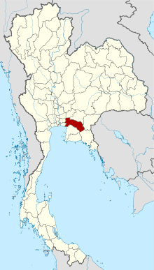 Map of Thailand highlighting Chachoengsao Province | |||
| Country | Thailand | ||
| Capital | Chachoengsao town | ||
| Government | |||
| • Governor | Anukun Tangkhananukunchai (since October 2013) | ||
| Area | |||
| • Total | 5,351 km2 (2,066 sq mi) | ||
| Area rank | Ranked 41st | ||
| Population (2017) | |||
| • Total | 709,889[1] | ||
| • Rank | Ranked 37th | ||
| • Density rank | Ranked 39th | ||
| Time zone | UTC+7 (ICT) | ||
| ISO 3166 code | TH-24 | ||

Chachoengsao (Thai: ฉะเชิงเทรา, pronounced [t͡ɕʰàʔ.t͡ɕʰɤ̄ːŋ.sāw]) is a province (changwat) of Thailand. Neighboring provinces are (from north clockwise) Prachin Buri, Sa Kaeo, Chanthaburi, Chon Buri, Samut Prakan, Bangkok, Pathum Thani, and Nakhon Nayok. It has a short coastline on the Gulf of Thailand.
History
Chachoengsao or Paet Riu is a province in eastern Thailand. It has a history dating back to the reign of King Borommatrailokkanat in the Ayutthaya period. People originally settled by the Bang Pakong River and along canals.
"Luangpho Phuttha Sothon" is a centre of faith of the people of Paet Riu.
In the past, Chachoengsao was a fourth-class city under the ministry of defence. In 1916, its status was changed from a city to a province.
Geography
The west part of the province is the low river plain of the Bang Pa Kong River, which is used extensively for farming rice. To the east is hillier terrain, with an average height of more than 100 m above sea level.
Symbols
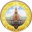
The provincial seal shows the main hall of the Sothornvararamvoraviharn temple. In this hall is the most important Buddha image of the province, known as Luangpho Phutthasothon.
The provincial tree is Peltophorum dasyrachis. The tree was assigned to the province by Queen Sirikit on the 50th anniversary of the coronation of King Rama IX in 2000. The provincial flower is the Yellow Flamboyant (Peltophorum pterocarpum).
The provincial slogan is The Bountiful Bang Pakong River,the Sacred Buddha Image of Luangpho Sothon, Phraya Si Sunthon the Scholar of Thai Language, and the Pristine Ang Rue Nai Forest
Administrative divisions
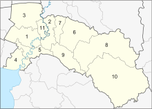
The province is divided into 11 districts (amphoe). These are further subdivided into 93 sub-districts (tambon) and 859 villages (muban).
Religion
Transport
Rail
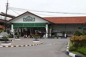
Chachoengsao's main station is Chachoengsao Junction Railway Station.
References
- ↑ "Population of the Kingdom". Department of Provincial Affairs (DOPA) Thailand (in Thai). 2017-12-31. Retrieved 4 Apr 2017.
- ↑ "Population by religion, region and area, 2015" (PDF). NSO. Retrieved 2017-10-12.
External links
| Wikimedia Commons has media related to Chachoengsao Province. |

- Website of province at the Wayback Machine (archived 2010-03-10)
- Province page from the Tourist Authority of Thailand at Archive.is (archived 2007-05-18)
- Flag of Chachoengsao Province
Places adjacent to Chachoengsao Province | |
|---|---|
Coordinates: 13°41′15″N 101°04′13″E / 13.68750°N 101.07028°E