Nakhon Pathom Province
| Nakhon Pathom นครปฐม | |||
|---|---|---|---|
| Province | |||
| |||
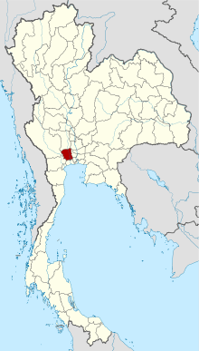 Map of Thailand highlighting Nakhon Pathom Province | |||
| Country | Thailand | ||
| Capital | Mueang Nakhon Pathom | ||
| Government | |||
| • Governor | Adisak Thep-at (since October 2016) | ||
| Area | |||
| • Total | 2,168.3 km2 (837.2 sq mi) | ||
| Area rank | Ranked 65th | ||
| Population (2017) | |||
| • Total | 911,492[1] | ||
| • Rank | Ranked 26th | ||
| • Density rank | Ranked 8th | ||
| Time zone | UTC+7 (ICT) | ||
| ISO 3166 code | TH-73 | ||


Nakhon Pathom (Thai: นครปฐม, pronounced [nə́kʰɔ̄ːn pə̄tʰǒm]) is one of the central provinces (changwat) of Thailand. Neighbouring provinces are (from north clockwise) Suphan Buri, Ayutthaya, Nonthaburi, Bangkok, Samut Sakhon, Ratchaburi, and Kanchanaburi. The province has long been known for its fruit orchards, but now includes two leading universities and major industrial areas.[2] Nakhon Pathom is one of the five provinces that forms the Bangkok Metropolitan Region.
Nakorn Pathom is home to the Sanamchandra Palace campus of Silpakorn University, the third oldest in Thailand.[3] It was established in 1923 as the School of Fine Arts by Corrado Ferroci (Prof. Silpa Bhirasri), who under the commission of King Rama V1, was appointed to work as a sculptor at the school. In 1943 the school achieved university status and now includes 12 faculties, a graduate school, and an international college that teaches entirely in English. There are two campuses in Bangkok, and one in Phetchaburi Province.
Mahidol University also has a campus in Nakhon Pathom.[4] Originally known as a leading medical university, it now teaches all major subjects and ranks high among universities in Southeast Asia.[5] Its Salaya campus includes an all-English language international college. Like Silpakorn, Mahidol has branch campuses in many other central Thailand locations.
Geography
Nakhon Pathom is a small province 56 km west of Bangkok. It is in the alluvial plain of central Thailand and is drained by the Tha Chin River (also called the Nakhon Chai Si), a tributary of the Chao Phraya River. The city of Bangkok has now grown so it actually extends to the provincial border of Nakhon Pathom.[2]
History
The name derives from the Pali words "Nagara Pathama" meaning "first city", and Nakhon Pathom is therefore often referred to as Thailand's oldest city. Archaeological remains have been found from the (pre-Thai) Dvaravati kingdom dating from the 6th to 11th centuries.
Nakhon Pathom Province originally on a trade route between China and India. Despite a commonly stated idea that it was once coastal, this was certainly not the case in any historical period as detailed in 'Reconsidering the Paleo-shoreline in the Lower Central Plain of Thailand' by Trongjai Hutangkura. When the Tha Chin River changed its course the city lost its main water source and was deserted, so the inhabitants moved to Nakhon Chai Si (or Sirichai). The 19th century King Mongkut (Rama IV) ordered the restoration of Phra Pathom Chedi which was crumbling and abandoned in the jungle. A city grew around the chedi bringing life back to Nakhon Pathom. A museum at the chedi displays the archaeological record of the historic area.
Major resettlement of the province included an emigration started during the reign of the Thai King Buddha Loetla Nabhalai (Rama II). This included Khmer villages (e.g., Don Yai Hom), the Lanna populated (Baan Nua), and Lao Song villages (e.g., Don Kanak) as well as a major influx of southern Chinese from the late 19th to early 20th centuries. Nakhon Pathom today attracts people from all over Thailand especially from Bangkok and the northeast as well as thousands of Burmese migrant workers. The province contains industrial zones, major university towns, government offices relocated from Bangkok, and agricultural and transport hubs.
Symbols
The provincial seal shows the Phra Pathom Chedi, at 120.45 meters one of the tallest pagodas in the world.[6] It is in Nakhon Pathom city centre, and has been an important Buddhist center since the 6th century. The current building was created by King Mongkut in 1860. On the pagoda a royal crown is depicted, the symbol for King Mongkut's work on reconstructing the pagoda.[7]
The provincial tree is the Diospyros decandra. The provincial slogan is Sweet pomelos, delicious rice, beautiful young ladies.
Administrative divisions

The province is subdivided into seven districts (amphoe). The districts are further subdivided into 105 communes (tambon) and 919 villages (muban). There is one city (thesaban nakhon) and 14 townships (thesaban tambon). There are also 102 tambon administrative organizations (TAO).
References
- ↑ "Population and House Report for Year 2017". Department of Provincial Administration, Ministry of Internal Affairs. Retrieved 2018-04-01. (Search page)
- 1 2 "Nakhon Pathom". Tourism Authority of Thailand (TAT). Archived from the original on 28 May 2015. Retrieved 28 May 2015.
- ↑ http://www.old.su.ac.th/
- ↑ "Mahidol University". Mahidol University. Retrieved 28 May 2015.
- ↑ "Ranking Web of Universities: Southeast Asia". Mahidol University. Retrieved 28 May 2015.
- ↑ "Phra Pathom Chedi". Tourism Authority of Thailand (TAT). Retrieved 28 May 2015.
- ↑ "Nakhon Pathom". THAILEX Travel Encyclopedia. Retrieved 28 May 2015.
External links

- Provincial website (Thai)
Places adjacent to Nakhon Pathom Province | |
|---|---|