Pandabeswar
| Pandabeswar | |
|---|---|
| Administrative centre | |
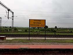 Pandabeswar railway station | |
 Pandabeswar Location in West Bengal, India  Pandabeswar Pandabeswar (India) | |
| Coordinates: 23°43′12.0″N 87°16′48.0″E / 23.720000°N 87.280000°ECoordinates: 23°43′12.0″N 87°16′48.0″E / 23.720000°N 87.280000°E | |
| Country |
|
| State | West Bengal |
| District | Paschim Bardhaman |
| Languages | |
| • Official | Bengali, English |
| Time zone | UTC+5:30 (IST) |
| PIN | 713346 (Pandaveshwar) |
| Telephone/STD code | 0343 |
| Lok Sabha constituency | Asansol |
| Vidhan Sabha constituency | Pandaveswar |
| Website |
bardhaman |
Pandabeswar (also spelled Pandaveswar) is an administrative centre in Pandabeswar CD Block in Durgapur subdivision of Paschim Bardhaman district in the state of West Bengal, India.
Geography
 |
| Cities, towns and ECL Areas in the northern portion of Durgapur subdivision in Paschim Bardhaman district MC: Municipal Corporation, CT: census town, R: rural/urban administrative centre Owing to space constraints in the small map, the actual locations in a larger map may vary slightly |
Police station
Pandabeswar police station has jurisdiction over Pandabeswar CD Block. The area covered is 161 km2 and the population covered is 176,445.[1][2]
CD Block HQ
The headquarters of Pandabeswar CD Block are located at Pandabeswar.[1]
Urbanisation
As per the 2011 census, 79.22% of the population of Durgapur subdivision was urban and 20.78% was rural. Durgapur subdivision has 1 municipal corporation at Durgapur and 38 (+1 partly) census towns (partly presented in the map alongside; all places marked on the map are linked in the full-screen map).[3]
Demographics
Pandabeswar is shown as part of Baidyanathpur in the map of Pandabeswar CD Block on page 243 of the District Census Handbook, Bardhaman, 2011. Separate demographic statistics are not available.
Economy
As per the Shodhganga website, collieries in the Pandaveswar Area of Eastern Coalfields are: Madaipur, Mandarbani, Nutandanga, Pandaveswar, Dalurbandh, Kendra, Samla, South Samla, Khottadih, Kankartala, Dalurbandh OCP, Palasthali OCP and Gangaramchak OCP.[4]
As per ECL website telephone numbers, operational collieries in the Pandaveswar Area in 2018 are: Dalurband Colliery, Khottadih OCP, Khottadih UG, Madhaipur Colliery, Manderbony Colliery, Pandaveswar Colliery and South Samla Colliery.[5]
Transport

There is a Railway station in Pandabeswar on the Andal-Sainthia branch line.[6]
Education
Pandaveswar College was established at Pandabeswar in 2005. It is affiliated with Kazi Nazrul University. It offers honours courses in Hindi, English, history and political science.[8][9]
Healthcare
There is a primary health centre at Pandabeswar.[10]
References
- 1 2 "District Statistical Handbook 2014 Bardhaman". Tables 2.1, 2.2. Department of Statistics and Programme Implementation, Government of West Bengal. Retrieved 23 September 2018.
- ↑ "Asansol Durgapur Police Commissionerate". Find your police station. Asansol Durgapur Police. Retrieved 23 September 2018.
- ↑ "District Statistical Handbook 2014 Burdwan". Table 2.2, 2.4(a). Department of Statistics and Programme Implementation, Government of West Bengal. Retrieved 15 September 2018.
- ↑ "Coalmining impact on the Environment" (PDF). Chapter V: Table 5.2. shodganga.infibnet. Retrieved 21 February 2017.
- ↑ "Area wise Closed User Group (CUG) Telephone Numbers" (PDF). Pandaveswar Area. Eastern Coalfields Limited. Retrieved 18 August 2018.
- ↑ "73531=>63531 Andal-Sainthia MEMU". Time Table. indiarailinfo. Retrieved 20 February 2017.
- ↑ "Rationalisation of Numbering Systems of National Highways" (PDF). New Delhi: Department of Road Transport and Highways. Retrieved 20 February 2017.
- ↑ "Pandaveswar College". PC. Retrieved 9 March 2017.
- ↑ "Pandaveswar College". College Admission. Retrieved 9 March 2017.
- ↑ "Bardhaman district". Medical Institutions. Bardhaman district administration. Retrieved 6 March 2017.
Cities, towns and locations in Paschim Bardhaman district | |||||
|---|---|---|---|---|---|
| Cities, municipal and census towns | |||||
| Locations other than cities and towns |
| ||||
| Neighbourhoods in Asansol |
| ||||
| Related topics |
| ||||