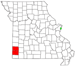
Joplin, Missouri, metropolitan area
| Joplin, Missouri | |
|---|---|
| Joplin, MO, MSA | |
 | |
| Country | United States |
| State(s) | Missouri, Oklahoma |
| Largest city | Joplin |
| Other cities |
- Carthage, Missouri - Miami, Oklahoma - Webb City, Missouri - Neosho, Missouri - Carl Junction, Missouri |
| Area | |
| • Total | 1,753 sq mi (4,540 km2) |
| Population (2015 Estimate) | |
| • Total | 209,192 |
| • Rank | 135th in the U.S. |
The Joplin, Missouri, metropolitan statistical area (MSA), as defined by the United States Census Bureau, is an area consisting of Jasper and Newton counties in southwest Missouri, anchored by the city of Joplin. As of the 2010 census it had a population of 175,518, though as of the 2013 estimates, the population is 207,488.[1]
The Joplin–Miami, Missouri–Oklahoma, combined statistical area (CSA) includes the Miami, Oklahoma, micropolitan statistical area, corresponding to Ottawa County in extreme northeast Oklahoma.
Counties
Missouri
Oklahoma
Communities
| Historical population | |||
|---|---|---|---|
| Census | Pop. | %± | |
| 1970 | 112,746 | — | |
| 1980 | 127,515 | 13.1% | |
| 1990 | 135,905 | 6.6% | |
| 2000 | 157,322 | 15.8% | |
| 2010 | 207,366 | 31.8% | |
| Est. 2017 | 209,819 | 1.2% | |
| U.S. Decennial Census | |||
Communities are categorized based on their populations.
Anchor cities
- Joplin, Missouri (principal city) pop: 52,282
- Miami, Oklahoma (principal city) pop: 13,212
Places with 5,000 to 20,000 inhabitants
- Carthage pop: 14,350
- Neosho pop: 12,031
- Webb City pop: 11,334
- Carl Junction pop: 7,864
Places with 1,000 to 4,999 inhabitants
Places with 500 to 999 inhabitants
- Diamond pop: 925
- Jasper pop: 941
- Quapaw pop: 891
- Airport Drive pop: 850
- Loma Linda pop: 779
- Leawood pop: 671
- Alba pop: 542
Places with less than 500 inhabitants
- Purcell pop: 396
- Fairview pop: 382
- North Miami pop: 382
- Shoal Creek Drive pop: 340
- Wyandotte pop: 334
- Saginaw pop: 308
- Carytown pop: 268
- Fidelity pop: 256
- Asbury pop: 205
- Newtonia pop: 203
- Neck City pop: 184
- Stella pop: 159
- Redings Mill pop: 152
- Wentworth pop: 150
- Stark City pop: 140
- Peoria pop: 133
- Avilla pop: 123
- Grand Falls Plaza pop: 115
- La Russell pop: 113
- Narcissa pop: 100
- Brooklyn Heights pop: 99
- Shoal Creek Estates pop: 97
- Reeds pop: 94
- Dotyville pop: 87
- Waco pop: 86
- Ritchey pop: 83
- Dennis Acres pop: 77
- Cliff Village pop: 41
Unincorporated places
Ghost Towns
Education
The Joplin, Missouri Metropolitan area is served by many different school districts such as the following:
- Afton School District
- Avilla School District
- Carl Junction School District
- Carthage School District
- Commerce School District
- Diamond School District
- East Newton School District
- Fairland School District
- Jasper School District
- Joplin School District
- Miami School District
- Neosho School District
- Quapaw school District
- Sarcoxie School District
- Seneca School District
- Webb City School District
- Westview School District
- Wyandotte School District
Demographics (previous Joplin Metropolitan Statistical Area)
As of the census[2] of 2010, there were 175,518 people, 64,286 households, and 44,270 families residing within the MSA. The racial makeup of the MSA was 93.5% White, 1.5% African American, 1.6% Native American, 1.0% Asian, 0.2% Pacific Islander, 1.45% from other races, and 2.23% from two or more races. Hispanic or Latino of any race were 5.2% of the population. For ever 100 females there are 95.3 males.
The median income for a household in the MSA was $37,158, and the median income for a family was $44,564. Males had a median income of $29,315 versus $20,883 for females.
See also
References
- https://web.archive.org/web/20140522161634/http://www.census.gov/popest/data/cities/totals/2013/SUB-EST2013-3.html
- https://web.archive.org/web/20150323004220/http://quickfacts.census.gov/qfd/states/29/2937592.html
- https://www.census.gov/popest/data/cities/totals/2011/SUB-EST2011-3.html
- http://www.joplinglobe.com/topstories/x1923113816/Silver-Creek-consolidation-question-carries-in-Newton-County%5Bpermanent+dead+link%5D

https://web.archive.org/web/20131013222920/http://2010.census.gov/2010census/popmap/