Interstate H-2
| ||||
|---|---|---|---|---|
| Veterans Memorial Freeway | ||||
|
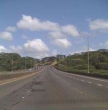
H-2 highlighted in red | ||||
| Route information | ||||
| Maintained by HDOT | ||||
| Length | 8.33 mi[1] (13.41 km) | |||
| Existed | 1976/1977 – present | |||
| Major junctions | ||||
| South end |
| |||
| North end |
| |||
| Highway system | ||||
| ||||

Interstate H-2 (H-2) is an intrastate Interstate Highway located on the island of O‘ahu in the US state of Hawai‘i. H-2 is also known as the Veterans Memorial Freeway. Despite the number, this is a north–south interstate, the H-series (for Hawaii) numbering reflects the order in which routes were funded and built. Its southern terminus is at H-1 in Pearl City, and its northern terminus is at Wilikina Drive (Wahiawa Bypass) (Route 99) in Wahiawā near Schofield Barracks and Wheeler Army Airfield.
Route description
H-2 begins at the Waiawa Interchange at H-1. The highway heads north–south with four lanes in each direction, passing the Waipio neighborhood of Waipahu and through the city of Mililani. At this point the highway narrows for its final three miles (4.8 km) as it reaches its terminus in Wahiawa, near Wheeler Army Airfield and Schofield Barracks. There is a 55-mile-per-hour (89 km/h) speed limit for the entirety of the freeway.
Exit list
The entire route is in Honolulu County.
| Location | mi[2] | km | Exit | Destinations | Notes |
|---|---|---|---|---|---|
| Pearl City | 0.00 | 0.00 | 1 | Signed as exits 1A (east) and 1B (west); exit 8 on H-1 | |
| Waipio | 2.12 | 3.41 | 2 | Ka Uka Boulevard | |
| Mililani | 5.19 | 8.35 | 5 | Mililani Mauka, Mililani Town | Access via Meheula Parkway; signed as exits 5A (Mauka) and 5B (Town) northbound |
| Waipio Acres | 6.56 | 10.56 | 7 | Northbound exit and southbound entrance | |
| Wahiawa | 7.28– 7.49 | 11.72– 12.05 | 8 | Northbound exit is via Route 80 | |
| 8.33 | 13.41 | 9 | Southbound exit and northbound entrance | ||
| — | Continues north as Wilikina Drive | ||||
| 1.000 mi = 1.609 km; 1.000 km = 0.621 mi | |||||
References
- ↑ Adderly, Kevin (January 30, 2018). "Table 1: Main Routes of the Dwight D. Eisenhower National System of Interstate and Defense Highways as of December 31, 2017". Route Log and Finder List. Federal Highway Administration. Retrieved June 19, 2018.
- ↑ DeLorme (2007). Street Atlas USA (Map). DeLorme. Toggle Measure Tool.
External links
Route map:

| Signed | |
|---|---|
| Unsigned | |
| Lists | |
| Other | |
Major Interstates highlighted | |