Massachusetts Turnpike
| ||||
|---|---|---|---|---|
| Interstate 90 | ||||
|
Massachusetts Turnpike highlighted in red | ||||
| Route information | ||||
| Length | 138.1 mi[1] (222.3 km) | |||
| Existed | 1957 – present | |||
| Restrictions | Hazardous goods and cargo tankers prohibited from tunnels[2] | |||
| Major junctions | ||||
| West end |
| |||
| East end |
| |||
| Location | ||||
| Counties | Berkshire, Hampden, Worcester, Middlesex, Suffolk, Norfolk | |||
| Highway system | ||||
| ||||
|
| ||||

The Massachusetts Turnpike (colloquially "Mass Pike" or "the Pike"[3]) is a toll road in the U.S. state of Massachusetts that is maintained by the Massachusetts Department of Transportation (MassDOT). The turnpike begins at the New York state line in West Stockbridge, linking with the Berkshire Connector portion of the New York State Thruway. Spanning 138 miles (222 km) along an east–west axis, it is entirely concurrent with the portion of Interstate 90 (I-90) that lies within the state. The turnpike is the longest Interstate Highway in Massachusetts, while I-90 in full (which begins nationally in Seattle, Washington) is the longest Interstate Highway in the United States.
The turnpike opened in 1957, and it was designated as part of the Interstate Highway System in 1959. The original western terminus of the turnpike was located at Route 102 in West Stockbridge before I-90 had been completed in New York state. The turnpike intersects with several Interstate Highways as it traverses the state, including I-91 in West Springfield; I-291 in Chicopee; I-84 in Sturbridge; the junction of I-290 and I-395 in Auburn; and I-495 in Hopkinton. The turnpike originally ended at Route 128 (now concurrent with I-95) in Weston; it was extended to Allston in 1964, and to the Central Artery (now designated as I-93, US 1, and Route 3) in Downtown Boston in 1965. The "Big Dig" megaproject provided for the construction of the Ted Williams Tunnel, which has carried the turnpike to its current eastern terminus at Route 1A beyond Logan International Airport since 2003. As an Interstate Highway, the turnpike is supplemented by I-190 and I-290 as auxiliary Interstate Highways.
The turnpike was maintained by the Massachusetts Turnpike Authority until the department was replaced by the Highway Division of MassDOT in 2009. The implementation and removal of tolls in some stretches of the turnpike have been controversial; presently, travel between most, but not all, exits require payment. The Fast Lane electronic toll collection system was introduced alongside cash payment in 1998; it was later folded into the E-ZPass branding in 2012. The original toll booths were demolished and replaced by toll gantries with the transition to open road tolling in 2016, which replaced cash payment with "pay-by-plate" billing.
Route description
The Massachusetts Turnpike is informally divided into two sections by MassDOT: the original 123-mile (198 km) "Western Turnpike" extending from the New York state border through the interchange with I-95 and Route 128 at exits 14 and 15 in Weston, and the 15-mile (24 km) "Boston Extension" that continues beyond exits 14 and 15 through Boston.[4] It is a four-lane highway from the New York state border through its interchange with I-84 at exit 9 in Sturbridge; it expands to six lanes beyond this interchange, and briefly travels with eight lanes from exit 17 in Newton through exit 22 by the Prudential Center in Boston.[4] The .75-mile (1.21 km) underwater section of the Ted Williams Tunnel, which carries the turnpike under Boston Harbor to its eastern terminus at Route 1A by Logan International Airport, reduces to four lanes.[5] There are 11 service plazas along the turnpike; each include a Gulf gas station, a Gulf Express convenience store, and restrooms, with fast food offerings varying by location. Lee, Blandford, Ludlow and Charlton have service plazas in both directions, Westborough and Framingham facilities are only accessible westbound, and the Natick service plaza is only accessible eastbound.[6]
Western Turnpike
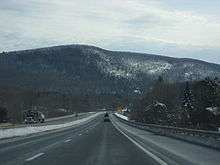

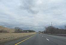
In the west, the turnpike begins in Berkshire County at the Massachusetts state line in West Stockbridge, where I-90 (routed through the Berkshire Connector portion of the New York State Thruway) enters from Canaan, New York.[7] Most toll plazas, now demolished, were located on the entrance/exit ramps before entering the turnpike itself. An exception was the mainline West Stockbridge toll plaza, designed for toll collection from inbound traffic from New York; it existed shortly after exit 1, an eastbound-only entrance and westbound-only exit in Massachusetts.[8] It crosses the Williams River later in West Stockbridge, and passes over the Housatonic River in Lee.[9] The 30-mile (48 km) gap between exit 2 to US 20 in Lee and exit 3 to US 202 and Route 10 in Westfield (the first in Hampden County) is the longest gap between exits on the turnpike,[10] and the seventh-longest gap between exits in the entire Interstate Highway System.[11] The highest elevation on the turnpike exists in The Berkshires, reaching 1,724 feet (525 m) above sea level in Becket; this point is also the highest elevation on I-90 east of South Dakota.[12] Beyond the peak elevation and between the exits, an eastbound runaway truck ramp exists in Russell.[13]
The turnpike has an interchange with I-91 and US 5 at exit 4 in West Springfield;[8] it passes over the Connecticut River before reaching Route 33 at exit 5 and I-291 at exit 6, both in Chicopee. The turnpike passes through Ludlow at exit 7 before crossing the Quaboag River to exit 8 in Palmer.[8][9] The turnpike first exits into Worcester County in Sturbridge, where exit 9 is the eastern terminus of I-84.[14] In Auburn, exit 10 deposits traffic into the route transition of I-395 traveling southbound and I-290 traveling eastbound.[14] The Blackstone River flows underneath the turnpike in Millbury,[9] where it has an interchange with Route 146 and a second direct connection to US 20 at exit 10A.[8] Entering Middlesex County in Hopkinton, it intersects with I-495 at exit 11A.[8] The turnpike crosses the Sudbury River between exit 12 at Route 9 and exit 13 at Route 30, all located within Framingham.[9][8] The last connection with another Interstate Highway on the Western Turnpike is located in Weston, at the I-95 and Route 128 concurrency.[8] This multi-piece interchange is collectively referred to as the "Weston tolls".[15] Exit 14 is an eastbound exit and westbound entrance, and exit 15 is a westbound exit and eastbound entrance; prior to demolition, a mainline toll plaza existed for through traffic.[8] Following the removal of the toll plazas, exit 15 was reconfigured into exit 15A for I-95 and Route 128, and exit 15B towards Route 30.[16] At this junction, the turnpike crosses over the Charles River.[9]
Boston Extension
The first exit of the Boston Extension, exit 16 is an eastbound entrance and westbound exit at Route 16 in Newton.[17] The turnpike enters Suffolk County in Boston before reaching the "Allston–Brighton tolls", depositing traffic towards the Boston neighborhoods of Allston and Brighton, and the nearby city of Cambridge.[4] Exit 18 is a lefthand eastbound exit and westbound entrance, and exit 20 is a westbound exit and eastbound entrance; a mainline toll plaza was previously placed in between them for through traffic, and was classified as "exit 19".[17] Compensating for the sparsity of eastbound entrances and westbound exits in Back Bay and Downtown Boston, a westbound U-turn ramp heading eastbound was opened in Allston in 2007;[18] while unsigned with an exit number, it is recognized as exit 20A for administrative purposes.[4] The turnpike crosses over the Muddy River past the Allston–Brighton tolls.[9]
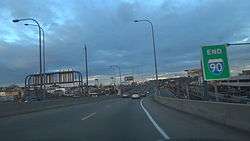
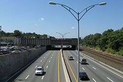
Exits 22 and 22A are located within the Prudential Tunnel, which takes the turnpike underneath the Prudential Center;[19] the former is an eastbound exit towards the Prudential Center and Copley Square, while the latter is a westbound-only entrance from Clarendon Street.[17] Beyond the Prudential Tunnel, exit 24 is labeled as a singular exit traveling westbound, but splits into three ramps for eastbound travel; exit 24A is a lefthand exit towards South Station, while exits 24B and 24C are directed towards I-93 northbound and southbound, respectively.[17] The turnpike travels under the Fort Point Channel before reaching South Boston at exit 25,[17] after which it enters the Ted Williams Tunnel to pass beneath Boston Harbor.[20] Exit 26 to Logan International Airport is the sole exit within the Ted Williams Tunnel, before the turnpike exits the tunnel and merges into Route 1A northbound toward Revere.[17]
Air rights
Much of the air space ("air rights") over the Boston Extension has been leased to third parties for commercial development. This concept was originally designed to "knit together communities" that were divided by the new highway,[21] since the turnpike had been described as "wider and more divisive to the city" than the original Central Artery.[22] More recently, the income received from the leased air rights have been used for paying off the Big Dig.[22] Presently, there are 23 parcels of air space over the highway, the majority of which have not yet been developed.[23] Among other objectives, guidelines established by the "Civic Vision for Turnpike Air Rights in Boston" in 2000 recommend that the proposed use of the parcels "[foster] increased use and capacity of public transportation" and "[reinforce] the vitality and quality of life in adjacent neighborhoods".[24]
The Star Market (briefly renamed Shaw's Supermarket) in Newton is the earliest example of commercial construction over the turnpike. In the 1960s, the Massachusetts Turnpike Authority intended to route the highway through the parking lot of the supermarket's previous location in the city; this alignment that was ultimately approved by the Massachusetts Supreme Judicial Court, under the condition that a replacement Star Market was allowed to be built over the turnpike.[25] Other projects developed through air rights include the Crowne Plaza (a Sheraton Hotel until 2009) in Newton,[26][27] the Copley Place shopping mall in Boston,[27][28] and the Prudential Center in Boston.[27][29] Proposals for future air rights projects include the mixed-use Fenway Center,[30] and an extension of the Boston University campus near Boston University Bridge.[31]
Tolls
As of 2009, toll revenue generated from the Massachusetts Turnpike is to be spent in the section in which it was collected, either the Western Turnpike or the Boston Extension (alternatively named the "Metropolitan Highway System" for administrative purposes).[32] Tolls from exit 1 in West Stockbridge through exit 6 in Chicopee were removed by then-Governor Bill Weld in 1996, following complaints that the tolls collected in Western Massachusetts were financing the Big Dig in Boston;[33] they were ultimately reinstated in October 2013.[34]
At the recommendation of former Secretary of Administration and Finance Eric Kriss, who recommended that tolls be eliminated along the entire turnpike with the exception of the tunnels leading to Logan International Airport,[35] the Massachusetts Turnpike Authority voted to remove all tolls west of Route 128 in Weston in October 2006.[36] Members of the Massachusetts Legislature Transportation Committee cited the potential need to amend state law and the uncertainty of how the turnpike would be maintained as setbacks to the toll removal, which ultimately never came to fruition.[37]
The issue of the removal of the tolls is highly charged politically. Several members of the state Democratic Party declared this as a political maneuver to bolster the gubernatorial campaign of Lieutenant Governor Kerry Healey, a Republican, who was behind in the polls at the time of the announcement. Also, because the MTA Board is composed of Romney appointees, Kriss's former association with the Romney administration and the ongoing election at the time, the issue was clouded by accusations of partiality and political agendas from both sides of the aisle.
In the November 9, 2006, edition of The Boston Globe, Romney announced his intention to try to remove the tolls before Governor-elect Deval Patrick, a Democrat, was inaugurated in January 2007, but this did not occur. As of November 2008, Patrick's plan was to remove all tolls west of Interstate 95, except at the West Stockbridge and Sturbridge tolls,[38] but this also did not occur before the end of his term in January 2015. State law requires tolls to be removed west of Route 128 when its debt is paid and the road is in "good condition", but MassDOT plans to continue tolls after the bonds are paid off in January 2017, because the road will still need $135 million per year for repairs and maintenance.[39]
At a January 22, 2009, board meeting, the Turnpike decided to stop charging a one-time $25.95 fee for the acquisition of a Fast Lane toll transponder, replacing it with a 50-cent monthly recurring service fee.[40] The implementation of the 50-cent monthly fee was canceled after long delays at toll plazas on Easter Sunday.[41][42]
Toll plazas

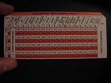
The turnpike traditionally utilized the ticket system for toll collection; a driver would obtain a ticket from an on-ramp, which they would surrender to an off-ramp and pay a toll based on traveled distance.[43] While most toll plazas were located on the entrance/exit ramps by the turnpike, exceptions included the mainline toll plazas in West Stockbridge, Weston, and Allston–Brighton.[4] Electronic toll collection was introduced as an alternative to cash payment with Fast Lane transponders in 1998; when installed in the inner windshield of a vehicle, the equipment would be recognized automatically in special lanes at toll plazas, and would withdraw the toll amount from the motorist's account.[44] It was first sponsored by BankBoston, and later FleetBoston Financial, before sponsorship was assumed by Citizens Bank in 2003.[45] Motorists were previously charged $27.50 for the hardware itself,[45] although this fee has since been removed.[46] Citing federal highway regulations that prohibit sponsorship of toll plaza signage, the contract with Citizens Bank was not renewed upon expiration; the Fast Lane name was replaced with the E-ZPass branding, with which Fast Lane was interoperable, in 2012.[47]
Open road tolling
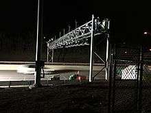
In 2014, Raytheon won a $130 million contract to convert the Massachusetts Turnpike to all-electronic open road tolling.[48] The stated goal of the change was to "make vehicle travel safer and more efficient".[49] Additional changes include the elimination of toll booths and toll booth operators, as well as the demolition of existing toll plazas and reconfiguration of surrounding roadways.[39][50][51] Overhead gantries between most exits will read EZPass transponders. Drivers without a transponder will "pay-by-plate", having their license plate photographed and an invoice sent to the registered owner. This method of payment adds a $3 surcharge per toll transaction, with payment made online, or in cash at a local retail location with an additional $2.95 fee.[52][53] Installation of gantries began in January 2016; the "Go-Live" date was October 28, 2016.[50] The inner segments of the toll booths were demolished 30 days after this date, which allowed traffic speeds to be raised. Complete demolition of toll booths and reconstruction is expected by the end of 2017,[50] except for the Sumner Tunnel.[54]
As there are no gantries between exits 4 and 7, or between exits 10 and 11, the Massachusetts Turnpike will essentially be free between those pairs of exits. Otherwise the plans are for the transition to open road tolling to be revenue neutral, meaning the tolls between any other pair of exits will only see small adjustments. Tolls will be slightly higher for out-of-state residents without an EZPassMA transponder, and no-transponder tolls will be higher still.[55]
When all-electronic tolling went live on the Mass Pike, the Tobin Bridge, Callahan Tunnel, Sumner Tunnel, and Ted Williams Tunnel joined the system and were converted to charging a single toll in both directions, rather than a double toll in one direction. The Tobin Bridge was converted to all-electronic tolling for southbound only in July 2014.[50]
In addition to license plate information, the gantries also collect vehicle speed data, which a MassDOT spokesperson said "will not be using the AET system to issue speeding violations".[56] Toll data is not a public record that must be disclosed by Freedom of Information Act requests, and MassDOT "All data collected will remain secure and kept confidential."[50] Toll data can be obtained by subpeona, and law enforcement will be able to specify license-plate numbers that will generate an immediate e-mail if detected by the system.[57]
History
Background and construction
Early plans for the Massachusetts Turnpike date back to the proposal of the "Western Expressway" in 1948. The original section of the expressway would have connected the then-proposed "Inner Belt" in Boston westward to Newton, with connections to US 20 and Route 30 for outbound traffic. Later extensions of the expressway would continue westward to and through Worcester. Plans for the original expressway included the "Springfield Bypass" of US 20 around the Springfield area. Part of this bypass, and the eventual turnpike, used the grading from the never-opened Hampden Railroad. Similarly, the "West Stockbridge Bypass" rerouted Route 102 from Route 183 in Stockbridge west to Route 102 east by the New York state line in West Stockbridge; the latter was built before the turnpike itself.
The Massachusetts Turnpike Authority was created in 1952 by a special act of the Massachusetts General Court (legislature) upon the recommendation of Governor Dever and his Commissioner of Public Works, William F. Callahan. (1952 Acts and Resolves chapter 354; 1952 Senate Doc. 1.) The enabling act was modeled upon that of the Mystic River Bridge Authority (1946 Acts and Resolves chapter 562), but several changes were made that would prove of great importance fifty years later. Callahan served as chairman of the Authority until his death in April 1964.
Construction began in 1955, and the whole four-lane road from Route 102 at the state line to Route 128 (now also Interstate 95 in Weston) opened on May 15, 1957.
Expansion into Boston
Early considerations for the Interstate Highway System included routing the transcontinental Interstate 90 along Route 2 within Massachusetts, although this alignment in the northern part of the state was too costly. Ultimately, the turnpike in the southern part of the state was approved for Interstate designation, and became concurrent with I-90 in 1959. The Berkshire Connector opened on May 26, 1959, connecting the west end to the New York State Thruway mainline south of Albany. Prior to its opening, traffic used NY Route 22 and US 20. At the Massachusetts/New York state line, one can see where the Turnpike made an abrupt right turn before terminating at Route 102 before the late-May 1959 connection into New York State, as the old pavement still exists for Turnpike Authority and State Police vehicles to access this remote stretch of highway.[58]
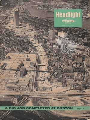
After political and legal battles related to the Boston Extension inside Route 128, construction began on March 5, 1962, with the chosen alignment running next to the Boston and Albany Railroad and reducing that line from four to two tracks. In September 1964 the part from Route 128 east to exit 18 (Allston) opened, and the rest was finished on February 18, 1965, taking it to the Central Artery. With the completion of the Boston Extension, that too was designated as I-90.
In the 1990s, then-Governor William Weld took the decision to turn over the assets of Boston's Big Dig project to the Turnpike Authority.[59][60][61] During this time he appointed James Kerasiotes to the Turnpike Authority to continue the authority's oversight of the Big Dig project.[62]
Big Dig

The Massachusetts Turnpike Authority managed the Central Artery/Tunnel Project (the "Big Dig"), which rerouted the elevated Central Artery into the O'Neill Tunnel through downtown Boston, and extended the turnpike beyond its terminus at the Central Artery into the Ted Williams Tunnel and connected it to Route 1A beyond Logan International Airport. Construction began in 1991, and the final extension of the turnpike was opened in 2003.
It was for the financial needs of the project that the "Metropolitan Highway System" was created with the turnpike east of Route 128; the Ted Williams, Sumner, and Callahan tunnels under Boston Harbor; and I-93 from Southampton Street through the O'Neill Tunnel and the Zakim Bridge to the foot of the Tobin Bridge.[63] Finances for the Western Turnpike and the Boston Extension continue to be handled separately with this reorganization.
Ceiling collapse
| Wikinews has related news: Portion of ceiling collapses in Boston tunnel |
In response to a fatality caused by the collapse of the ceiling of the eastbound I-90 connector tunnel approaching the Ted Williams Tunnel on July 10, 2006, and in response to Turnpike Authority Chairman Matthew J. Amorello's refusal (at the time) to resign, Romney took legal steps to have Amorello forcibly removed as head of the Massachusetts Turnpike Authority.[64] This effort culminated in Amorello's resignation on August 15, 2006. The next day, John Cogliano was sworn in as the new Chairman of the Turnpike Authority by Romney.[65] On November 27, 2006, departing Attorney General Tom Reilly (Democrat) announced the state will launch a civil suit over the collapse of the ceiling in the Ted Williams Tunnel. The Commonwealth will be seeking over $150 million from project manager Bechtel/Parsons Brinckerhoff, builder Modern Continental Construction Co. and the manufacturer of the epoxy used to hold the ceiling bolts.[66][67][68][69]
Future
Proposed exits
The construction of an exit between exit 2 in Lee and exit 3 in Westfield, currently separated by a 30-mile (48 km) gap, has been controversial since the 1960s.[70] The state conducted a study to determine the feasibility of such a project in 2018;[70] land currently occupied by a service plaza and a maintenance facility (both in Blandford) and Algeria Road in Otis have been suggested as locations for a potential exit.[71]
Allston Interchange
The "I-90 Allston Interchange Improvement Project" is intended to replace a deteriorating viaduct in Allston by straightening the turnpike through the land of the former Beacon Park Yard, which is currently owned by Harvard University.[72] The design phase is expected to be completed in 2019, and is planned to break ground in 2020.[73]
Mileage-based exit numbering
While Massachusetts has used sequential exit numbers since 1964,[74] the 2009 edition of the Manual on Uniform Traffic Control Devices required that all U.S. states submit plans to transition to mileage-based exit numbering by 2012.[75] All exits on the turnpike were expected to be renumbered following this convention with two sign replacement projects scheduled for completion by 2018; the contractors were ultimately instructed to install the new signs with the existing numbers, albeit with wider exit tabs that would accommodate larger two- and three-digit exit numbers should the conversion take place in the future.[76]
Government oversight
Since 2001, the Turnpike Authority had come under fire from state politicians in a fight for control of the quasi-state agency. Beginning in 2001, former Massachusetts acting Governor Jane Swift (Republican) attempted to fire Christy Mihos, a former Turnpike board member and Jordan Levy, the current Vice Chairman of the board.
Mihos and Levy had cast votes on the board to postpone a toll hike. Swift objected, saying such a delay was "fiscally irresponsible" and saying the two men "interfered with the effective daily management of the Authority."[77] Mihos and Levy refused to step down and sued Swift to retain their positions. The Massachusetts Supreme Judicial Court (SJC) ruled that the Turnpike was "not part of the machinery of the government" and therefore not subject to Swift's decisions.[78]
Governor Mitt Romney, elected in 2002 during a fiscal crisis, ran on a political platform of streamlining state government and eliminating waste. Part of this was the elimination of the Turnpike Authority. Romney wanted to fold the Turnpike into MassHighway, the state highway department, operated under the Executive Office of Transportation. A first step to this was to replace the Chairman of the Board, Matthew J. Amorello with someone loyal to the Governor. The Governor has the power to appoint members to the board, but the Massachusetts Supreme Judicial Court (SJC) advised in an advisory opinion that "nothing in G. L. c. 81A explicitly provides for the removal and reassignment of the chairperson to the position of "member."[79][80]
Romney put pressure on Amorello to step down. Amorello announced he would do so in 2007, after Romney would have left office. Romney continued to press the legislature to give him the power to remove members from the board, specifically the chairman, pointing to a series of financial and construction mishaps over the last several years. However, the legislature instead sought to keep Amorello on board by extending the terms of various board members to prevent Romney from removing Amorello.[81]
Under a plan to save state funds, the Massachusetts Registry of Motor Vehicles (RMV) announced plans to close eleven of its branches in leased locations and move the operations into facilities owned by MassHighway and the Massachusetts Turnpike Authority located in toll plazas, visitor centers, and offices. RMV branch closings were planned for Framingham, Lowell, North Attleboro, Cambridgeside Galleria Mall in Cambridge, New Bedford, Eastfield Mall in Springfield, Southbridge, Falmouth, Eastham, Beverly, and Boston.[82] Also, a portion of the newly increased sales tax in the state averted a planned toll increase. The MTA will receive approximately $100 million from the state general fund over the next few years, alleviating the need for the toll hike.[83]
Under legislation signed into law by Gov. Deval Patrick on June 26, 2009, the turnpike was folded into a new super-agency that controls all surface transportation in the state. The new agency, the Massachusetts Department of Transportation (MassDOT), operates all highways formerly under MassHighway and the Turnpike Authority as well as eight urban roadways formerly owned and maintained by the state Department of Conservation and Recreation (DCR).[84] In addition, MassDOT oversees the RMV, MBTA, regional transit authorities, and the state aeronautics commission.[85] The new Transportation Department began operations on November 1, 2009.[86]
The Turnpike Authority also owned the Callahan Tunnel and Sumner Tunnel, the other two road connections between downtown Boston and East Boston under Boston Harbor.[87] Upon completion of the Central Artery/Tunnel Project, all tunnels constructed as part of the Big Dig, including the O'Neill Tunnel segment of I-93, were transferred to its control.[88] The Authority received no state or federal government funding. Its revenues came from tolls, leases on air rights and service areas, and advertising. Its assets were all transferred to the new MassDOT agency as part of the restructuring of agencies.[89]
Highway shield

The original logo depicted Paul Revere on horseback with the words "Massachusetts Turnpike Authority" in a circle around him. One incarnation of the pilgrim hat shield had a Native American arrow sticking through the pilgrim hat. It was replaced with a plain hat and the words "Mass Pike" in 1989. It has been reported variously that the sign was changed due to confusion among motorists who sometimes mistakenly turned in the direction the arrow pointed (right) when attempting to enter the turnpike,[90] or that it was the result of a letter campaign describing the signs as offensive to Native Americans.[91]
According to MTA board member Mary Z. Connaughton's blog entry for the Boston Herald, all of the pilgrim-hat signage unique to the Turnpike will be eliminated.[92] However, in a personal correspondence with AARoads.com's road blog, a MassDOT official said that usage of the hat would actually increase. When guide signs on I-95 and I-495 are replaced, the current "Mass Pike" signage will be replaced with pilgrim hat shields.[93]
Exit list
| County | Location[94] | mi[94] | km | Exit[95] | Destinations[95] | Notes |
|---|---|---|---|---|---|---|
| Berkshire | West Stockbridge | 0.000 | 0.000 | – | Continuation of I-90 from New York | |
| 2.736 | 4.403 | 1 | Westbound exit and eastbound entrance | |||
| Lee | 8.5 | 13.7 | Lee Service Plaza | |||
| 10.01 | 16.11 | Electronic Toll Gantry[50] | ||||
| 10.592 | 17.046 | 2 | To Route 102 and US 7 | |||
| Hampden | Blandford | 26.25 | 42.25 | Electronic Toll Gantry[50] | ||
| 29.0 | 46.7 | Blandford Service Plaza | ||||
| Westfield | 40.434 | 65.072 | 3 | |||
| 40.86 | 65.76 | Electronic Toll Gantry[50] | ||||
| West Springfield | 45.740 | 73.611 | 4 | Exit 14 on I-91 | ||
| Chicopee | 49.041 | 78.924 | 5 | |||
| 51.154 | 82.324 | 6 | Exit 7 on I-291 | |||
| Ludlow | 54.780 | 88.160 | 7 | |||
| 55.6 | 89.5 | Ludlow Service Plaza | ||||
| 57.68 | 92.83 | Electronic Toll Gantry[50] | ||||
| Palmer | 62.641 | 100.811 | 8 | |||
| Worcester | Warren | 69.78 | 112.30 | Electronic Toll Gantry[50] | ||
| Sturbridge | 78.300 | 126.012 | 9 | Eastern terminus of I-84 | ||
| Charlton | 80.2 | 129.1 | Charlton Service Plaza | |||
| 89.10 | 143.39 | Electronic Toll Gantry[50] | ||||
| Auburn | 90.049 | 144.920 | 10 | Exit 7 on I-290 | ||
| Millbury | 93.642 | 150.702 | 10A | Exit 10 on Route 146 | ||
| 96.343 | 155.049 | 11 | ||||
| Westborough | 104.6 | 168.3 | Westborough Service Plaza (westbound only) | |||
| Middlesex | Hopkinton | 104.86 | 168.76 | Electronic Toll Gantry[50] | ||
| 106.236 | 170.970 | 11A | Exit 22 on I-495 | |||
| Southborough | 109.07 | 175.53 | Electronic Toll Gantry[50] | |||
| Framingham | 111.181 | 178.928 | 12 | |||
| 113.92 | 183.34 | Electronic Toll Gantry[50] | ||||
| 114.4 | 184.1 | Framingham Service Plaza (westbound only) | ||||
| 116.600 | 187.650 | 13 | ||||
| Natick | 117.6 | 189.3 | Natick Service Plaza / Fast Lane Service Center (eastbound only) | |||
| Weston | 120.21 | 193.46 | Electronic Toll Gantry[50] | |||
| 122.600 | 197.306 | 14 | Eastbound exit and westbound entrance; exit 25 on I-95 | |||
| 123.458 | 198.686 | 15A | Westbound exit and eastbound entrance; exit 25 on I-95 | |||
| 15B | Westbound exit; shared ramp with exit 15A until 2017 | |||||
| Newton | 125.207 | 201.501 | 16 | Westbound exit and eastbound entrance | ||
| 126.18 | 203.07 | Electronic Toll Gantry[50] | ||||
| 127.553 | 205.277 | 17 | Washington Street / Galen Street / Centre Street / Park Street / St. James Street – Newton, Watertown | |||
| Suffolk | Boston | 130.04 | 209.28 | Electronic Toll Gantry[50] | ||
| 130.991 | 210.810 | 18 | Cambridge Street / Storrow Drive – Brighton, Cambridge | Eastbound left exit and westbound entrance | ||
| 20 | Cambridge Street / Storrow Drive – Brighton, Cambridge | Westbound exit and eastbound entrance | ||||
| 131.15 | 211.07 | Electronic Toll Gantry[50] | ||||
| 132.863 | 213.822 | 21 | Westbound entrance only | |||
| West end of Prudential Tunnel | ||||||
| 133.344 | 214.596 | 22 | Dartmouth Street – Prudential Center, Copley Square | Eastbound exit and westbound entrance | ||
| 133.586 | 214.986 | 22A | Clarendon Street | Westbound entrance only | ||
| East end of Prudential Tunnel | ||||||
| 133.876 | 215.453 | 23 | Arlington Street | Westbound entrance only | ||
| 134.315 | 216.159 | 24A | South Station | Eastbound left exit only | ||
| 24B | Eastbound left exit only; No eastbound entrance from I-93 south; Signed as exit 24 westbound; Exit 20 on I-93 north; Exit 20B on I-93 south | |||||
| 24C | ||||||
| Fort Point Tunnel under Fort Point Channel | ||||||
| 134.773 | 216.896 | 25 | South Boston | Via Summer Street | ||
| Ted Williams Tunnel under Boston Harbor | ||||||
| Electronic Toll Gantry[50] | ||||||
| 137.239 | 220.865 | 26 | ||||
| 138.15 | 222.33 | – | National eastern terminus of I-90 | |||
| 1.000 mi = 1.609 km; 1.000 km = 0.621 mi | ||||||
References
- ↑ "State Numbered Routes with Milepoints in District 4" (PDF). Commonwealth of Massachusetts. Archived from the original (PDF) on July 19, 2011. Retrieved June 21, 2017.
- ↑ "Hazardous material route designation". Mass.gov. Retrieved January 15, 2018.
- ↑ "Open Road Toll Structure Now On Mass Pike In Weston". WBZ-TV. January 4, 2016. Retrieved June 19, 2017.
- 1 2 3 4 5 Cambridge Systematics, Inc. (January 28, 2010). "Massachusetts Turnpike: Metropolitan Highway System" (PDF). Massachusetts Department of Transportation. Retrieved June 19, 2017.
- ↑ "Massachusetts SuperGraphic". U-Haul. Retrieved June 19, 2017.
- ↑ "Travel Service Plazas & Tourist Information Center". Massachusetts Department of Transportation. Retrieved June 20, 2017.
- ↑ O'Brien, Tim (March 25, 2010). "Thruway connector's name spurs question". Times Union. Hearst Corporation. Retrieved June 19, 2017.
- 1 2 3 4 5 6 7 8 "I-90: Massachusetts Turnpike" (PDF). Central Transportation Planning Staff. Retrieved June 19, 2017.
- 1 2 3 4 5 6 "Travel Activities". Massachusetts Department of Transportation. Retrieved June 19, 2017.
- ↑ Sacharczyk, Tamara (May 17, 2016). "Hilltown residents pushing for new Mass Pike exit". WWLP. Retrieved June 21, 2017.
- ↑ Carey, Anne (August 13, 2011). "Top 16 longest gaps between Interstate exits". USA Today. Gannett Company. Retrieved June 21, 2017.
- ↑ Vanhoenacker, Mark (August 18, 2014). "What Does This Beloved Road Sign on the Massachusetts Turnpike Actually Mean?". Slate. The Slate Group. Retrieved June 19, 2017.
- ↑ "Runaway Truck Ramp". Flickr. September 9, 2017. Retrieved July 20, 2018.
- 1 2 "Official Massachusetts Transportation Map". Massachusetts Department of Transportation. Retrieved June 21, 2017.
- ↑ "2015 Triennial Inspection: Metropolitan Highway System" (PDF). TranSystems. Retrieved June 22, 2017.
- ↑ "Weston: Newly Constructed Ramp Opens Friday, June 23". Massachusetts Department of Transportation. June 22, 2017. Retrieved June 27, 2017.
- 1 2 3 4 5 6 "I-90: Mass Turnpike (Route 16, Newton, to Route 1A, East Boston)" (PDF). Central Transportation Planning Staff. Retrieved June 22, 2017.
- ↑ Estes, Andrea (September 10, 2007). "Pike U-turn ramp opening delayed". Boston.com. Retrieved June 22, 2017.
- ↑ Sweet, Laurel (March 26, 2017). "Man killed as car goes airborne in Pru tunnel". Boston Herald. Retrieved June 22, 2017.
- ↑ "Tunnels & Bridges". Massachusetts Department of Transportation. Retrieved June 22, 2017.
- ↑ "Why Develop Air Rights" (PDF). The Boston Informer. Retrieved June 21, 2017.
- 1 2 "Mass Pike Air Rights". Boston.com. Retrieved June 21, 2017.
- ↑ ARCH 7130 Research Studio (March 14, 2013). "Air Rights by Northeastern School of Architecture". Issuu. Retrieved June 21, 2017.
- ↑ "Civic Vision for Turnpike Air Rights in Boston". Boston Redevelopment Authority. March 3, 2003. Archived from the original on February 3, 2004. Retrieved June 21, 2017.
- ↑ Herwick III, Edgar (May 24, 2017). "How Did That Star Market End Up Over The Massachusetts Turnpike?". WGBH. Retrieved June 21, 2017.
- ↑ "Sheraton over Mass Pike becomes a Crowne Plaza". Boston.com. June 26, 2009. Retrieved June 21, 2017.
- 1 2 3 DePaola, Frank (March 15, 2013). "Tunnel Inspection and Testing Protocol For Roadways Covered by Air Rights Developments" (PDF). Massachusetts Department of Transportation. Retrieved June 21, 2017.
- ↑ Palmer, Thomas (March 19, 2006). "Building on the Pike". Boston.com. Retrieved June 21, 2017.
- ↑ Treffeisen, Beth (October 28, 2016). "Project Over Turnpike Moves Closer to Reality". Beth Treffeisen Photography. Retrieved June 21, 2017.
- ↑ Acitelli, Tom (October 24, 2016). "Fenway Center could finally get going next year". Curbed. Retrieved June 21, 2017.
- ↑ "BU says campus future is up in the air". The Daily Free Press. Boston University. May 6, 2008. Retrieved June 21, 2017.
- ↑ Mullan, Jeffrey (December 13, 2010). "Transportation Budget in Plain Language Explanation of MassDOT Funding Sources". Massachusetts Department of Transportation. Retrieved June 21, 2017.
- ↑ Fanto, Clarence (July 30, 2013). "Update: Westernmost Pike tolls will return, but how much will they be?". The Berkshire Eagle. Retrieved June 21, 2017.
- ↑ "Western Mass. tolls set to be restored". Boston.com. October 13, 2013. Archived from the original on October 14, 2013. Retrieved June 21, 2017.
- ↑ Kriss, Eric (October 18, 2006). "Turnpike Task Force Final Report" (PDF). Turnpike Task Force. Archived from the original (PDF) on July 17, 2011. Retrieved June 21, 2017.
- ↑ Misrha, Raja; Daniel, Mac (October 29, 2006). "Pike board acts to end tolls west of Route 128". The Boston Globe. Retrieved June 21, 2017.
- ↑ Daniel, Mac (October 10, 2006). "Ending Pike tolls is called illegal". Boston.com. Retrieved June 21, 2017.
- ↑ Patrick planning to dismantle Mass. Turnpike - News - MetroWest Daily News, Framingham, MA - Framingham, MA
- 1 2 Thompson, Elaine (January 23, 2016). "All-Electronic Tolling Begins Installation on Mass. Pike". Telegram & Gazette. Worcester, MA. Retrieved September 5, 2016.
- ↑ Martin Finucane (January 21, 2009). "Fast Lane transponders will be free, but users will see a new fee". The Boston Globe. Archived from the original on January 24, 2009. Retrieved April 3, 2010.
- ↑ Noah Bierman (April 22, 2009). "After Easter snafus, Pike puts toll taker layoffs on hold". The Boston Globe. Archived from the original on April 25, 2009. Retrieved April 3, 2010.
- ↑ "Fast Lane Transponders Are Now Fee Free". WBZ TV. Archived from the original on April 28, 2009. Retrieved August 6, 2009.
- ↑ Burke, Isaac (July 1, 2016). "Mass Pike prepares to phase out toll booths". Daily Hampshire Gazette. Retrieved June 22, 2017.
- ↑ Chesto, Jon (May 10, 2012). "Massachusetts pulls out of the Fast Lane in favor of E-ZPass". Wicked Local. Archived from the original on June 11, 2017. Retrieved June 22, 2017.
- 1 2 Flint, Anthony (October 24, 2003). "Turnpike users may get a free toll device". Boston.com. Retrieved June 22, 2017.
- ↑ "Mass. Pike Electronic Tolling: What You Should Know". CBS Boston. October 27, 2016. Retrieved June 22, 2017.
- ↑ O'Connell, Scott (June 16, 2012). "Mass Pike says goodbye to 'Fast Lane'". The MetroWest Daily News. GateHouse Media. Retrieved June 22, 2017.
- ↑ Baker, Cynthia (August 13, 2014). "Raytheon Awarded $130 Million to Convert Massachusetts to Electronic Highway Tolling System" (Press release). Raytheon. Retrieved September 5, 2016.
- ↑ Dummies, Gintautas (June 7, 2016). "New Mass. Pike Electronic Tolling: Will There Be Any Cost Savings from Eliminating Toll Plazas?". MassLive. Retrieved August 9, 2016.
- 1 2 3 4 5 6 7 8 9 10 11 12 13 14 15 16 17 18 19 "All Electronic Tolling". Massachusetts Department of Transportation. Archived from the original on October 28, 2016. Retrieved June 6, 2017.
- ↑ Dummies, Gintautas (July 27, 2016). "New Mass. Pike Toll Rate Structure Expected to Be Released in August". MassLive. Retrieved August 9, 2016.
- ↑ Highway Division (2016). "Pay By Plate MA". Massachusetts Department of Transportation. Retrieved September 5, 2016.
- ↑ McKay, David (July 19, 2016). "'Open Road Tolling Coming Soon: Time to Get an E-ZPass". Chicopee, MA: WWLP-TV. Retrieved August 9, 2016.
- ↑ Highway Division (August 22, 2016). "All Electronic Tolling: Toll Plaza Demolition and Roadway Reconstruction" (PDF). Massachusetts Department of Transportation. Retrieved September 5, 2016.
- ↑ Rocheleau, Matt (August 22, 2016). "How Much Will Your New Mass. Pike Toll Be?". The Boston Globe. Retrieved September 5, 2016.
- ↑ Bombard, Noah R. (July 19, 2016). "Yes, Those New Electronic Toll Gantries on the Mass. Pike Are Clocking Your Speed". MassLive. Retrieved August 9, 2016.
- ↑ Matt Rocheleau (August 22, 2016). "New Mass. Gantries Can Send Authorities Alerts". The Boston Globe. Retrieved September 5, 2016.
- ↑ "View".
- ↑ "The real builder of the Big Dig". Retrieved October 4, 2014.
- ↑ "Lessons of Boston's Big Dig". Retrieved October 4, 2014.
- ↑ "Massachusetts Turnpike (I-90)".
- ↑ "A Handy Guide to the Big Dig Screw-Up".
- ↑ "MGL Chapter 81A, Section 3".
- ↑ Lehigh, Scot (July 14, 2006). "Amorello, now adrift". The Boston Globe.
- ↑ "Cogliano Sworn In as New Turnpike Chief". WCVB. August 16, 2006. Archived from the original on September 30, 2007. Retrieved October 27, 2009.
- ↑ Herbst, Svea (November 28, 2006). "Mass. to sue Big Dig firms over tunnel accident". Reuters.
- ↑ Murphy, Sean P.; Andrea Estes (July 11, 2007). "Wide risk, wide blame". The Boston Globe. Retrieved October 9, 2009.
- ↑ Saltzman, Jonathan (November 15, 2008). "Companies to settle for $26m in tunnel collapse". The Boston Globe. Retrieved October 9, 2009.
- ↑ Finucane, Martin (March 27, 2009). "AG settles with final two firms in fatal collapse of Big Dig tunnel". The Boston Globe. Retrieved October 9, 2009.
- 1 2 Kinney, Jim (May 9, 2018). "Exit 2.5 next right: Where could a new Massachusetts Turnpike exit go between Westfield and Lee?". MassLive. Retrieved July 20, 2018.
- ↑ Kinney, Jim (September 11, 2018). "MassDOT narrows possible sites for new Massachusetts Turnpike exit". MassLive. Retrieved September 19, 2018.
- ↑ Sperance, Cameron (October 12, 2017). "Harvard's Boston Real Estate Move Has Made It 'An Allston University With A Cambridge Campus'". Bisnow Media. Retrieved June 28, 2018.
- ↑ "I-90 Allston Interchange Improvement Project Update". Massachusetts Department of Transportation. November 14, 2017. Retrieved June 28, 2018.
- ↑ Clauss, Kyle Scott (April 8, 2016). "Many Massachusetts Highway Exit Numbers Could Soon Change". Boston Magazine. Retrieved June 28, 2018.
- ↑ Thompson, Elaine (March 19, 2016). "Watchdog Report: No signs yet from state on exit-conversion launch". Telegram & Gazette. Retrieved June 28, 2018.
- ↑ Malme, Robert H. "Misc. Massachusetts Highway Photos: MassDOT Exit Renumbering Project 2016". Massachusetts Highways for the 21st Century. Archived from the original on March 5, 2016. Retrieved July 13, 2018.
- ↑ "JORDAN LEVY & another vs. THE ACTING GOVERNOR & another". November 19, 2001. Retrieved July 13, 2007.
- ↑ "JORDAN LEVY & another vs. THE ACTING GOVERNOR & another SJC-08730". May 7, 2002. Retrieved July 2, 2007.
- ↑ "Answer of the justices to the governor". June 29, 2005. Retrieved July 2, 2007.
- ↑ "REQUEST FOR ADVISORY OPINION, A-108 SJC-09461". June 29, 2005. Retrieved July 2, 2007.
- ↑ Murphy, Sean P. (June 2, 2006). "Budget amendment in Senate would let Amorello keep job". The Boston Globe.
- ↑ Riley, David Riley (July 3, 2009). "Registry to close Framingham branch, 10 other locations". The MetroWest Daily News. Retrieved August 1, 2009.
- ↑ "Masspike toll hike scrapped". WWLP. Associated Press. June 29, 2009. Archived from the original on September 27, 2011. Retrieved August 1, 2009.
- ↑ "Chapter 25 of the Acts of 2009". The 186th General Court of The Commonwealth of Massachusetts. Retrieved November 5, 2009.
- ↑ "Governor Patrick signs bill to dramatically reform transportation system". Commonwealth of Massachusetts. June 26, 2009. Archived from the original on June 30, 2009. Retrieved August 1, 2009.
- ↑ "About Us". Commonwealth of Massachusetts. Retrieved November 3, 2009.
- ↑
- ↑ "The Big Dig". Archived from the original on December 13, 2009. Retrieved October 4, 2014.
- ↑ Schworm, Peter (October 16, 2009). "End of the road for Mass. Pike". The Boston Globe. Retrieved November 3, 2009.
- ↑ Montgomery, M. R. (February 28, 1991). "Redrawing the Native American Image". The Boston Globe. p. 69. Retrieved April 3, 2010.
Too many tourists, non-English readers and reflexive drivers were always turning right, following the politically incorrect arrow to nowhere.
- ↑ https://news.google.com/newspapers?nid=1917&dat=19891122&id=2XIhAAAAIBAJ&sjid=hYgFAAAAIBAJ&pg=1152,5928057
- ↑ Connaughton, Mary Z. (July 21, 2009). "Hats off, Governor". Boston Herald. Archived from the original on September 18, 2012. Retrieved August 1, 2009.
- ↑ "Mass Turnpike Authority to be absorbed by new Mass Surface Trans Authority". Retrieved October 4, 2014.
- 1 2 MassDOT Planning Division. "Massachusetts Route Log Application". Massachusetts Department of Transportation. Retrieved August 22, 2014.
- 1 2 Massachusetts Department of Transportation. "Exit Numbers and Names: Route I-90 (West Stockbridge to Boston)". MassDOT. Retrieved June 13, 2016.
- Ingraham, Joseph C. "Boston To Chicago; New Section of Thruway Completes Express Route Between Cities Boston To Chicago". The New York Times. May 24, 1959. Resorts Travel section, page XX1.
External links
Route map:
| Wikimedia Commons has media related to Massachusetts Turnpike. |
- Official Web Site
- The Roads of Metro Boston - Massachusetts Turnpike (I-90)
- Speculative List of Future I-90/Mass Pike Exit Numbers
| Previous state: New York |
Massachusetts | Next state: Terminus |