Wilton, New York
| Wilton | |
|---|---|
| Town | |
| Town of Wilton | |
 Wilton Location within the state of New York | |
| Coordinates: 43°8′33″N 73°43′58″W / 43.14250°N 73.73278°W | |
| Country | United States |
| State | New York |
| County | Saratoga |
| Area[1] | |
| • Total | 35.95 sq mi (93.12 km2) |
| • Land | 35.83 sq mi (92.81 km2) |
| • Water | 0.12 sq mi (0.31 km2) |
| Elevation | 325 ft (99 m) |
| Population (2010) | |
| • Total | 16,173 |
| • Estimate (2016)[2] | 16,785 |
| • Density | 468.41/sq mi (180.85/km2) |
| Time zone | UTC-5 (Eastern (EST)) |
| • Summer (DST) | UTC-4 (EDT) |
| ZIP code | 12831, 12833, 12866 |
| Area code(s) | 518 |
| FIPS code | 36-82403[3] |
| GNIS feature ID | 0979647[4] |
Wilton is a town in Saratoga County, New York, United States. The population was 16,173 at the 2010 census.
The Town of Wilton is in the northeastern part of the county, northeast of Saratoga Springs, which it borders.
History
The region, once called "Palmertown," was first settled by Europeans around 1764. The Town of Wilton was created in 1818 from the Town of Northumberland.
The Grant Cottage State Historic Site is located in Wilton, in an area known as Mount McGregor, which is the highest peak of the Palmertown Range, mostly north of Wilton. This site is the place where Ulysses S. Grant died of throat cancer in 1885 just after completing his memoirs.[5]
A narrow-gauge railway built in 1882, the Saratoga, Mount McGregor and Lake George Railroad, ran through Wilton.
Notable people
- Henry D. Barron, Wisconsin jurist and legislator
- Ulysses S. Grant, U.S. President
- Edgar T. Brackett, politician and businessman
- Seneca Ray Stoddard, photographer and naturalist
Geography
According to the United States Census Bureau, the town has a total area of 36.0 square miles (93 km2). 35.9 square miles (93 km2) of it is land and 0.1 square miles (0.26 km2) of it (0.25%) is water.
U.S. Route 9 and the Adirondack Northway (Interstate 87) are parallel north-south highways. New York State Route 50 is a north-south highway in the eastern part of Wilton.
Demographics
| Historical population | |||
|---|---|---|---|
| Census | Pop. | %± | |
| 1820 | 1,293 | — | |
| 1830 | 1,303 | 0.8% | |
| 1840 | 1,438 | 10.4% | |
| 1850 | 1,458 | 1.4% | |
| 1860 | 1,499 | 2.8% | |
| 1870 | 1,204 | −19.7% | |
| 1880 | 1,118 | −7.1% | |
| 1890 | 1,116 | −0.2% | |
| 1900 | 989 | −11.4% | |
| 1910 | 908 | −8.2% | |
| 1920 | 826 | −9.0% | |
| 1930 | 997 | 20.7% | |
| 1940 | 1,231 | 23.5% | |
| 1950 | 1,407 | 14.3% | |
| 1960 | 1,902 | 35.2% | |
| 1970 | 2,984 | 56.9% | |
| 1980 | 7,221 | 142.0% | |
| 1990 | 10,623 | 47.1% | |
| 2000 | 12,511 | 17.8% | |
| 2010 | 16,173 | 29.3% | |
| Est. 2016 | 16,785 | [2] | 3.8% |
| U.S. Decennial Census[6] | |||
Government
The Town Council is a five-member legislative body, consisting of the Supervisor and 4 councilman. The Supervisor is the presiding officer of the council, the chief administrator of town affairs, and the town's legislative representative on the Saratoga County Board of Supervisors. Other elected officials are the Town Clerk, Superintendent of Highways and two Town Justices.
Supervisor - Art Johnson (R, C, I)
Council people:
- John Lant (R, I)
- Steven Streicher (R, C)
- John McEachron, Sr. (R)
- JoAnn Klepetar (D)
Town Clerk - Susan Baldwin (R, C, I)
Highway Superintendent - Kirklin Woodcock (R, C)
Town Justice:
- Gearald Worth (R, C)
- David Towne (R, I, C)
Communities and locations in Wilton
- Ballard Corners – A hamlet by the east town line on NY-50 at the junction of County Road 33.
- Barnes Corners – A location in the southeast part of the town on NY-50.
- Dimmick Corners – A location in the northeast part of the town on County Road 32.
- Gurn Spring – A hamlet southeast of Wilton village on County Road 33.
- Kings Station – A hamlet south of Wilton village on US-9.
- Loughberry Lake – A small lake in the southwest part of Wilton.
- Mt. McGregor Correctional Facility – A New York state medium security prison at the north town line (now closed). On its grounds lies the Grant Cottage.
- Travers Corners – A hamlet south of Wilton village.
- Wilton – The hamlet of Wilton in located on US-9 at the junction with County Roads 101, 32, 33, and 34, in the north part of the town.
See also
References
- ↑ "2016 U.S. Gazetteer Files". United States Census Bureau. Retrieved Jul 5, 2017.
- 1 2 "Population and Housing Unit Estimates". Retrieved June 9, 2017.
- 1 2 "American FactFinder". United States Census Bureau. Retrieved 2008-01-31.
- ↑ "US Board on Geographic Names". United States Geological Survey. 2007-10-25. Retrieved 2008-01-31.
- ↑ Official website of the Town of Wilton
- ↑ "Census of Population and Housing". Census.gov. Retrieved June 4, 2015.
External links
- Wilton Fire Department
- Early history of Wilton
- Wilton information
- Wilton Emergency Squad
- Maple Avenue Fire Company
- Greenfield Fire District
- Wilton Town Court
Municipalities and communities of Saratoga County, New York, United States | ||
|---|---|---|
| Cities | 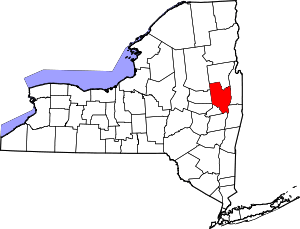 | |
| Towns | ||
| Villages | ||
| CDPs | ||
| Other hamlets | ||
| Footnotes | ‡This populated place also has portions in an adjacent county or counties | |
Coordinates: 43°10′48″N 73°44′39″W / 43.18000°N 73.74417°W