Clarkstown, New York
| Clarkstown | |
|---|---|
| Town | |
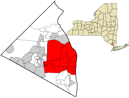 Location in Rockland County and the state of New York. | |
 Clarkstown Location within the state of New York | |
| Coordinates: 41°7′34″N 73°58′49″W / 41.12611°N 73.98028°WCoordinates: 41°7′34″N 73°58′49″W / 41.12611°N 73.98028°W | |
| Country | United States |
| State | New York |
| County | Rockland |
| Established | March 18, 1791 |
| Government | |
| • Supervisor | George Hoehmann |
| Area[1] | |
| • Total | 47.07 sq mi (121.91 km2) |
| • Land | 38.47 sq mi (99.63 km2) |
| • Water | 8.60 sq mi (22.28 km2) |
| Elevation | 105 ft (32 m) |
| Population (2010) | |
| • Total | 84,187 |
| • Estimate (2016)[2] | 87,332 |
| • Density | 2,270.31/sq mi (876.57/km2) |
| Time zone | UTC-5 (Eastern (EST)) |
| • Summer (DST) | UTC-4 (EDT) |
| ZIP code | 10956 (New City), 10920 (Congers), 10954 (Nanuet), 10960 (Nyack), 10989 (Valley Cottage), 10994 (West Nyack) |
| Area code(s) | 845 |
| FIPS code | 36-15968 |
| GNIS feature ID | 0978832 |
| Website | http://town.clarkstown.ny.us |
Clarkstown is a town in Rockland County, New York, United States. The town is on the eastern border of the county, located north of the town of Orangetown, east of the town of Ramapo, south of the town of Haverstraw, and west of the Hudson River. As of the 2010 census, the town had a total population of 84,187.[3] The community of New City, the county seat of Rockland County, is also the seat of town government and of the Clarkstown Police Department, the county sheriff's police office, and the county correctional facility. New City makes up about 41.47% of the town's population.
In 2008 Clarkstown became one of 600 municipalities nationwide to sign the United States Mayor's Climate Protection Agreement to reduce carbon dioxide emissions to 7 percent below the 1990 levels by 2012.
History
The town of Clarkstown was created in 1791 in Orange County, before Rockland County was formed.
Geography

The Hudson River defines the eastern border of the town, which is opposite the town of Mount Pleasant in Westchester County.
According to the United States Census Bureau, the town has a total area of 46.9 square miles (121 km2), of which 38.5 square miles (100 km2) is land and 8.4 square miles (22 km2) (17.87%) is water.
The New York State Thruway (Interstate 87/Interstate 287) intersects the Palisades Interstate Parkway in the town.
Demographics
| Historical population | |||
|---|---|---|---|
| Census | Pop. | %± | |
| 1820 | 1,808 | — | |
| 1830 | 2,298 | 27.1% | |
| 1840 | 2,533 | 10.2% | |
| 1850 | 3,111 | 22.8% | |
| 1860 | 3,874 | 24.5% | |
| 1870 | 4,137 | 6.8% | |
| 1880 | 4,378 | 5.8% | |
| 1890 | 5,216 | 19.1% | |
| 1900 | 6,305 | 20.9% | |
| 1910 | 7,980 | 26.6% | |
| 1920 | 7,317 | −8.3% | |
| 1930 | 10,188 | 39.2% | |
| 1940 | 12,251 | 20.2% | |
| 1950 | 15,674 | 27.9% | |
| 1960 | 33,196 | 111.8% | |
| 1970 | 61,653 | 85.7% | |
| 1980 | 77,091 | 25.0% | |
| 1990 | 79,346 | 2.9% | |
| 2000 | 82,082 | 3.4% | |
| 2010 | 84,187 | 2.6% | |
| Est. 2016 | 87,332 | [2] | 3.7% |
| U.S. Decennial Census[4] | |||
As of the 2010 Census, there were 84,187 people, 29,234 households, and 22,186 families residing in the Town of Clarkstown. The population density was 1,800 per square mile. There were 30,314 housing units at an average density of 646.35 per square mile. There were 29,234 households out of which 27.9% had children under the age of 18 living with them, 62.1% were married couples living together, 10.4% had a female householder with no husband present, and 24.1% were non-families. 36.2% of all households were made up of individuals, and 31.8% had someone living alone who was 65 years of age of older. The average household size was 2.84 and the average family size was 3.28. The median age was 42.8 years. https://factfinder.census.gov/faces/tableservices/jsf/pages/productview.xhtml?src=CF
As of the census[5] of 2000, there were 82,082 people, 27,697 households, and 21,991 families residing in the town. The population density was 2,129.7 people per square mile (822.3/km²). There were 28,220 housing units at an average density of 732.2 per square mile (282.7/km²). The racial makeup of the town was 79.97% White, 7.87% African American, 0.13% Native American, 7.90% Asian, 0.10% Pacific Islander, 1.99% from other races, and 2.03% from two or more races. Hispanic or Latino of any race were 6.92% of the population.
There were 27,697 households out of which 36.9% had children under the age of 18 living with them, 67.4% were married couples living together, 9.1% had a female householder with no husband present, and 20.6% were non-families. 16.9% of all households were made up of individuals and 6.5% had someone living alone who was 65 years of age or older. The average household size was 2.90 and the average family size was 3.27.
In the town, the population was spread out with 24.7% under the age of 18, 6.6% from 18 to 24, 28.3% from 25 to 44, 28.1% from 45 to 64, and 12.3% who were 65 years of age or older. The median age was 39 years. For every 100 females, there were 94.3 males. For every 100 females age 18 and over, there were 90.3 males.
According to a 2007 estimate, the median income for a household in the town was $92,121, and the median income for a family was $104,909. Males had a median income of $57,773 versus $40,805 for females. The per capita income for the town was $34,430. About 2.5% of families and 3.8% of the population were below the poverty line, including 4.5% of those under age 18 and 3.4% of those age 65 or over.
Clarkstown is the most densely populated town in Rockland County and is home to New City, which is the county seat. Clarkstown has more business districts in it than any other town in Rockland County, including the Palisades Center, which is among the largest malls in the world.
Elected representation
The Town of Clarkstown has as its chief executive a Town Supervisor. The current Town Supervisor is George Hoehmann. Clarkstown is represented in the United States House of Representatives by Congresswoman Nita Lowey. It is represented in New York State government by Senator David Carlucci and Assemblyman Kenneth Zebrowski.
Public transportation
| Headquarters | 10 Maple Avenue |
|---|---|
| Locale | New City, New York |
| Service area | Clarkstown, New York |
| Service type | bus service, paratransit |
| Routes | 5 |
| Fleet |
10[6] (2009 figures) |
| Daily ridership |
518 (weekday) 366 (Saturday)[6] |
| Website | Clarkstown Mini-Trans |
Clarkstown Mini-Trans is the provider of local mass transportation in Clarkstown. It has five bus routes:
- Route A- Nanuet Mall to Lakewood Drive
- Route B- Nanuet Mall to Zukor Park
- Route C- Nanuet Mall to South Mountain Road
- Route D- Nanuet Mall to Palisades Center Mall
- Route E- Nanuet Mall to Ridge Road
Additionally, Transport of Rockland provides local mass transportation. Routes 59, 91, 92, 93, and 97 serve the town.[7]
Commuter transportation is provided by New Jersey Transit's Pascack Valley Line at Nanuet, with service to Hoboken and connecting service to New York Penn Station. Tappan ZEExpress, operated by Transport of Rockland provides bus service from the Palisades Center in West Nyack and The HUB in Central Nyack to the Tarrytown train station and the White Plains TransCenter.[8] In addition, Rockland Coaches provides express service to the Port Authority Bus Terminal in New York City from Park-and-Ride and other pickup locations in New City, Bardonia, West Nyack, and Nanuet via Route 49 and 49J, and local service to New York from New City, Valley Cottage, and Upper Nyack on Routes 9A, 9T, and 20.[9]
Education
The town of Clarkstown is served by several school districts.[10] The majority of the town is served by the Clarkstown Central School District, which educates students in New City, Bardonia, Congers, and West Nyack.[11] The village of Upper Nyack as well as the hamlets of Valley Cottage and Central Nyack are served by the Nyack Public Schools,[12] while the Hamlet of Nanuet is served by the Nanuet Union Free School District.[13] A small portion on the western town border is served by the East Ramapo Central School District.[14]
High schools located in the town include Clarkstown South High School in West Nyack, Clarkstown North High School in New City, Nyack Senior High School in Upper Nyack, and Nanuet Senior High School in Nanuet.
- Clarkstown Central School District
- In 2015 U.S. News & World Report ranked Clarkstown North Senior High School with a Silver award as the 135 Best High School in New York State and 1,329 nationally[15]
- In 2017 U.S. News & World Report ranked Clarkstown South Senior High School with a Silver award as the 116 Best High School in New York State and 1,219 nationally.
- In 2017 U.S. News & World Report ranked Clarkstown North Senior High School with a Silver award as the 117 Best High School in New York State and 1,224 nationally.
- In 2018, ranked 78 Best School Districts in Clarkstown by Niche's.
Communities and locations in Clarkstown, NY
- Bardonia – A hamlet east of Spring Valley.
- Brownsell Corners – A hamlet in the north part of the town, now considered a part of New City.
- Centenary – A hamlet near the north town line, now the north-easternmost side of New City.
- Central Nyack – A hamlet on the south town line.
- Congers – A hamlet in the eastern part of the town.
- Lake DeForest – A long lake with a north–south orientation.
- High Tor State Park – A state park along the north town line.
- Germonds – A location south of New City.
- Hook Mountain State Park – A state park in the east part of the town.
- Lake Lucille – A location in the north part of the town.
- Mount Ivy – A hamlet on the north town line.
- Nanuet – A hamlet.
- New City – A hamlet that is the county seat.
- New City Condominiums– A neighborhood near the center of New City
- New City Park – A community in South New City.
- Nyack Beach State Park – A state park near the Hudson River.
- Oakbrook – A hamlet east of Spring Valley
- Rockland Lake – A hamlet located west of a lake of the same name.
- Rockland Lake State Park – A state park in the eastern part of the town.
- Spring Valley – A village, the east portion of which is within the town.
- Upper Nyack – A village north of Nyack.
- Valley Cottage – A hamlet in the eastern part of the town.
- West Nyack – A hamlet west of Nyack village.
Rankings
CNN Money
- In 2008, CNNMoney.com named Clarkstown the 71st best small "city" to live in America.
- In 2010, CNNMoney.com named Clarkstown the 41st best small "city" to live in America, which was the highest such ranking in New York.[16]
- In 2012, CNNMoney.com named Clarkstown the 35th best small "city" to live in America.
- In 2014, CNNMoney.com named Clarkstown the 7th best small "city" to live in America.[17]
CQ Press Crime ranking
In 2005, it was named by Morgan Quitno the second safest city in the United States whose population is greater than 75,000 as well as the second safest overall from over 369 cities. This was the fifth year in a row in which Clarkstown made it within the top five and top ten respectively in these categories.
In 2007, Clarkstown was once again named the second safest city in the United States, in the 14th annual "2007 – 2008 City Crime Rankings" published by CQ Press – formally known as Morgan Quitno, a unit of Congressional Quarterly Inc. It was based on the FBI's September 24, 2007, crime statistics report which looked at 378 municipal areas with at least 75,000 people based on per-capita rates for homicide, rape, robbery, aggravated assault, burglary and auto theft.
In 2008, Clarkstown was named the 6th safest city in the United States in the 15th annual "2008 – 2009 City Crime Rankings" published by CQ Press.
In 2009, Clarkstown was named the 7th safest city in the United States in the 16th annual "2009 – 2010 City Crime Rankings" published by CQ Press.
In 2010, Clarkstown was named the 5th safest city in the United States in the 17th annual "2010 – 2011 City Crime Rankings" published by CQ Press.[18]
In 2011, Clarkstown was named the 7th safest city in the United States in the 18th annual "2011 – 2012 City Crime Rankings" published by CQ Press.
In 2012, Clarkstown was named the 8th safest city in the United States in the 19th annual "2012 – 2013 City Crime Rankings" published by CQ Press.
In 2013, Clarkstown was named the 8th safest city in the United States in the 20th annual "2013 – 2014 City Crime Rankings" published by CQ Press.
However, these rankings are highly controversial, because of their source. In October 2007 the American Society of Criminology, the United States Conference of Mayors, and the Federal Bureau of Investigation requested that the publisher reconsider the promotion of the book – specifically, "their inaccurate and inflammatory press release labeling cities as 'safest' and 'most dangerous'" – because the rankings are "baseless and damaging."
Educational ranking
In 2015 U.S. News & World Report ranked Clarkstown South Senior High School with a silver award as the 128 Best High School in New York State and 1,233 nationally.[19]
In 2015 U.S. News & World Report ranked Clarkstown North Senior High School with a silver award as the 135 Best High School in New York State and 1,329 nationally.[20]
Clarkstown Going Green
Clarkstown has taken steps towards "going green" by conducting energy audits, purchasing Energy Star office equipment and using green cleaning products in town facilities. Other steps included:
- 2005 – Purchasing 10% of the energy used by town government from wind and solar sources.
- 2006 – Passing a tree preservation law.
- 2007 – Purchasing Hybrid vehicles and smaller cars.
- 2008 – Installing energy-efficient lighting (LED) at its parks and recreation building with sensors that automatically turn off lights when no motion is detected.
US Supreme Court case
In 1994, Clarkstown was involved in litigation that challenged a town ordinance that required all waste picked up in the town to be sorted for recyclables at a specific privately operated facility. The case made it to the United States Supreme Court in C&A Carbone, Inc. v. Town of Clarkstown, in which the ordinance was held unconstitutional.
References
- ↑ "2016 U.S. Gazetteer Files". United States Census Bureau. Retrieved Jul 5, 2017.
- 1 2 "Population and Housing Unit Estimates". Retrieved June 9, 2017.
- ↑ "Profile of General Population and Housing Characteristics: 2010 Demographic Profile Data (DP-1): Clarkstown town, Rockland County, New York". U.S. Census Bureau, American Factfinder. Archived from the original on September 11, 2013. Retrieved February 1, 2012.
- ↑ "Census of Population and Housing". Census.gov. Archived from the original on May 12, 2015. Retrieved June 4, 2015.
- ↑ "American FactFinder". United States Census Bureau. Archived from the original on September 11, 2013. Retrieved 2008-01-31.
- 1 2 NTD Program filing for Clarkstown Mini-Trans, 2009
- ↑ Transport of Rockland
- ↑ Tappan ZEExpress
- ↑ Rockland Coaches
- ↑ Clarkstown Schools Information
- ↑ Clarkstown Central School District
- ↑ Nyack Public Schools
- ↑ Nanuet Union Free School District
- ↑ East Ramapo Central School District
- ↑ 2015 Academic Indicators
- ↑ "Amherst in top 50 of 'Best Places to Live'". BuffaloNews.com. July 16, 2010.
- ↑ http://time.com/money/collection/best-places-to-live/best-places-to-live/
- ↑ http://os.cqpress.com/citycrime/2010/City_crime_rate_2010-2011_lowtohigh.pdf
- ↑
- ↑ 2015 Academic Indicators
External links
Municipalities and communities of Rockland County, New York, United States | ||
|---|---|---|
| Towns | 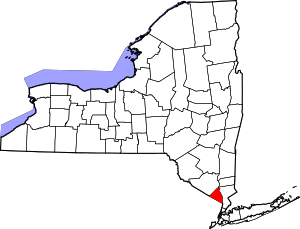 | |
| Villages | ||
| CDPs | ||
| Other hamlets | ||