Manakau

Manakau is a settlement in the Horowhenua District, at the southern edge of the Manawatu-Wanganui Region of New Zealand's North Island.[1] It lies 8 km north of Otaki and 12 km south of Levin, to both of which it is connected by State Highway 1, which skirts Manakau's western edge. The township 5 km inland from the coast of the Tasman Sea.[2]
In 1886, Manakau became the first place to have a railway station on the newly completed Wellington-Manawatu railway line.[3] The line is now part of the North Island Main Trunk Line, but the station itself has long been closed. Industries in the area include horticulture,[3] and there are several plant nurseries in or close to the township.
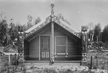
Manakau comes from the Māori words mana (prestige, authority) and kau (alone, sole). The name refers to an invasion of the district by notable tribal leader Te Rauparaha, who subdued the area on the strength of his prestige alone, with the local residents putting up no resistance.[4] The streets are named after Māori members of Parliament.[3]
References
- ↑ Although most of the township lies in Manawatu-Wanganui, some rural properties at the southern end of the township actually lie within the Wellington Region.
- ↑ Dowling, P. (ed.) (2004). ’’Reed New Zealand atlas’’. Auckland: Reed Publishing. Map 48. ISBN 0 7900 0952 8
- 1 2 3 McKinnon, M. "Horowhenua," Te Ara - the Encyclopedia of New Zealand, 21 April 2015. Retrieved 21 April 2018.
- ↑ Reed, A.W. (1975). Place names of New Zealand. Wellington: A.H. & A.W. Reed. p. 243