Auckland Region
Coordinates: 36°54′S 174°47′E / 36.900°S 174.783°E
| Auckland Region | |
| Country | |
 | |
| Regional council | |
|---|---|
| Name: | Auckland Council |
| Mayor: | Phil Goff |
| Population: | 1,657,200 June 2017[1] |
| Land area: | 4,894 km2 (1,890 sq mi)[2] |
| Website: | AucklandCouncil.govt.nz |
| Cities and towns | |
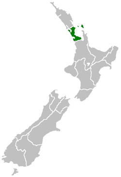
The Auckland Region is one of the sixteen regions of New Zealand, named for the city of Auckland, the country's largest urban area. The region encompasses the Auckland metropolitan area, smaller towns, rural areas, and the islands of the Hauraki Gulf. Containing 35 percent of the nation's residents,[1] it has by far the largest population and economy of any region of New Zealand, but the second-smallest land area.
On 1 November 2010, the Auckland Region became a unitary authority controlled by the Auckland Council, replacing the previous regional council and seven local councils. In the process, an area in its southeastern corner was transferred to the neighbouring Waikato Region. The name "Auckland Region" remains present in casual usage.
Geography

On the mainland, the region extends from the mouth of the Kaipara Harbour in the north across the southern stretches of the Northland Peninsula, past the Waitakere Ranges and the isthmus of Auckland and across the low-lying land surrounding the Manukau Harbour. The region ends within a few kilometres of the mouth of the Waikato River. It is bordered in the north by the Northland Region, and in the south by the Waikato Region. It also includes the islands of the Hauraki Gulf.
The Hunua Ranges and the adjacent coastline along the Firth of Thames were part of the region until the Auckland Council was formed in late 2010, when they were transferred to the neighbouring Waikato Region.
In land area it is smaller than all the other regions and unitary authorities except Nelson. Its highest point is the summit of Little Barrier Island, at 722 metres.
See also
References
- 1 2 "Subnational Population Estimates: At 30 June 2017 (provisional)". Statistics New Zealand. 24 October 2017. Retrieved 24 October 2017. For urban areas, "Subnational population estimates (UA, AU), by age and sex, at 30 June 1996, 2001, 2006-16 (2017 boundary)". Statistics New Zealand. 24 October 2017. Retrieved 24 October 2017.
- ↑ "Auckland Council Draft Annual Plan 2011/2012 - Volume 1: Our Region" (PDF). Auckland Council. p. 2. Retrieved 9 March 2011.
External links


| North Island | ||
|---|---|---|
| South Island | ||
* Governed by a unitary authority rather than a regional council | ||