Fairwood, King County, Washington
| Fairwood, Washington | |
|---|---|
| CDP | |
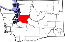
 Location of Cascade-Fairwood, Washington | |
| Coordinates: 47°26′49″N 122°08′37″W / 47.44694°N 122.14361°WCoordinates: 47°26′49″N 122°08′37″W / 47.44694°N 122.14361°W | |
| Country | United States |
| State | Washington |
| County | King |
| Area[1] | |
| • Total | 4.86 sq mi (12.59 km2) |
| • Land | 4.86 sq mi (12.59 km2) |
| • Water | 0.0 sq mi (0.0 km2) |
| Population (2010) | |
| • Total | 19,102 |
| • Density | 3,927.2/sq mi (1,517.2/km2) |
| Time zone | UTC-8 (Pacific (PST)) |
| • Summer (DST) | UTC-7 (PDT) |
| FIPS code | 53-10372[2] |
| GNIS feature ID | 2407983[3] |
Fairwood is an unincorporated community and census-designated place (CDP) in King County, Washington, United States. The population of the CDP was 19,102 at the 2010 census. The population of the King County Incorportion area of Fairwood is 25,000 as of 2007.[4]
Economy
Employment
Residents are employed at a slightly higher rate than the rest of the County and the median income is $85,000 (versus $69,000 for King County). More than half of the workers in the Fairwood area work in south King County with less than a 30-minute commute. A significant number of Fairwood workers are in professional, management and sales jobs (70%).
Geography
Cascade-Fairwood is located at 47°26′49″N 122°08′37″W / 47.44694°N 122.14361°W (47.447062, -122.143586).[5] According to the United States Census Bureau, the CDP has a total area of 3.6 square miles (9.3 km²).
The Fairwood area forms a plateau which extends from the bluffs of the Cedar River Valley on the north and east down to State Route 167 and the Kent Valley on the West. Fairwood includes opens spaces, towering trees, many neighborhoods and several commercial districts. It surrounds the Seattle watershed of Lake Youngs on the south, and borders Renton to the east, and Maple Valley to the southeast. The Fairwood area features five sizable lakes, timberland, and farmland. The incorporation area of Fairwood is 6.2-square-miles.
Neighborhoods
|
|
|
Climate
Fairwood's climate features cool/mild wet winter, and a dry-summer. The warmest month of the year in Cascade-Fairwood within the past 3–6 years is July and the coldest is December.
Autumn, winter, and spring are frequently characterized by rain, in the Seattle area, while the summers are fairly dry and warm by comparison. Fairwood's location closer to downslope winds from the Cascade Mountains means it can get fairly hot in the summers. An exception to the damp weather occurs in El Niño years when the Seattle area stays fairly dry.
Fairwood typically receives some snowfall on an annual basis, but heavy snow is rare.
Geographic location
Places adjacent to Fairwood, King County, Washington | |
|---|---|
Parks and recreation
There are many large lakes and community parks in the Fairwood area
- Fairwood Golf & Country Club – A large 18 hole golf course located in the Fairwood Greens neighborhood. It features 6,316 yards of golf from the longest tees for a par of 71. The country club includes a heated 8-lane junior Olympic sized pool, and fitness gym.[6][7]
- Spring Lake / Lake Desire Park – Located in eastern Fairwood between Lake Desire and Spring Lake. It features an 11-mile backcountry trail for hiking, horseback riding and mountain biking.[8]
- Soos Creek Trail and Park – In western Fairwood, home to a large riparian habitat great for birdwatching of ducks, song birds, and raptors. The 12 mile long Soos Creek trail was extended up to Fairwood in the late 2000s.
- McGarvey Park – Features a 1.2 mile hiking trail up Cedar Mountain (Echo Mountain) through evergreen forest, passing over Peterson Creek. It has views of Mount Rainier on the summit of Cedar Mountain.[9]
- Petrovitsky Park – Located just north of Petrovitsky Rd, an 88-acre park with 4 baseball fields and soccer fields, a playground, and picnic areas.[10][11]
- Cedar River Trail – North of the Fairwood plateau the trail hugs the winding Cedar River from Renton to Maple Valley.[12]
Education
Fairwood is served by three school districts, Renton, Kent, and Tahoma. Schools in the Fairwood area are:
High schools
Middle schools
- Nelsen Middle School
- Meeker Meeker Middle School
- Northwood Middle School
Elementary schools
- Renton Park ES
- Carriage Crest ES
- Fairwood ES
- Glenridge ES
- Lake Youngs ES
- Ridgewood ES
- Springbrook ES
Major roads
There are three major arterials that run through Fairwood. Petrovitsky Road Runs through the east/west through Fairwood's commercial core and many of its neighborhoods. It stretches from downtown Renton, near the Boeing Renton Factory, and Boeing Commercial Aviation; where many Fairwood residents work, to Maple Valley, winding through the rural timberland, ranches, and farms of eastern Fairwood. 140th Avenue runs north/south adjacent to the Fairwood shopping centers and Soos Creek. It stretches from Maple Valley highway on the north and leads 9 miles to Green River Community College by way of Kent's east hill. State Route 169 (Maple Valley highway) on the northern end of Fairwood provides short access to Interstate 405.
Public safety
Fairwood Fire Protection and Emergency Medical Services are served by Fire Districts 40 and 37. The Fire District 40 station is located on Petrovitsky Rd in the center of Fairwood. The King County Sheriff provides policing services to the area, with a Sheriff's substation located in Fairwood Center. Valley Medical Center at Fairwood provides medical services and specializes in family medicine, behavioral health, and internal medicine.[13]
Demographics
| Historical population | |||
|---|---|---|---|
| Census | Pop. | %± | |
| 1980 | 16,939 | — | |
| 1990 | 30,107 | 77.7% | |
| 2000 | 34,580 | 14.9% | |
| 2010 | 19,102 | −44.8% | |
As of the census[2] of 2000, there were 34,580 people, 13,065 households, and 9,197 families residing in the CDP. The population density was 3,898.6 people per square mile (1,505.2/km²). There were 13,456 housing units at an average density of 1,517.0/sq mi (585.7/km²). The racial makeup of the CDP was 72.95% White, 6.09% African American, 0.60% Native American, 13.50% Asian, 0.46% Pacific Islander, 1.88% from other races, and 4.51% from two or more races. Hispanic or Latino of any race were 4.11% of the population.
There were 13,065 households out of which 35.4% had children under the age of 18 living with them, 56.6% were married couples living together, 9.9% had a female householder with no husband present, and 29.6% were non-families. 22.4% of all households were made up of individuals and 4.7% had someone living alone who was 65 years of age or older. The average household size was 2.65 and the average family size was 3.14.
In the CDP the population was spread out with 26.2% under the age of 18, 8.4% from 18 to 24, 33.1% from 25 to 44, 24.7% from 45 to 64, and 7.6% who were 65 years of age or older. The median age was 35 years. For every 100 females there were 98.6 males. For every 100 females age 18 and over, there were 96.3 males.
The median income for a household in the CDP was $57,996, and the median income for a family was $66,811. Males had a median income of $47,094 versus $33,886 for females. The per capita income for the CDP was $25,752. About 4.6% of families and 5.9% of the population were below the poverty line, including 9.0% of those under age 18 and 4.1% of those age 65 or over.
As of the census[2] of 2010, there were 19,000 people, and 7,516 households in the CDP. The population density was 3,898.6 people per square mile (1,505.2/km²). There were 13,456 housing units at an average density of 1,517.0/sq mi (585.7/km²). The racial makeup of the CDP was 65.3% White, 7.4% African American, 0.50% Native American, 17.6% Asian, 0.60% Pacific Islander, 4.51% from two or more races, 6.5% Hispanic or Latino of any race
The median income for a household in the CDP was $88,859, and the median income for a family was $66,811. Males had a median income of $47,094 versus $33,886 for females. The per capita income for the CDP was $38,624. About 3.0% of the population were below the poverty line.[1]
The population of the Fairwood incorporation area is 25,000 with a land area of 6.27 square miles. The population is expected to grow up to 28,783 residents in 2015.[4]
Politics
On the national level, Cascade-Fairwood leans towards candidates of the Democratic Party. Democrat John Kerry received about 56 percent of the vote in 2004 to Republican George W. Bush's 43 percent. Despite this, there are a number of pockets where the Republican Party often wins marginal majorities.
The Cascade area (approximately a population of 17,000), which included much of unincorporated Benson Hill north of SE 200 St. and west of 128th Ave. SE, voted to annex to the City of Renton in 2007 and this became effective March 1, 2008. The remaining unincorporated area of King County, which is primarily the Fairwood community, has the option of annexing to the City of Renton or incorporating as a city.
In February 2005, the Fairwood Task Force filed a Notice of Intent to Incorporation with King County, Washington, to establish a new City of Fairwood. This attempt to incorporate the City of Fairwood was very narrowly defeated in the election held on September 19, 2006. In that election, 48.22% of the votes were for incorporation; a swing of only 136 votes in the election would have changed the result.
The process to form a City of Fairwood was restarted by the Fairwood Municipal Initiative when it filed a Notice of Proposed Incorporation with King County, Washington on April 16, 2007.[14] As of October 2008, the incorporation effort is now under the jurisdiction of the King County Boundary Review Board (BRB)[15] and a consulting firm hired by the BRB is conducting an economic feasibility study for the proposed City of Fairwood.
On November 3, 2009 Proposition 1 to incorporate a City of Fairwood failed again as it did in 2006.
Efforts are also ongoing to annex the Fairwood area into the City of Renton.[16] Additionally, the Red Mill area of the Fairwood PAA is presently undertaking a separate petition method annexation.[17]
On November 2, 2010, 57.6% of voters voted against a proposition to annex Fairwood to Renton.[18]
References
- 1 2 "Fairwood CDP (King), Washington". United States Census Bureau. Archived from the original on 2013-03-16. Retrieved 28 February 2013.
- 1 2 3 "American FactFinder". United States Census Bureau. Archived from the original on 2013-09-11. Retrieved 2008-01-31.
- ↑ "Fairwood Census Designated Place". Geographic Names Information System. United States Geological Survey.
- 1 2 "City of Fairwood Incorporation Study" (PDF). King County. Retrieved 28 February 2013.
- ↑ "US Gazetteer files: 2010, 2000, and 1990". United States Census Bureau. 2011-02-12. Retrieved 2011-04-23.
- ↑ "Services > Swim & Fitnes". Fairwood Golf & Country Club. Retrieved 15 February 2013.
- ↑ "Fairwood Golf & Country Club, Fairwood Golf Course". GolfLink. Demand Media, Inc. Retrieved 15 February 2013.
- ↑ "Spring Lake / Lake Desire Park" (PDF). your.kingcounty.gov. King County, Washington. Retrieved 15 February 2013.
- ↑ Hite, Will. "McGarvey Park, Renton – Cedar Mountain". WillhiteWeb.com. WillhiteWeb. Retrieved 15 February 2013.
- ↑ Milan, Frana. "Shiny new fields coming to Petrovitsky Park". King County Parks Plog. WordPress. Retrieved 15 February 2013.
- ↑ "PETROVITSKY PARK". thespotsport.com. The Spot Sport. Archived from the original on 2010-09-16. Retrieved 15 February 2013.
- ↑
- ↑ "Valley Medical Center Fairwood Clinic". Valley Medical Center. Retrieved 28 February 2013.
- ↑ Fairwood Municipal Initiative Archived 2008-08-20 at the Wayback Machine.
- ↑ King County Boundary Review Board
- ↑ Choose Renton
- ↑ Red Mill Annexation Map
- ↑ Results – King County Elections
Municipalities and communities of King County, Washington, United States | ||
|---|---|---|
| Cities |
|  |
| Towns | ||
| CDPs |
| |
| Unincorporated communities | ||
| Indian reservation | ||
| Ghost towns | ||
| Footnotes | ‡This populated place also has portions in an adjacent county or counties | |
