Shadow Lake, Washington
| Shadow Lake, Washington | |
|---|---|
| CDP | |
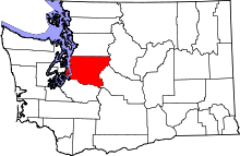
 Shadow Lake, Washington Location of Shadow Lake, Washington. | |
| Coordinates: 47°24′6″N 122°4′10″W / 47.40167°N 122.06944°WCoordinates: 47°24′6″N 122°4′10″W / 47.40167°N 122.06944°W | |
| Country | United States |
| State | Washington |
| County | King |
| Area | |
| • Total | 5.3 sq mi (13.8 km2) |
| • Land | 5.2 sq mi (13.4 km2) |
| • Water | 0.1 sq mi (0.4 km2) |
| Population (2010) | |
| • Total | 2,262 |
| • Density | 436.0/sq mi (168.3/km2) |
| Time zone | UTC-8 (Pacific (PST)) |
| • Summer (DST) | UTC-7 (PDT) |
| GNIS feature ID | 2585035[1] |
Shadow Lake is a census-designated place (CDP) in King County, Washington, United States. The population was 2,262 at the 2010 census.
Geography
Shadow Lake is located at 47°24′06″N 122°04′10″W / 47.40167°N 122.06944°W (47.401561, -122.069418).[2]
According to the United States Census Bureau, the CDP had a total area of 5.3 square miles (13.8 km²), of which, 5.2 square miles (13.4 km²) of it is land and 0.1 square miles (0.4 km²) of it (2.68%) is water.
Tahoma National Cemetery is located at (47.38722, -122.09354) "Tahoma National Cemetery". in Shadow Lake even though it has a City of Kent, Washington zip-code 98042.
References
- ↑ "Shadow Lake Census Designated Place". Geographic Names Information System. United States Geological Survey.
- ↑ "US Gazetteer files: 2010, 2000, and 1990". United States Census Bureau. 2011-02-12. Retrieved 2011-04-23.
Municipalities and communities of King County, Washington, United States | ||
|---|---|---|
| Cities |
|  |
| Towns | ||
| CDPs |
| |
| Unincorporated communities | ||
| Indian reservation | ||
| Ghost towns | ||
| Footnotes | ‡This populated place also has portions in an adjacent county or counties | |
This article is issued from
Wikipedia.
The text is licensed under Creative Commons - Attribution - Sharealike.
Additional terms may apply for the media files.