Tha Takiap District
| Tha Takiap ท่าตะเกียบ | |
|---|---|
| Amphoe | |
 | |
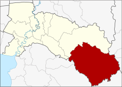 Amphoe location in Chachoengsao Province | |
| Coordinates: 13°26′41″N 101°36′40″E / 13.44472°N 101.61111°ECoordinates: 13°26′41″N 101°36′40″E / 13.44472°N 101.61111°E | |
| Country | Thailand |
| Province | Chachoengsao |
| Seat | Tha Takiap |
| Area | |
| • Total | 1,054.8 km2 (407.3 sq mi) |
| Population (2017) | |
| • Total | 46,603 |
| • Density | 44.18/km2 (114.4/sq mi) |
| Time zone | UTC+7 (ICT) |
| Postal code | 24160 |
| Geocode | 2410 |
Tha Takiap (Thai: ท่าตะเกียบ, pronounced [tʰâː tā.kìa̯p]) is the easternmost district (amphoe) of Chachoengsao Province, central Thailand.
History
The minor district (king amphoe) Tha Takiap was established on 1 April 1991 by splitting off two tambon from Sanam Chai Khet District.[1] It was upgraded to a full district on 5 December 1996.[2]
Geography
Neighboring districts are (from the north clockwise) Sanam Chai Khet of Chachoengsao Province, Khao Chakan, Wang Nam Yen, and Wang Sombun of Sa Kaeo Province, Kaeng Hang Maeo of Chanthaburi Province, and Bo Thong and Ko Chan of Chonburi Province.
Administration
Central administration
Tha Takiap is divided into two sub-districts (tambon), which are further subdivided into 47 administrative villages (Muban).
| No. | Name | Thai | Villages | Pop.[3] |
|---|---|---|---|---|
| 1. | Tha Takiap | ท่าตะเกียบ | 22 | 19,357 |
| 2. | Khlong Takrao | คลองตะเกรา | 25 | 27,246 |
Local administration
There are two sub-district administrative organizations (SAO) in the district:
- Tha Takiap (Thai: องค์การบริหารส่วนตำบลท่าตะเกียบ) consisting of sub-district Tha Takiap.
- Khlong Takrao (Thai: องค์การบริหารส่วนตำบลคลองตะเกรา) consisting of sub-district Khlong Takrao.
References
- ↑ ประกาศกระทรวงมหาดไทย เรื่อง แบ่งเขตท้องที่อำเภอสนามชัยเขต จังหวัดฉะเชิงเทรา ตั้งเป็นกิ่งอำเภอท่าตะเกียบ (PDF). Royal Gazette (in Thai). 108 (15 ง): 1063. January 31, 1991.
- ↑ พระราชกฤษฎีกาตั้งอำเภอเหนือคลอง อำเภอนายายอาม อำเภอท่าตะเกียบ อำเภอขุนตาล อำเภอแม่ฟ้าหลวง อำเภอแม่ลาว อำเภอรัษฎา อำเภอพุทธมณฑล อำเภอวังน้ำเขียว อำเภอเจาะไอร้อง อำเภอชำนิ อำเภอโนนดินแดง อำเภอปางมะผ้า อำเภอสนธิ อำเภอหนองม่วง อำเภอเบญจลักษ์ อำเภอโพนนาแก้ว อำเภอบุ่งคล้า อำเภอดอนมดแดง และอำเภอลืออำนาจ พ.ศ. ๒๕๓๙ (PDF). Royal Gazette (in Thai). 113 (62 ก): 5–8. November 20, 1996.
- ↑ "Population statistics 2017" (in Thai). Department of Provincial Administration. Retrieved 2018-04-04.
External links