Wacol, Queensland
| Wacol Brisbane, Queensland | |||||||||||||||
|---|---|---|---|---|---|---|---|---|---|---|---|---|---|---|---|
_-_panoramio.jpg) | |||||||||||||||
 Wacol | |||||||||||||||
| Coordinates | 27°34′59″S 152°55′14″E / 27.5830°S 152.9205°ECoordinates: 27°34′59″S 152°55′14″E / 27.5830°S 152.9205°E | ||||||||||||||
| Population | 3,761 (2016 census)[1] | ||||||||||||||
| • Density | 181.7/km2 (470.6/sq mi) | ||||||||||||||
| Postcode(s) | 4076 | ||||||||||||||
| Area | 20.7 km2 (8.0 sq mi) | ||||||||||||||
| Location | 18 km (11 mi) from Brisbane GPO | ||||||||||||||
| LGA(s) |
City of Brisbane (Jamboree Ward)[2] | ||||||||||||||
| State electorate(s) | Inala | ||||||||||||||
| Federal Division(s) | Oxley | ||||||||||||||
| |||||||||||||||
Wacol is a suburb in the City of Brisbane, Queensland, Australia.[3] In the 2016 census, a total of 3,761 people lived within the boundaries of Wacol.[4]
Geography
Wacol is located on the east bank of the Brisbane River, 18 kilometres (11 mi) south-west of the Brisbane central business district, on the Brisbane-Ipswich railway line. It is served by Wacol railway station.
History
.jpg)
The suburb takes its name from its railway station.
Wolston House was opened in 1852. Still intact today the building is the only surviving early Brisbane River settlement.[5] The building was planned to be demolished however the National Trust of Queensland intervened to save the building. Major conservation work was undertaken.
The Wolston railway station was opened on 8 October 1874, taking its name from Wolston House. However, the name caused confusion with the Wilston railway station, so it was renamed on 8 July 1927 to Wacol railway station. Wacol is a coined word from weigh coal, as the principal purpose of the station was coal handling.[6][7]
The suburb played host to the American military during World War II, who constructed Camp Columbia in 1942; after the war, control of the facility was transferred to the Australian government for use as a migrant reception and training centre.
Heritage listings
Wacol has a number of heritage-listed sites, including:
- 60 Grindle Road: Wolston Park Hospital[8]
- 223 Grindle Road: Wolston House[9]
Demographics
In the 2011 census, Wacol recorded a population of 2,957 people; 19.3% female and 80.7% male.[4]
The median age of the Wacol population was 35 years, 2 years below the Australian median. There is a marked over-representation of people aged between 20 and 40 years in Wacol, where they account for 54.1% of the population, compared to the national figure of 27.7%. The young and old are under-represented: children aged under 15 years made up 3.6% of the population (nationally 19.3%) and people aged 65 years and over made up 5.2% of the population (nationally 14.0%).[4]
76.5% of people living in Wacol were born in Australia, compared to the national average of 69.8%; the next most common countries of birth were New Zealand 5.2%, Indonesia 2.9%, England 2.7%, Vietnam 1.2%, Fiji 0.6%.[4]
19.5% of people spoke only English at home; the next most popular languages were 1% Vietnamese, 0.5% Spanish, 0.3% Serbian, 0.3% Italian, 0.3% Mandarin.[4]
Facilities
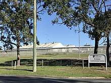
Wacol is home for jail inmates at the Brisbane Correctional Centre (previously known as Sir David Longland Correctional Centre), Arthur Gorrie Correctional Centre, Brisbane Youth Detention Centre (10- to 17-year-olds), the Brisbane Women's Correctional Centre and the Wolston Correctional Centre. The Park Centre for Mental Health, formerly known as the Wolston Park Hospital, has acted as an institution for the mentally ill since 1865.[10] In December 2011, the Royal Society for the Prevention of Cruelty to Animals moved from their premises in Fairfield to Wacol.[11] There is also a significant industrial park located in the area.
Transport
The Ipswich Motorway crosses the suburb. A major upgrade of the road was completed in 2010.[12] The Logan Motorway connects to the Ipswich Motorway in the south of the suburb.
Wacol railway station and Gailes railway station (which, despite its name, is located in Wacol) provides access to regular Queensland Rail City network services to Brisbane, Ipswich and Rosewood via Ipswich.
In the 2011 census, 11.2% of employed people traveled to work on public transport and 66.3% by car (either as driver or as passenger).[4]
See also
References
- ↑ Australian Bureau of Statistics (27 June 2017). "Wacol (Brisbane City) (State Suburb)". 2016 Census QuickStats. Retrieved 16 March 2013.

- ↑ "Jamboree Ward". Brisbane City Council. Brisbane City Council. Retrieved 12 March 2017.
- ↑ "Wacol - suburb in City of Brisbane (entry 43382)". Queensland Place Names. Queensland Government. Retrieved 10 October 2017.
- 1 2 3 4 5 6 Australian Bureau of Statistics (31 October 2012). "Wacol (Brisbane City) (State Suburb)". 2011 Census QuickStats. Retrieved 16 March 2013.
- ↑ Cook, Penny (2006). Discover Queensland Heritage. Corinda, Queensland: Pictorial Press Australia. p. 32. ISBN 1876561424.
- ↑ "Wacol - railway station in City of Brisbane (entry 36108)". Queensland Place Names. Queensland Government. Retrieved 11 October 2017.
- ↑ "GENERAL NEWS. Wolston's New Name". The Brisbane Courier (21, 676). Queensland, Australia. 18 July 1927. p. 12. Retrieved 11 October 2017 – via National Library of Australia.
- ↑ "Wolston Park Hospital Complex (entry 600340)". Queensland Heritage Register. Queensland Heritage Council. Retrieved 6 July 2013.
- ↑ "Wolston House (entry 600339)". Queensland Heritage Register. Queensland Heritage Council. Retrieved 6 July 2013.
- ↑ "A Walk Through Time". State of Queensland. 2 September 2005. Retrieved 12 December 2011.
- ↑ James Kelly (9 December 2011). "RSPCA closes Fairfield shelter". ABC News. Australian Broadcasting Corporation. Retrieved 12 December 2011.
- ↑ "Ipswich Motorway upgrade: Wacol to Darra". Department of Transport and Main Roads. 27 July 2011. Retrieved 12 December 2011.
External links
| Wikimedia Commons has media related to Wacol, Queensland. |