Shire of Dumbleyung
The Shire of Dumbleyung is a local government area in the Wheatbelt region of Western Australia, about 40 kilometres (25 mi) east of Wagin and about 275 kilometres (171 mi) southeast of Perth, the state capital. The Shire covers an area of 2,540 square kilometres (981 sq mi), and is involved in grain and livestock production and various biodiversity industries including cereals, summer crops, oil mallees, yabbies, emus, poultry and trout. Its seat of government is the town of Dumbleyung.
| Shire of Dumbleyung Western Australia | |||||||||||||||
|---|---|---|---|---|---|---|---|---|---|---|---|---|---|---|---|
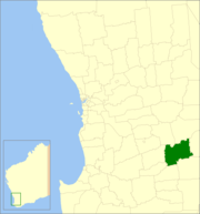 Location in Western Australia | |||||||||||||||
| Population | 671 (2016)[1] | ||||||||||||||
| • Density | 0.27/km2 (0.70/sq mi) | ||||||||||||||
| Established | 1909 | ||||||||||||||
| Area | 2,540.1 km2 (980.7 sq mi) | ||||||||||||||
| President | Gordon Davidson | ||||||||||||||
| Council seat | Dumbleyung | ||||||||||||||
| Region | Wheatbelt | ||||||||||||||
| State electorate(s) | Roe | ||||||||||||||
| Federal Division(s) | O'Connor | ||||||||||||||
| Website | Shire of Dumbleyung | ||||||||||||||
| |||||||||||||||
History
On 1 October 1909, the Dumbleyung Road District was created. On 1 July 1961, it became a Shire following the enactment of the Local Government Act 1960.[2]
Wards
As of 3 May 2003, the shire has been divided into 4 wards.
- Dumbleyung Ward (3 councillors)
- North Ward (3 councillors)
- Kukerin (1 councillor)
- South Ward (2 councillors)
Previously, there were 5 wards: Central (Dumbleyung), North (Dongolocking), South (Datatine), Merilup and Kukerin.
Towns
- Dumbleyung
- Dongolocking
- Kukerin
- Merilup
- Moulyinning
- Nippering
- Tarin Rock
Population
| Year | Population |
|---|---|
| 1911 | 929 |
| 1921 | 1,689 |
| 1933 | 1,610 |
| 1947 | 1,246 |
| 1954 | 1,493 |
| 1961 | 1,444 |
| 1966 | 1,458 |
| 1971 | 1,221 |
| 1976 | 1,038 |
| 1981 | 1,009 |
| 1986 | 1,021 |
| 1991 | 856 |
| 1996 | 834 |
| 2001 | 701 |
| 2006 | 632 |
| 2016 | 671 |
References
- Australian Bureau of Statistics (27 June 2017). "Dumbleyung (Local Government Area)". 2016 Census QuickStats. Retrieved 21 August 2019.

- WA Electoral Commission, Municipality Boundary Amendments Register (release 3.0), 31 July 2007.