Shire of Goomalling
The Shire of Goomalling is a local government area in the Wheatbelt region of Western Australia, about 240 kilometres (149 mi) northeast of Perth, the state capital. The Shire covers an area of 2,836 square kilometres (1,095 sq mi) and its seat of government is the town of Goomalling.
| Shire of Goomalling Western Australia | |||||||||||||||
|---|---|---|---|---|---|---|---|---|---|---|---|---|---|---|---|
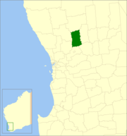 Location in Western Australia | |||||||||||||||
| Population | 1,033 (2016 census)[1] | ||||||||||||||
| • Density | 0.56227/km2 (1.4563/sq mi) | ||||||||||||||
| Established | 1895 | ||||||||||||||
| Area | 1,837.2 km2 (709.3 sq mi) | ||||||||||||||
| Mayor | John Bird | ||||||||||||||
| Council seat | Goomalling | ||||||||||||||
| Region | Wheatbelt | ||||||||||||||
| State electorate(s) | Moore | ||||||||||||||
| Federal Division(s) | Durack | ||||||||||||||
| Website | Shire of Goomalling | ||||||||||||||
| |||||||||||||||
History
On 18 January 1895, the Goomalling Road District was created. On 1 July 1961, it became a Shire following the enactment of the Local Government Act 1960.[2]
Wards
The shire has been divided into 4 wards:
- Town Ward (4 councillors)
- North Ward (2 councillors)
- South Ward (2 councillors)
- Central Ward (1 councillor)
Towns and localities
- Goomalling
- Jennacubbine
- Konnongorring
- Mumberkine
- Ucarty
- Wongamine
Population
| Year | Population |
|---|---|
| 1921 | 1,508 |
| 1933 | 1,803 |
| 1947 | 1,403 |
| 1954 | 1,721 |
| 1961 | 1,567 |
| 1966 | 1,567 |
| 1971 | 1,444 |
| 1976 | 1,254 |
| 1981 | 1,269 |
| 1986 | 1,206 |
| 1991 | 1,084 |
| 1996 | 1,035 |
| 2001 | 939 |
| 2006 | 935 |
| 2011 | 985 |
References
- Australian Bureau of Statistics (27 June 2017). "Goomalling (S)". 2016 Census QuickStats. Retrieved 28 October 2019.

- WA Electoral Commission, Municipality Boundary Amendments Register (release 3.0), 31 July 2007.
External links
This article is issued from Wikipedia. The text is licensed under Creative Commons - Attribution - Sharealike. Additional terms may apply for the media files.