City of Gosnells
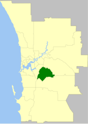
The City of Gosnells is a local government area in the southeastern suburbs of the Western Australian capital city of Perth, located northwest of Armadale and about 20 kilometres (12 mi) southeast of Perth's central business district. The City covers an area of 128 square kilometres (49.42 sq mi), much of which is state forest rising into the Darling Scarp to the east, and had a population of approximately 118,000 at the 2016 Census. The largest activity centre in the City is the Central Maddington shopping centre. District centres exist in the Gosnells town centre, Thornlie and Canning Vale.
| City of Gosnells Western Australia | |||||||||||||||
|---|---|---|---|---|---|---|---|---|---|---|---|---|---|---|---|
 | |||||||||||||||
| Population |
| ||||||||||||||
| • Density | 922/km2 (2,389/sq mi) | ||||||||||||||
| Established | 1907 | ||||||||||||||
| Area | 128 km2 (49.4 sq mi) | ||||||||||||||
| Mayor | Glenn Dewhurst | ||||||||||||||
| Council seat | Gosnells | ||||||||||||||
| Region | SE Metropolitan Perth | ||||||||||||||
| State electorate(s) | Cannington, Thornlie, Jandakot, Kalamunda, Southern River | ||||||||||||||
| Federal Division(s) | Hasluck, Canning | ||||||||||||||
| Website | City of Gosnells | ||||||||||||||
| |||||||||||||||
History
The name Gosnells dates back to 1862 when Charles Gosnell who was the owner of London cosmetic company John Gosnell & Co., bought Canning location 16 from the Davis family who were the original grantees in 1829. While the purchase of the land was a personal investment by Charles Gosnell, when the land was sold to developers in 1903 the developers used the association to the well known cosmetic company, claiming it had bought the land because of its fertile soil to grow flowers for the manufacture of its perfume range. The abundance of the Arum Lily (Zantedeschia aethiopica) in the area and the marketing by the developers contributed to the myth about the Gosnell company, being so successful that the Gosnells railway station was constructed on the Armadale line in 1903.[3][4]
The Gosnells Road District was created out of the abolished Canning Road District on 1 July 1907. Industry in the form of brickworks were introduced to Beckenham in the early 1990s. Between 1912 and 1915 fruit fly wiped out nearly all of the stone fruit crops in the region and many farmers turned to dairying and market gardening. Irrigation was vital due to sandy, infertile soils of Canning Vale. In 1923, the City received land from Jandakot Road District when that entity was abolished. Significant development did not occur until the post-war years. The population grew from 7,400 in 1954 to about 11,000 in 1966, and then to 21,000 in 1970.[5] On 1 July 1961, Gosnells Road District became the Shire of Gosnells following enactment of the Local Government Act 1960. On 1 July 1973 it gained town status as the Town of Gosnells and assumed its current name when it attained City status on 1 July 1977.[6]
A large industrial estate was established in Maddington in the 1970s. Commercial and industrial development has also occurred in a linear pattern along Albany Highway between Beckenham and Gosnells.
Mayors
The present mayor is Mayor David Goode.
Wards
There are currently no wards within the City of Gosnells with the entire electorate represented by 12 councillors. The mayor is now elected by popular vote from the elected councillors.
Prior to 2011, the city was divided into 3 wards, each of 4 councillors. The mayor was directly elected. The three wards were:
- Canning Vale Ward
- Bickley Ward
- Gosnells Ward
Suburbs
- Beckenham
- Canning Vale *
- Gosnells
- Huntingdale
- Kenwick
- Langford
- Maddington
- Martin
- Orange Grove
- Southern River
- Thornlie
( * indicates suburb partially located within City)
Population
| Year | Population |
|---|---|
| 1911 | 737 |
| 1921 | 1,936 |
| 1933 | 3,016 |
| 1947 | 4,405 |
| 1954 | 7,366 |
| 1961 | 7,524 |
| 1966 | 11,374 |
| 1971 | 22,040 |
| 1976 | 40,422 |
| 1981 | 52,419 |
| 1986 | 60,610 |
| 1991 | 69,342 |
| 1996 | 73,421 |
| 2001 | 79,782 |
| 2006 | 91,579 |
| 2011 | 106,585 |
| 2016 | 118,000 |
Heritage listed places
As of 2020, 188 places are heritage-listed in the City of Gosnells,[7] of which six are on the State Register of Heritage Places.[8]
References
- Australian Bureau of Statistics (27 June 2017). "Gosnells (C)". 2016 Census QuickStats. Retrieved 26 November 2017.

- "3218.0 – Regional Population Growth, Australia, 2017-18". Australian Bureau of Statistics. 27 March 2019. Retrieved 31 December 2019. Estimated resident population (ERP) at 30 June 2018.
- "A Condensed History" (PDF). Retrieved 14 July 2015., City of Gosnells 2007
- "North Otago Times, Volume IX, Issue 262, 26 November 1867, Page 1". Papers Past. Retrieved 23 April 2008., 1867 the arrival of perfumes Direct from John Gosnells & Co., Perfumers to Her Majesty(Queen Victoria), was noted in the business section of the New Zealand newspaper North Otago Times
- http://forecast2.id.com.au/templates/forecast2/Clients/328Gosn/PDF/10.pdf%5B%5D
- "Municipality Boundary Amendments Register" (PDF). Western Australian Electoral Distribution Commission. Retrieved 11 January 2020.
- "City of Gosnells Heritage Places". inherit.stateheritage.wa.gov.au. Heritage Council of Western Australia. Retrieved 2 May 2020.
- "City of Gosnells State Register of Heritage Places". inherit.stateheritage.wa.gov.au. Heritage Council of Western Australia. Retrieved 2 May 2020.
External links
- Official website
- City of Gosnells Population and Housing Forecasts, 2011