Shire of Williams
The Shire of Williams is a local government area in the Wheatbelt region of Western Australia, about 161 kilometres (100 mi) southeast of the state capital, Perth. The Shire covers an area of 2,306 square kilometres (890 sq mi), and its seat of government is the town of Williams.
| Shire of Williams Western Australia | |||||||||||||||
|---|---|---|---|---|---|---|---|---|---|---|---|---|---|---|---|
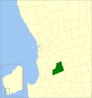 Location in Western Australia | |||||||||||||||
| Population | 981 (2016 census)[1] | ||||||||||||||
| • Density | 0.42547/km2 (1.1020/sq mi) | ||||||||||||||
| Established | 1871 | ||||||||||||||
| Area | 2,305.7 km2 (890.2 sq mi) | ||||||||||||||
| President | Jarrad Logie | ||||||||||||||
| Council seat | Williams | ||||||||||||||
| Region | Wheatbelt | ||||||||||||||
| State electorate(s) | Roe | ||||||||||||||
| Federal Division(s) | O'Connor | ||||||||||||||
| Website | Shire of Williams | ||||||||||||||
| |||||||||||||||
History
The Williams Road District was created on 12 February 1871 as one of the first regional local government areas in Western Australia. On 1 July 1961 it became a shire following the enactment of the Local Government Act 1960, which reformed all road districts into shires.[2]
Wards
Until 2002, the Shire was divided into 3 wards - North West (1), North East (1) and Central (3). On 3 May 2003 all wards were abolished and councillors sit at large.[2]
Towns and localities
- Williams
- Boraning
- Congelin
- Culbin
- Narrakine
- Quindanning
Population
| Year | Population |
|---|---|
| 1911 | 866 |
| 1921 | 772 |
| 1933 | 929 |
| 1947 | 933 |
| 1954 | 1,413 |
| 1961 | 1,330 |
| 1966 | 1,193 |
| 1971 | 1,177 |
| 1976 | 1,178 |
| 1981 | 1,174 |
| 1986 | 1,146 |
| 1991 | 1,005 |
| 1996 | 1,018 |
| 2001 | 869 |
| 2006 | 863 |
| 2011 | 914 |
| 2016 | 981 |
Notable councillors
- Frederick Piesse, Williams Roads Board member 1880–1889, chairman 1886–1889; later a state MP
References
- Australian Bureau of Statistics (27 June 2017). "Williams (S)". 2016 Census QuickStats. Retrieved 28 October 2019.

- "Municipality Boundary Amendments Register" (PDF). Western Australian Electoral Distribution Commission. Retrieved 11 January 2020.
External links
This article is issued from Wikipedia. The text is licensed under Creative Commons - Attribution - Sharealike. Additional terms may apply for the media files.