Shire of Menzies
The Shire of Menzies is a local government area in the Goldfields-Esperance region of Western Australia located to the north of Kalgoorlie. It covers an area of 124,635 square kilometres (48,122 sq mi), and its seat of government is the town of Menzies.
| Shire of Menzies Western Australia | |||||||||||||||
|---|---|---|---|---|---|---|---|---|---|---|---|---|---|---|---|
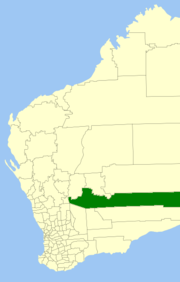 Location in Western Australia | |||||||||||||||
| Population | 490 (2016 census)[1] | ||||||||||||||
| • Density | 0.00393/km2 (0.01018/sq mi) | ||||||||||||||
| Area | 124,635 km2 (48,121.8 sq mi) | ||||||||||||||
| Council seat | Menzies | ||||||||||||||
| Region | Goldfields-Esperance | ||||||||||||||
| State electorate(s) | Kalgoorlie | ||||||||||||||
| Federal Division(s) | O'Connor | ||||||||||||||
| Website | Shire of Menzies | ||||||||||||||
| |||||||||||||||
History
The Shire of Menzies originated as the Menzies Road District, which was established on 31 May 1912 after the subdivision of the North Coolgardie Road District into three separate road districts (Menzies, Kookynie and Mt Malcolm). The North Coolgardie Road District had absorbed three municipalities on 1 March 1912, including the Municipality of Menzies covering the Menzies township, but had quickly proven too large and cumbersome to administer and was broken up.[2]
The Kookynie Road District merged into the Menzies Road District in mid-1918.[3]
The Menzies Road District became a shire on 1 July 1961 under the Local Government Act 1960, which reformed all remaining road districts into shires.[2]
Wards
The shire is divided into three wards:
- Menzies Ward (three councillors)
- Kookynie Ward (three councillors)
- Ularring Ward (one councillor)
Towns and localities
References
- Australian Bureau of Statistics (27 June 2017). "Menzies (S)". 2016 Census QuickStats. Retrieved 26 November 2017.

- "Municipality Boundary Amendments Register" (PDF). Western Australian Electoral Distribution Commission. Retrieved 11 January 2020.
- "ITEMS OF INTEREST". The Midlands Advertiser. Western Australia. 10 May 1918. p. 3. Retrieved 14 December 2019 – via Trove.