Shire of Tammin
The Shire of Tammin is a local government area in the Wheatbelt region of Western Australia. Its seat of government is the town of Tammin, about 80 kilometres (50 mi) west of Merredin and about 180 kilometres (112 mi) east of Perth, the state capital.
| Shire of Tammin Western Australia | |||||||||||||||
|---|---|---|---|---|---|---|---|---|---|---|---|---|---|---|---|
.jpg) Tammin Town Hall, 2018 | |||||||||||||||
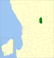 Location in Western Australia | |||||||||||||||
| Population | 402 (2016 census)[1] | ||||||||||||||
| • Density | 0.3644/km2 (0.9438/sq mi) | ||||||||||||||
| Established | 1948 | ||||||||||||||
| Area | 1,103.2 km2 (425.9 sq mi) | ||||||||||||||
| Mayor | Rodney Stokes | ||||||||||||||
| Council seat | Tammin | ||||||||||||||
| Region | Wheatbelt | ||||||||||||||
| State electorate(s) | Central Wheatbelt | ||||||||||||||
| Federal Division(s) | Durack | ||||||||||||||
| Website | Shire of Tammin | ||||||||||||||
| |||||||||||||||
History
Originally the area was governed by the Meckering Road Board (now the neighbouring Shire of Cunderdin).
The Tammin Road District was gazetted on 18 June 1948. On 1 July 1961, it became a shire under the Local Government Act 1960, which reformed all remaining road districts into shires.[2]
Wards
The Shire has never had wards, and all six councillors sit at large. The Shire President is elected from amongst the councillors.
Towns and localities
- Tammin
- Bungulla
- Wyola
- Yorkrakine
Population
| Year | Population |
|---|---|
| 1954 | 895 |
| 1966 | 828 |
| 1971 | 777 |
| 1976 | 631 |
| 1981 | 555 |
| 1986 | 543 |
| 1991[3] | 489 |
| 2001 | 423 |
| 2006 | 391 |
| 2011 | 404 |
| 2016[4] | 402 |
References
- Australian Bureau of Statistics (27 June 2017). "Tammin (S)". 2016 Census QuickStats. Retrieved 28 October 2019.

- "Municipality Boundary Amendments Register" (PDF). Western Australian Electoral Distribution Commission. Retrieved 11 January 2020.
- ABS (26 May 2020). "Historical Censuses (Pre 1996)".
- ABS (26 May 2020). "Quickstats".
External links
This article is issued from Wikipedia. The text is licensed under Creative Commons - Attribution - Sharealike. Additional terms may apply for the media files.