Shire of Beverley
The Shire of Beverley is a local government area in the Wheatbelt region of Western Australia about 130 kilometres (80 mi) southeast of Perth, the state capital. The Shire covers an area of 2,372 square kilometres (916 sq mi), starting 20 kilometres (12 mi) outside Armadale in the Darling Scarp and extending eastwards beyond the scarp into agricultural lands which support broad acre activities such as livestock and cropping. Its seat of government is the town of Beverley, which accommodates just over half of the Shire's population.
| Shire of Beverley Western Australia | |||||||||||||||
|---|---|---|---|---|---|---|---|---|---|---|---|---|---|---|---|
.jpg) Beverley Town Hall, 2018 | |||||||||||||||
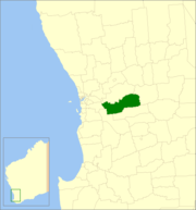 Location in Western Australia | |||||||||||||||
| Population | 1,745 (2016 census)[1] | ||||||||||||||
| • Density | 0.73560/km2 (1.9052/sq mi) | ||||||||||||||
| Established | 1871 | ||||||||||||||
| Area | 2,372.2 km2 (915.9 sq mi) | ||||||||||||||
| Mayor | Dee Ridgway | ||||||||||||||
| Council seat | Beverley | ||||||||||||||
| Region | Wheatbelt | ||||||||||||||
| State electorate(s) | Central Wheatbelt | ||||||||||||||
| Federal Division(s) | Pearce | ||||||||||||||
| Website | Shire of Beverley | ||||||||||||||
| |||||||||||||||
History
The Beverley Road District was proclaimed on 24 January 1871.[2] It was initially far larger on its eastern and southern sides than the present shire, extending east to the colonial border.[3]
The township of Beverley itself was separated as the Municipality of Beverley on 31 March 1892 and the East Beverley Road District separated on 18 October 1895.[2][4]
The Brookton Road District was separated from Beverley on 26 April 1906.[5] However, on 27 April 1906, the East Beverley district was abolished, partially re-absorbed into Beverley and partially into the new Brookton board.[2][6]
The Municipality of Beverley was re-absorbed into the road district on 4 April 1913.[2]
It was declared a shire and named the Shire of Beverley with effect from 1 July 1961 following the passage of the Local Government Act 1960, which reformed all remaining road districts into shires.[2]
Wards
The Shire is divided into three wards, which became effective on 2 May 1987.[7]
- North Ward (three councillors)
- West Ward (three councillors)
- South Ward (three councillors)
Prior to 1986, the Shire was represented by eight councillors across four wards which had existed in some form since the amalgamation of the Municipal District in 1913:[2]
- Kokeby Ward
- North East Ward
- Central Ward
- Dale Ward
Towns
- Beverley
- Flint
- Mount Kokeby
- Mount Dale
- Talbot West
- West Dale
Population
| Year | Population |
|---|---|
| 1921 | 1,882 |
| 1933 | 1,992 |
| 1947 | 1,629 |
| 1954 | 1,968 |
| 1961 | 1,899 |
| 1966 | 1,773 |
| 1971 | 1,628 |
| 1976 | 1,577 |
| 1981 | 1,554 |
| 1986 | 1,502 |
| 1991 | 1,433 |
| 1996 | 1,399 |
| 2001 | 1,461 |
| 2006 | 1,562 |
| 2011 | 1,567 |
Notable councillors
- Henry Lukin, Beverley Road Board member 1876; later a state MP
- Edmund Smith, Beverley Road Board member 1894–1896, chairman 1896; later a state MP
- Frank Broun, Beverley Road Board member 1902–1904, 1906–1914, 1917–1919, chairman 1908–1909, 1911–1914, 1917–1919; also a state MP
References
- Australian Bureau of Statistics (27 June 2017). "Beverley (S)". 2016 Census QuickStats. Retrieved 28 October 2019.

- "Municipality Boundary Amendments Register" (PDF). Western Australian Electoral Distribution Commission. Retrieved 11 January 2020.
- "24 January 1871" (PDF). Government Gazette of South Australia. Retrieved 15 January 2020.
- "18 October 1892" (PDF). Government Gazette of Western Australia. Retrieved 15 January 2020.
- "BROOKTON NOTES". Western Mail. Western Australia. 31 March 1906. p. 8. Retrieved 15 January 2020 – via Trove.
- "East Beverley Roads Board". The Beverley Times. Western Australia. 23 June 1906. p. 7. Retrieved 15 January 2020 – via Trove.
- "Local Government Act 1960 - Shire of Beverley (Ward Boundaries and Representation) Order No.1 1986". Western Australia Government Gazette. 7 November 1986. p. 1986:4164–4165.