Shire of Wyalkatchem
The Shire of Wyalkatchem is a local government area located in the Wheatbelt region of Western Australia. Its seat of government is the town of Wyalkatchem, about 190 kilometres (118 mi) northeast of Perth, the state capital.
| Shire of Wyalkatchem Western Australia | |||||||||||||||
|---|---|---|---|---|---|---|---|---|---|---|---|---|---|---|---|
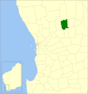 Location in Western Australia | |||||||||||||||
| Population | 516 (2016 census)[1] | ||||||||||||||
| • Density | 0.3234/km2 (0.8377/sq mi) | ||||||||||||||
| Established | 1920 | ||||||||||||||
| Area | 1,595.4 km2 (616.0 sq mi) | ||||||||||||||
| Mayor | Quentin Davies | ||||||||||||||
| Council seat | Wyalkatchem | ||||||||||||||
| Region | Wheatbelt | ||||||||||||||
| State electorate(s) | Central Wheatbelt | ||||||||||||||
| Federal Division(s) | Durack | ||||||||||||||
| Website | Shire of Wyalkatchem | ||||||||||||||
| |||||||||||||||
History
On 18 June 1920, the Wyalkatchem Road District was created out of land previously administered by the Ninghan and Dowerin Road Boards. On 1 July 1961, it became the Shire of Wyalkatchem under the Local Government Act 1960, which reformed all remaining road districts into shires.[2]
Wards
The shire has no wards, and seven councillors. The shire president is elected from amongst the councillors.
Towns and localities
- Wyalkatchem
- Benjaberring
- Cowcowing
- Korrelocking
- Nembudding
Population
| Year | Population |
|---|---|
| 1921 | 1,218 |
| 1933 | 1,533 |
| 1947 | 1,094 |
| 1954 | 1,235 |
| 1961 | 1,383 |
| 1966 | 1,252 |
| 1971 | 1,113 |
| 1976 | 1,005 |
| 1981 | 954 |
| 1986 | 786 |
| 1991 | 704 |
| 1996 | 628 |
| 2001 | 661 |
| 2006 | 564 |
| 2011 | 523 |
| 2016 | 516 |
References
- Australian Bureau of Statistics (27 June 2017). "Wyalkatchem (S)". 2016 Census QuickStats. Retrieved 28 October 2019.

- "Municipality Boundary Amendments Register" (PDF). Western Australian Electoral Distribution Commission. Retrieved 11 January 2020.
This article is issued from Wikipedia. The text is licensed under Creative Commons - Attribution - Sharealike. Additional terms may apply for the media files.