Shire of Moora
The Shire of Moora is a local government area in the northern Wheatbelt region of Western Australia, and generally lies between the Brand Highway and Great Northern Highway about 180 kilometres (112 mi) north of Perth, the state capital. The Shire covers an area of 3,767 square kilometres (1,454 sq mi) and its seat of government is the town of Moora.
| Shire of Moora Western Australia | |||||||||||||||
|---|---|---|---|---|---|---|---|---|---|---|---|---|---|---|---|
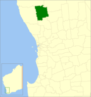 Location in Western Australia | |||||||||||||||
| Population | 2,428 (2016 census)[1] | ||||||||||||||
| • Density | 0.69/km2 (1.8/sq mi) | ||||||||||||||
| Established | 1908 | ||||||||||||||
| Area | 3,766.9 km2 (1,454.4 sq mi) | ||||||||||||||
| Mayor | Sheryl Bryan | ||||||||||||||
| Council seat | Moora | ||||||||||||||
| Region | Wheatbelt | ||||||||||||||
| State electorate(s) | Moore | ||||||||||||||
| Federal Division(s) | Durack | ||||||||||||||
| Website | Shire of Moora | ||||||||||||||
| |||||||||||||||
History
The Moora Road District was gazetted on 11 December 1908, created from part of the Victoria Plains Road District. The first election for the Moora Road Board was on 12 February 1909. Henry Lefroy was elected Chairman at the first meeting of the Road Board on 19 March 1909. Lefroy had previously been elected Chairman of the Victoria Plains Road Board in 1876.[2][3][4]
On 1 July 1961, Moora became a Shire under the Local Government Act 1960, which reformed all remaining road districts into shires.[5]
Wards
The shire is undivided and the nine councillors represent the entire shire.
Until 20 October 2007, the shire was divided into wards, most with 1 councillor each:
- Moora Town Ward (4 councillors)
- Bindi Bindi
- Coomberdale
- Koojan
- Miling
- Watheroo
Towns and localities
Population
| Year | Population |
|---|---|
| 1911 | 1,921 |
| 1921 | 1,642 |
| 1933 | 2,088 |
| 1947 | 2,006 |
| 1954 | 2,896 |
| 1961 | 3,082 |
| 1966 | 2,981 |
| 1971 | 3,120 |
| 1976 | 3,040 |
| 1981 | 3,102 |
| 1986 | 2,828 |
| 1991 | 2,654 |
| 1996 | 2,541 |
| 2001 | 2,557 |
| 2006 | 2,410 |
| 2011 | 2,476 |
| 2016 | 2,428 |
Notable councillors
- Edgar Lewis, Moora Roads Board member 1936–1939; later a state MP
- Ray Jones, Moora Roads Board member 1948–1952; later a state MP
In popular culture
In January 2017, a video emblazoned with the seal of Shire of Moora was uploaded to YouTube. The video, showing a road being built, went viral, bringing unexpected attention to the area.[6]
References
- Australian Bureau of Statistics (27 June 2017). "Moora (S)". 2016 Census QuickStats. Retrieved 1 December 2017.

- "New Moora District Road Board First Election". The Midlands Advertiser. Moora, WA. 19 February 1909. p. 5. Retrieved 8 July 2015.
- "Moora District Roads Board". The Midlands Advertiser. Moora, WA. 26 March 1909. p. 5. Retrieved 8 July 2015.
- "Shire History". Shire of Moora. Retrieved 8 July 2015.
- "Municipality Boundary Amendments Register" (PDF). Western Australian Electoral Distribution Commission. Retrieved 11 January 2020.
- "Road building video is unlikely viral hit". 13 January 2017. Retrieved 14 January 2017.