Shire of Nungarin
The Shire of Nungarin is a local government area in the Wheatbelt region of Western Australia, and with a population of 257 as at the 2016 census, is one of the nation's smallest. It is located about 40 kilometres (25 mi) north of Merredin and about 300 kilometres (186 mi) east of the state capital, Perth. The Shire covers an area of 1,164 square kilometres (449 sq mi), and its seat of government is the town of Nungarin.
| Shire of Nungarin Western Australia | |||||||||||||||
|---|---|---|---|---|---|---|---|---|---|---|---|---|---|---|---|
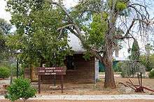
 Nungarin shire offices, 2014 | |||||||||||||||
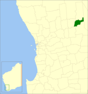 Location in Western Australia | |||||||||||||||
| Population | 257 (2016 census)[1] | ||||||||||||||
| • Density | 0.2208/km2 (0.5719/sq mi) | ||||||||||||||
| Established | 1921 | ||||||||||||||
| Area | 1,163.8 km2 (449.3 sq mi) | ||||||||||||||
| Mayor | Eileen O'Connell | ||||||||||||||
| Council seat | Nungarin | ||||||||||||||
| Region | Wheatbelt | ||||||||||||||
| State electorate(s) | Central Wheatbelt | ||||||||||||||
| Federal Division(s) | Durack | ||||||||||||||
| Website | Shire of Nungarin | ||||||||||||||
| |||||||||||||||
History
Initially, Nungarin was governed by the Kellerberrin Road Board. In 1911, responsibility for the area was transferred to the Merredin Road Board.
The Shire of Nungarin originated as the Nungarin Road District, which was gazetted on 24 March 1921. It was originally much larger, extending north into what is now the Shire of Mount Marshall until losing a section to that road board on 6 July 1923.[2]
In 1933, it included the Bonnie Rock, Campion, Lake Brown, Mukinbudin and Wilgoyne districts, with an area of 1708 square miles. In that year, it faced pressure to relocate the board seat to Mukinbudin as a more central location; however, instead, the Nungarin Road District was split into two and the Mukinbudin Road District formed on 1 September 1933, resulting in the Nungarin district losing over three quarters of its land area.[3][2]
On 1 July 1961, it became the Shire of Nungarin under the Local Government Act 1960, which reformed all remaining road districts into shires.[2]
Wards
The Shire has been divided into 3 wards. Prior to the elections in May 2003, there were 7 wards.
- Central Ward (3 councillors)
- Kwelkan/Danberrin/Elabbin Ward (2 councillors)
- Mangowine/Campion/Knungajin Ward (2 councillors)
References
- Australian Bureau of Statistics (27 June 2017). "Nungarin (S)". 2016 Census QuickStats. Retrieved 21 March 2018.

- "Municipality Boundary Amendments Register" (PDF). Western Australian Electoral Distribution Commission. Retrieved 11 January 2020.
- "Nungarin Road Board". Dampier Herald. Western Australia. 29 June 1933. p. 2. Retrieved 23 January 2020 – via Trove.