Shire of West Arthur
The Shire of West Arthur is a local government area in the Wheatbelt region of Western Australia, generally to the west of Albany Highway about 200 kilometres (124 mi) south-east of Perth, the state capital. The Shire covers an area of 2,834 square kilometres (1,094 sq mi) and its seat of government is the town of Darkan. Industries within the Shire, worth approximately $45 million per year to the State's economy,[2] are dominated by wool and sheep, and also include timber, grain, forestry, beef, pigs, cattle hide tanning, engineering and earthmoving.
| Shire of West Arthur Western Australia | |||||||||||||||
|---|---|---|---|---|---|---|---|---|---|---|---|---|---|---|---|
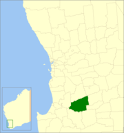 Location in Western Australia | |||||||||||||||
| Population | 809 (2016 census)[1] | ||||||||||||||
| • Density | 0.28544/km2 (0.7393/sq mi) | ||||||||||||||
| Established | 1896 | ||||||||||||||
| Area | 2,834.2 km2 (1,094.3 sq mi) | ||||||||||||||
| President | Raymond Harrington | ||||||||||||||
| Council seat | Darkan | ||||||||||||||
| Region | Wheatbelt | ||||||||||||||
| State electorate(s) | Roe | ||||||||||||||
| Federal Division(s) | O'Connor | ||||||||||||||
| Website | Shire of West Arthur | ||||||||||||||
| |||||||||||||||
History
The West Arthur Road District was created on 10 January 1896. On 1 July 1961, it became the Shire of West Arthur under the Local Government Act 1960, which reformed all remaining road districts into shires.[3] The name relates to its position with respect to the former Arthur Road District, which was renamed to Wagin in 1905.
Wards
The ward system was discontinued on 20 October 2007 and all nine councillors represent the entire shire.
Previously, the shire was divided into four wards:
- North West (three councillors)
- North East (two councillors)
- South East (two councillors)
- South West (two councillors)
Towns
- Darkan
- Arthur River
- Bokal
- Boolading
- Bowelling
- Cordering
- Duranillin
- Moodiarrup
- Trigwell
Population
| Year | Population |
|---|---|
| 1911 | 674 |
| 1921 | 624 |
| 1933 | 1,047 |
| 1947 | 876 |
| 1954 | 1,295 |
| 1961 | 1,398 |
| 1966 | 1,427 |
| 1971 | 1,303 |
| 1976 | 1,293 |
| 1981 | 1,288 |
| 1986 | 1,118 |
| 1991 | 973 |
| 1996 | 985 |
| 2001 | 863 |
| 2006 | 858 |
| 2011 | 868 |
References
- Australian Bureau of Statistics (27 June 2017). "West Arthur (S)". 2016 Census QuickStats. Retrieved 28 October 2019.

- Agriculture WA (July 2000). "Agriculture Statistical Overview 96/97 - Shire of West Arthur" (PDF). Archived from the original (PDF) on 17 September 2006. Retrieved 15 November 2006.
- "Municipality Boundary Amendments Register" (PDF). Western Australian Electoral Distribution Commission. Retrieved 11 January 2020.
External links
- Official website
- West Arthur Telecentre includes community information.