Randolph County, Alabama
Randolph County is a county on the central eastern border of the U.S. state of Alabama.[1] As of the 2010 census, the population was 22,913.[2] Its county seat is Wedowee.[1][3] Its name is in honor of John Randolph, a member of the United States Senate from Virginia.[1] Randolph County was a prohibition or dry county until 2012, when the citizens of Randolph County voted to repeal prohibition.
Randolph County | |
|---|---|
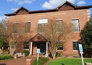 County courthouse in Wedowee | |
 Seal | |
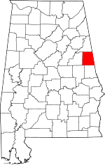 Location within the U.S. state of Alabama | |
 Alabama's location within the U.S. | |
| Coordinates: 33°17′21″N 85°27′37″W | |
| Country | |
| State | |
| Founded | December 18, 1832[1] |
| Named for | John Randolph of Roanoke |
| Seat | Wedowee |
| Largest city | Roanoke |
| Area | |
| • Total | 584 sq mi (1,510 km2) |
| • Land | 581 sq mi (1,500 km2) |
| • Water | 3.6 sq mi (9 km2) 0.56%% |
| Population (2010) | |
| • Total | 22,913 |
| • Estimate (2019) | 22,722 |
| • Density | 39/sq mi (15/km2) |
| Time zone | UTC−6 (Central) |
| • Summer (DST) | UTC−5 (CDT) |
| Congressional district | 3rd |
| Website | randolphcountyalabama |
| |
History
Randolph County was established by the Alabama Legislature on December 18, 1832,[1] following Indian Removal of the Creek people. It was named in honor of John Randolph, a well-known Virginia congressman. Randolph County was one of several counties created out of the last Creek cession formulated by the Treaty of Cusseta, on March 24, 1832. It lies within the Piedmont region, which extends from Alabama to Pennsylvania.[1]
The first white settlers said the county had an abundance of the "purest and coldest freestone water in the world." The area was also noted for its gentle rolling hills.[4] The first county seat for Randolph County was established in 1833 at Hedgeman Triplett's Ferry on the west bank of the Big Tallapoosa River, about 10 miles (16 km) west of Wedowee, Alabama.[1]
In 1835 (2 years later), the county seat was moved by the commissioners to nearby Wedowee. This city lies in the center of Randolph County, on a fork of the Little Tallapoosa River. Wedowee was named after a Creek tribal chief "Wah-wah-nee" (or "Wah-dow-wee") of a village here. The European-American town was developed near that site after the Creek were forced out.[1]
The county was developed for agriculture, specifically cotton plantations, which were worked by African-American slaves brought by migrants to the region or transported from the Upper South during the domestic slave trade. It was adjacent to what became known as the Black Belt of Alabama, an area of plantation development in the uplands, where short-staple cotton was cultivated. Many African Americans stayed in the area as sharecroppers and tenant farmers after the Civil War, but left for other opportunities during the first half of the 20th century. The table below shows population declines from 1920 to 1970, reflecting this demographic change. In 2010 some 20 percent of the population was African American, reflecting this history of cotton agriculture.
Geography
According to the U.S. Census Bureau, the county has a total area of 584 square miles (1,510 km2), of which 581 square miles (1,500 km2) is land and 3.6 square miles (9.3 km2) (0.6%) is water.[5]
Adjacent counties
- Cleburne County - north
- Carroll County, Georgia - northeast
- Heard County, Georgia - east
- Troup County, Georgia - southeast
- Chambers County - south
- Tallapoosa County - southwest
- Clay County - west
Demographics
| Historical population | |||
|---|---|---|---|
| Census | Pop. | %± | |
| 1840 | 4,973 | — | |
| 1850 | 11,581 | 132.9% | |
| 1860 | 20,059 | 73.2% | |
| 1870 | 12,006 | −40.1% | |
| 1880 | 16,575 | 38.1% | |
| 1890 | 17,219 | 3.9% | |
| 1900 | 21,647 | 25.7% | |
| 1910 | 24,659 | 13.9% | |
| 1920 | 27,064 | 9.8% | |
| 1930 | 26,861 | −0.8% | |
| 1940 | 25,516 | −5.0% | |
| 1950 | 22,513 | −11.8% | |
| 1960 | 19,477 | −13.5% | |
| 1970 | 18,331 | −5.9% | |
| 1980 | 20,075 | 9.5% | |
| 1990 | 19,881 | −1.0% | |
| 2000 | 22,380 | 12.6% | |
| 2010 | 22,913 | 2.4% | |
| Est. 2019 | 22,722 | [6] | −0.8% |
| U.S. Decennial Census[7] 1790–1960[8] 1900–1990[9] 1990–2000[10] 2010–2018[2] | |||
As of the 2000 census,[11] there were 22,380 people, 8,642 households, and 6,222 families living in the county. The population density was 38 people per square mile (15/km2). There were 10,285 housing units at an average density of 18 per square mile (7/km2). The racial makeup of the county was 76.38% White (non-Hispanic), 22.24% Black or African American, 0.20% Native American, 0.22% Asian, 0.34% from other races, and 0.62% from two or more races. 3.82% of the population were Hispanic or Latino of any race.
There were 8,642 households, 31.10% had children under the age of 18 living with them; 56.20% were married couples living together, 12.20% had a female householder with no husband present, and 28.00% were non-families. Nearly 25.60% of households were made up of individuals, and 11.50% were one person aged 65 or older. The average household size was 2.52, and the average family size was 3.02.
The age distribution was 25.10% under the age of 18, 8.70% from 18 to 24, 26.80% from 25 to 44, 23.50% from 45 to 64, and 15.90% 65 or older. The median age was 38 years. For every 100 females, there were 93.40 males. For every 100 females age 18 and over, there were 90.00 males.
The median household income was $28,675 and the median family income was $34,684. Males had a median income of $27,069 versus $20,323 for females. The per capita income for the county was $14,147. About 12.60% of families and 17.00% of the population were below the poverty line, including 22.10% of those under age 18 and 14.80% of those age 65 or over.
2010 census
At the 2010 census there were 22,913 people, 9,164 households, and 6,357 families living in the county. The population density was 39 people per square mile (15/km2). There were 11,982 housing units at an average density of 20.6 per square mile (8/km2). The racial makeup of the county was 76.5% White (non-Hispanic), 20.1% Black or African American, 0.4% Native American, 0.2% Asian, 1.6% from other races, and 1.1% from two or more races. 2.8% of the population were Hispanic or Latino of any race.[12] There were 9,164 households, 27.0% had children under the age of 18 living with them; 51.0% were married couples living together, 13.9% had a female householder with no husband present, and 30.6% were non-families. Nearly 27.9% of households were made up of individuals, and 12.6% were one person aged 65 or older. The average household size was 2.46, and the average family size was 2.98.
The age distribution was 23.9% under the age of 18, 8.2% from 18 to 24, 22.9% from 25 to 44, 28.0% from 45 to 64, and 17.0% 65 or older. The median age was 41.2 years. For every 100 females, there were 94.0 males. For every 100 females age 18 and over, there were 95.8 males.
The median household income was $34,593 and the median family income was $43,528. Males had a median income of $31,305 versus $27,908 for females. The per capita income for the county was $19,844. About 14.7% of families and 21.5% of the population were below the poverty line, including 28.0% of those under age 18 and 12.8% of those age 65 or over.
Government
| Year | GOP | Dem | Others |
|---|---|---|---|
| 2016 | 75.6% 7,705 | 22.5% 2,291 | 1.9% 191 |
| 2012 | 69.3% 7,224 | 29.5% 3,078 | 1.1% 119 |
| 2008 | 69.1% 7,175 | 29.5% 3,064 | 1.4% 145 |
| 2004 | 68.1% 6,127 | 31.3% 2,817 | 0.6% 57 |
| 2000 | 58.9% 4,666 | 39.1% 3,094 | 2.0% 159 |
| 1996 | 47.4% 3,304 | 43.4% 3,023 | 9.2% 642 |
| 1992 | 46.8% 3,813 | 40.7% 3,318 | 12.5% 1,021 |
| 1988 | 64.0% 4,625 | 34.1% 2,462 | 1.9% 137 |
| 1984 | 65.7% 4,940 | 32.5% 2,439 | 1.8% 136 |
| 1980 | 46.2% 3,279 | 47.6% 3,378 | 6.2% 437 |
| 1976 | 37.8% 2,286 | 58.6% 3,539 | 3.6% 219 |
| 1972 | 75.1% 4,427 | 22.6% 1,330 | 2.3% 135 |
| 1968 | 12.3% 839 | 9.8% 666 | 77.9% 5,299 |
| 1964 | 62.7% 3,127 | 37.4% 1,864 | |
| 1960 | 34.6% 1,697 | 64.7% 3,175 | 0.7% 33 |
| 1956 | 33.3% 1,584 | 66.2% 3,151 | 0.6% 26 |
| 1952 | 26.1% 1,047 | 73.8% 2,964 | 0.2% 7 |
| 1948 | 27.1% 469 | 72.9% 1,261 | |
| 1944 | 28.0% 702 | 71.1% 1,785 | 1.0% 25 |
| 1940 | 21.7% 670 | 77.9% 2,407 | 0.4% 12 |
| 1936 | 22.2% 793 | 77.4% 2,766 | 0.4% 15 |
| 1932 | 25.5% 767 | 74.1% 2,226 | 0.4% 12 |
| 1928 | 59.0% 1,815 | 40.9% 1,257 | 0.1% 2 |
| 1924 | 33.4% 669 | 65.3% 1,307 | 1.3% 25 |
| 1920 | 44.9% 1,113 | 54.7% 1,357 | 0.4% 9 |
| 1916 | 32.9% 652 | 66.7% 1,324 | 0.5% 9 |
| 1912 | 14.8% 268 | 65.0% 1,177 | 20.2% 366 |
| 1908 | 32.7% 395 | 66.2% 799 | 1.1% 13 |
| 1904 | 30.5% 695 | 66.6% 1,518 | 2.9% 67 |
Transportation
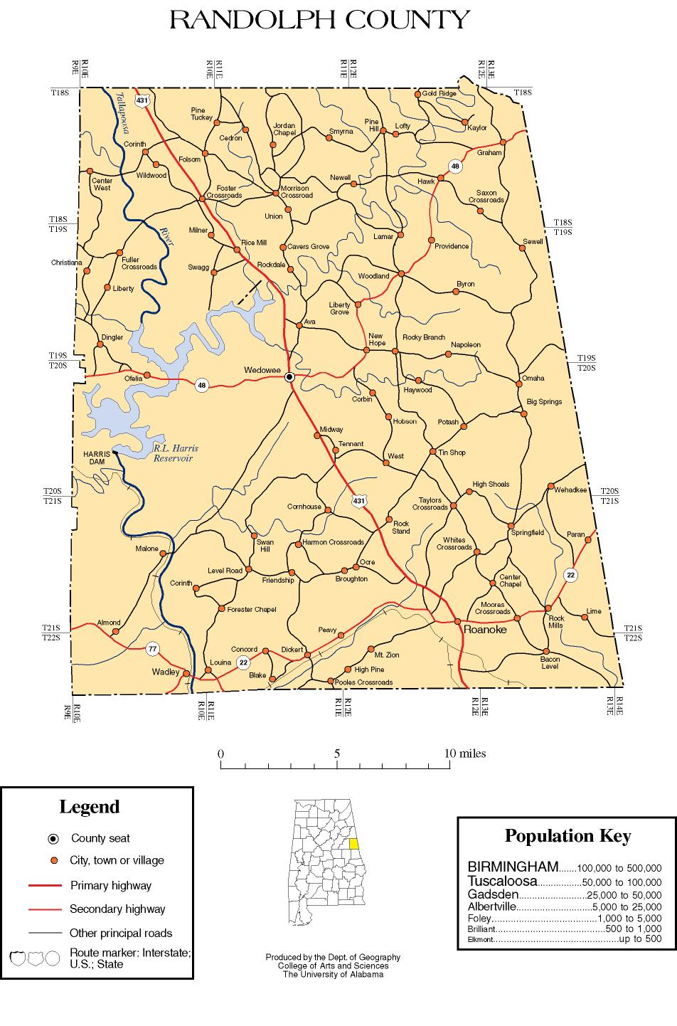
Major highways


Rail
Communities
City
Census-designated places
Unincorporated communities
Places of interest
Randolph County is home to Lake Wedowee, a section of the Tallapoosa River.
See also
Notes
- "ACES Randolph County Office" (links/history), Alabama Cooperative Extension System (ACES), 2007, webpage: ACES-Randolph.
- "State & County QuickFacts". United States Census Bureau. Retrieved May 17, 2014.
- "Find a County". National Association of Counties. Retrieved June 7, 2011.
- Lois Walls George, Paula Burson Lambert, Wyner S. Phillips, Randolph County, page 113
- "2010 Census Gazetteer Files". United States Census Bureau. August 22, 2012. Retrieved August 22, 2015.
- "Population and Housing Unit Estimates". Retrieved May 21, 2019.
- "U.S. Decennial Census". United States Census Bureau. Retrieved August 22, 2015.
- "Historical Census Browser". University of Virginia Library. Retrieved August 22, 2015.
- Forstall, Richard L., ed. (March 24, 1995). "Population of Counties by Decennial Census: 1900 to 1990". United States Census Bureau. Retrieved August 22, 2015.
- "Census 2000 PHC-T-4. Ranking Tables for Counties: 1990 and 2000" (PDF). United States Census Bureau. April 2, 2001. Retrieved August 22, 2015.
- "U.S. Census website". United States Census Bureau. Retrieved May 14, 2011.
- "U.S. Census website". United States Census Bureau. Retrieved August 7, 2015.
- "Dave Leip's Atlas of U.S. Presidential Elections". Retrieved November 21, 2016.
External links
- RANDOLPH COUNTY CENTER
- Randolph County map of roads/towns (map © 2007 Univ. of Alabama).
Places adjacent to Randolph County, Alabama | ||||||||||
|---|---|---|---|---|---|---|---|---|---|---|
| ||||||||||
Municipalities and communities of Randolph County, Alabama, United States | ||
|---|---|---|
| City | Map of Alabama highlighting Randolph County | |
| Towns | ||
| CDPs | ||
| Unincorporated communities | ||
Montgomery (capital) | ||
| Topics | ||
| Society |
| |
| Regions | ||
| Flora and fauna | ||
| Largest cities | ||
| Metros |
| |
| Counties |
| |
| Authority control |
|
|---|