Blount County, Alabama
Blount County is a county located in the U.S. state of Alabama. As of the 2010 census, the population was 57,322.[1] Its county seat is Oneonta.
Blount County | |
|---|---|
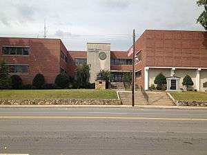 Blount County Courthouse in Oneonta, Alabama | |
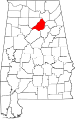 Location within the U.S. state of Alabama | |
 Alabama's location within the U.S. | |
| Coordinates: 33°58′N 86°35′W | |
| Country | |
| State | |
| Founded | February 6, 1818 |
| Seat | Oneonta |
| Largest city | Oneonta |
| Area | |
| • Total | 651 sq mi (1,690 km2) |
| • Land | 645 sq mi (1,670 km2) |
| • Water | 5.9 sq mi (15 km2) 0.9%% |
| Population (2010) | |
| • Total | 57,322 |
| • Estimate (2019) | 57,826 |
| • Density | 88/sq mi (34/km2) |
| Time zone | UTC−6 (Central) |
| • Summer (DST) | UTC−5 (CDT) |
| Congressional district | 6th |
| Website | www |
| |
Blount County is a moist county. In the November 6, 2012 elections, a countywide ballot initiative to allow alcohol sales was narrowly defeated, but Blountsville, Cleveland and Oneonta have allowed for the sale of alcohol since 2013.
Blount County has been dubbed the "Covered Bridge Capital of Alabama" since it has more historic covered bridges standing within a single county than any other in the state - with earlier covered bridges known of. This county celebrates the Covered Bridge Festival every autumn in Oneonta to commemorate its three remaining covered bridges.
History
Blount County was created by the Alabama Territorial Legislature on February 6, 1818, formed from land ceded to the federal government by the Creek Nation on August 9, 1814. This county was named for Governor Willie Blount of Tennessee, who provided assistance to settlers in Alabama during the Creek War of 1813–14. This county lies in the northeastern quadrant of the state, which is sometimes known as the mineral region of Alabama. Blount County is bordered by Cullman, Marshall, Etowah, Jefferson, Walker, and St. Clair Counties. This county is drained by the Locust and Mulberry Forks of the Black Warrior River. Blount County covers 650 square miles (1,700 km2). The Warrior coal field is located in Blount County.
Caleb Fryley and John Jones established Bear Meat Cabin in 1816. Its post office was opened in 1821, and the settlement was incorporated as Blountsville on December 13, 1827. In 1889, an election resulted in the county seat being transferred to Oneonta, Alabama.
Geography
According to the U.S. Census Bureau, the county has a total area of 651 square miles (1,690 km2), of which 645 square miles (1,670 km2) is land and 5.9 square miles (15 km2) (0.9%) is water.[2]
Adjacent counties
- Marshall County – northeast
- Etowah County – east
- St. Clair County – southeast
- Walker County – southwest
- Jefferson County – south
- Cullman County – northwest
Transportation
Major highways
.svg.png)


Rail
- CSX Transportation, formerly the Louisville and Nashville Railroad
Demographics
| Historical population | |||
|---|---|---|---|
| Census | Pop. | %± | |
| 1820 | 2,415 | — | |
| 1830 | 4,233 | 75.3% | |
| 1840 | 5,570 | 31.6% | |
| 1850 | 7,367 | 32.3% | |
| 1860 | 10,865 | 47.5% | |
| 1870 | 9,945 | −8.5% | |
| 1880 | 15,369 | 54.5% | |
| 1890 | 21,927 | 42.7% | |
| 1900 | 23,119 | 5.4% | |
| 1910 | 21,456 | −7.2% | |
| 1920 | 25,538 | 19.0% | |
| 1930 | 28,020 | 9.7% | |
| 1940 | 29,490 | 5.2% | |
| 1950 | 28,975 | −1.7% | |
| 1960 | 25,449 | −12.2% | |
| 1970 | 26,853 | 5.5% | |
| 1980 | 36,459 | 35.8% | |
| 1990 | 39,248 | 7.6% | |
| 2000 | 51,024 | 30.0% | |
| 2010 | 57,322 | 12.3% | |
| Est. 2019 | 57,826 | [3] | 0.9% |
| U.S. Decennial Census[4] 1790–1960[5] 1900–1990[6] 1990–2000[7] 2010–2018[1] | |||
As of the census[8] of 2010, there were 57,322 people, 16,175 households, and 16,175 families residing in the county. The population density was 88.79 people per square mile. There were 23,887 housing units at an average density of 37 per square mile. The racial makeup of the county was 92.6% White, 1.3% Black or African American, 0.5% Native American, 0.2% Asian, 0.1% Pacific Islander, 4.1% from other races, and 1.2% from two or more races. 8.1% of the population were Hispanic or Latino of any race.
There were 16,175 family households, of which 31.1% had children under the age of 18 living with them, 60.6% were married couples living together, 9.7% had a female householder with no husband present, and 25% were non-families. Alternative households included: 22.2% of households were made up of those living alone and 9.7% had someone living alone who was 65 years of age or older. The average household size was 2.63 and the average family size was 3.72.[9]
Blount County's population spread was as follows: 25.40% under the age of 18, 8.40% from 18 to 24, 29.20% from 25 to 44, 24.10% from 45 to 64, and 12.90% were 65 years of age or older. The median age was 36 years. For every 100 females, there were 99.70 males. For every 100 females age 18 and over, there were 97.30 males.
The median income for a household in the county was $35,241, and the median income for a family was $41,573. Males had a median income of $31,455 versus $22,459 for females. The per capita income for the county was $16,325. About 8.60% of families and 11.70% of the population were below the poverty line, including 13.20% of those under age 18 and 17.40% of those age 65 or over.
Communities
Cities
- Oneonta (county seat)
- Warrior (Partly in Jefferson County)
Towns
- Allgood
- Altoona (partly in Etowah County)
- Blountsville
- Cleveland
- County Line (partly in Jefferson County)
- Garden City (partly in Cullman County)
- Hayden
- Highland Lake
- Locust Fork
- Nectar
- Rosa
- Snead
- Susan Moore
- Trafford (partly in Jefferson County)
Census-designated place
Unincorporated communities
Government
Blount County is a stronghold for Republicans. Since 2004, it has voted for the Republican presidential nominee with at least eighty percent of the vote every time. It was Hubert Humphrey’s weakest county in the nation in 1968 with only 3.64 percent of the vote. It was one of only two counties in the state to give Donald Trump over 90 percent of the two party vote, the other being Winston. [10]
| Year | GOP | DEM | Others |
|---|---|---|---|
| 2016 | 89.33% 22,859 | 8.43% 2,156 | 2.24% 573 |
| 2012 | 86.27% 20,757 | 12.34% 2,970 | 1.38% 333 |
| 2008 | 84.02% 20,389 | 14.51% 3,522 | 1.47% 356 |
| 2004 | 80.85% 17,386 | 18.31% 3,938 | 0.84% 180 |
| 2000 | 70.48% 12,667 | 27.69% 4,977 | 1.83% 329 |
| 1996 | 59.09% 9,056 | 33.02% 5,061 | 7.90% 1,210 |
| 1992 | 53.81% 8,882 | 32.92% 5,433 | 13.27% 2,190 |
| 1988 | 64.61% 8,754 | 33.10% 4,485 | 2.28% 309 |
| 1984 | 68.16% 8,508 | 29.95% 3,738 | 1.89% 236 |
| 1980 | 53.59% 6,819 | 44.45% 5,656 | 1.96% 249 |
| 1976 | 38.56% 4,233 | 60.53% 6,645 | 0.91% 100 |
| 1972 | 79.36% 6,486 | 19.36% 1,582 | 1.28% 105 |
| 1968 | 22.15% 2,013 | 3.64% 331 | 74.20% 6,742 |
| 1964 | 64.67% 4,442 | 35.33% 2,427 | |
| 1960 | 42.80% 2,557 | 56.98% 3,404 | 0.22% 13 |
| 1956 | 44.38% 2,628 | 54.17% 3,208 | 1.45% 86 |
| 1952 | 35.19% 1,720 | 64.67% 3,161 | 0.14% 7 |
| 1948 | 30.08% 771 | 69.92% 1,792 | |
| 1944 | 31.73% 998 | 67.85% 2,134 | 0.41% 13 |
| 1940 | 23.25% 855 | 75.71% 2,784 | 1.03% 38 |
| 1936 | 20.88% 744 | 78.23% 2,788 | 0.90% 32 |
| 1932 | 20.34% 582 | 77.99% 2,232 | 1.68% 48 |
| 1928 | 52.06% 1,745 | 47.94% 1,607 | 0.00% 0 |
| 1924 | 40.92% 1,518 | 56.15% 2,083 | 2.94% 109 |
| 1920 | 49.15% 3,465 | 50.14% 3,535 | 0.71% 50 |
| 1916 | 44.71% 1,229 | 54.13% 1,488 | 1.16% 32 |
| 1912 | 24.65% 567 | 48.74% 1,121 | 26.61% 612 |
| 1908 | 45.34% 973 | 52.80% 1,133 | 1.86% 40 |
| 1904 | 37.51% 910 | 57.01% 1,383 | 5.48% 133 |
Places of interest
Blount County is home to an abundance of outdoor activities, such as Rickwood Caverns State Park and the Locust Fork of the Black Warrior River that are used by canoeists and kayakers. The county is also home to the picturesque covered bridges mentioned above: the Swann Covered Bridge, the Horton Mill Covered Bridge, and the Easley Covered Bridge. As of summer 2009, all three bridges were closed due to safety concerns at the recommendation of the Alabama Department of Transportation. Restorations were completed from 2011 through 2013 and they are once again open.[12][13]
See also
References
- "State & County QuickFacts". United States Census Bureau. Archived from the original on May 17, 2014. Retrieved May 15, 2014.
- "2010 Census Gazetteer Files". United States Census Bureau. August 22, 2012. Retrieved August 22, 2015.
- "Population and Housing Unit Estimates". Retrieved May 18, 2019.
- "U.S. Decennial Census". United States Census Bureau. Retrieved August 22, 2015.
- "Historical Census Browser". University of Virginia Library. Retrieved August 22, 2015.
- Forstall, Richard L., ed. (March 24, 1995). "Population of Counties by Decennial Census: 1900 to 1990". United States Census Bureau. Retrieved August 22, 2015.
- "Census 2000 PHC-T-4. Ranking Tables for Counties: 1990 and 2000" (PDF). United States Census Bureau. April 2, 2001. Retrieved August 22, 2015.
- "Community Facts". United States Census Bureau. Retrieved 3 February 2014.
- "American Fact Finder". United States Census Bureau. Archived from the original on February 12, 2020. Retrieved February 3, 2014.
- Dave Leip’s U.S. Election Atlas; 1968 Presidential Election Statistics
- "Dave Leip's Atlas of U.S. Presidential Elections". Retrieved November 15, 2016.
- http://www.blountcountian.com/news/2010-02-17/News/Citizen_concerns_prompt_covered_bridge_update.html Archived 2011-07-08 at the Wayback Machine Retrieved June 20, 2010
- http://news.alabamapower.com/2013/05/21/covered-bridges-back-in-business/ Retrieved August 15, 2013
External links
Places adjacent to Blount County, Alabama | ||||||||||
|---|---|---|---|---|---|---|---|---|---|---|
| ||||||||||
Municipalities and communities of Blount County, Alabama, United States | ||
|---|---|---|
| Cities | Map of Alabama highlighting Blount County | |
| Towns | ||
| CDP | ||
| Unincorporated communities | ||
| Footnotes | ‡This populated place also has portions in an adjacent county or counties | |
| Properties | ||
|---|---|---|
See also: National Register of Historic Places listings in Blount County, Alabama and List of National Historic Landmarks in Alabama | ||
Montgomery (capital) | ||
| Topics | ||
| Society |
| |
| Regions | ||
| Flora and fauna | ||
| Largest cities | ||
| Metros |
| |
| Counties |
| |
| Authority control |
|
|---|